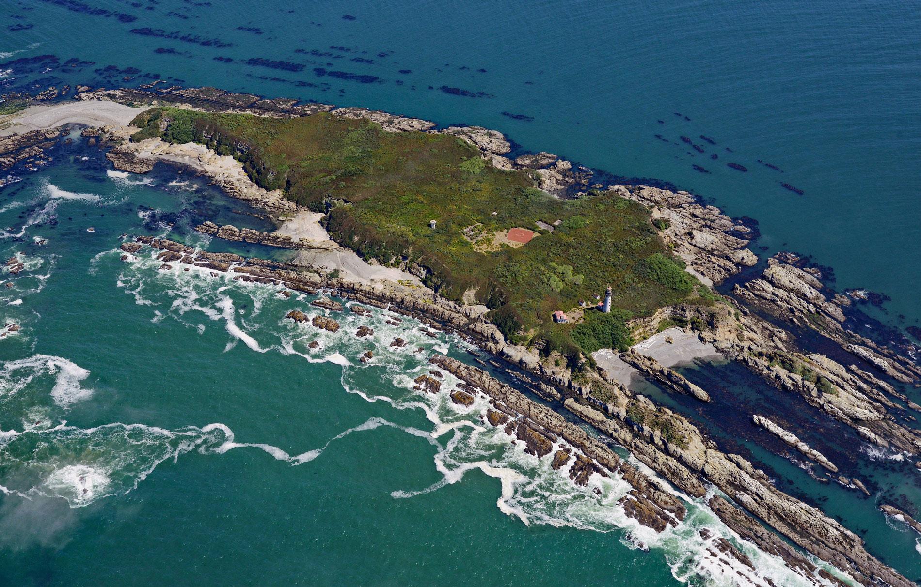
Destruction Island is part of the Quillayute Needles National Wildlife Refuge, located 3.5 miles (6 km) offshore from the Olympic Peninsula, about 56 miles (90 km) southwest of Port Angeles and 17 miles (27 km) south-southeast of La Push, Washington. Quillayute Needles are a group of islands, rocks, and reefs extending along Washington’s coast between Hand Rock to the north and Destruction Island to the south. Together with Flattery Rocks and Copalis Rock, these islands make up the Washington Islands Wilderness, which was established in 1970 as an area closed to the public with the exception of Tatoosh Island, James Island, and Destruction Island.
Destruction Island is named after two historical events. The first was in 1775, when Spanish Navy explorer Lieutenant Juan Francisco de la Bodega y Quadra, dispatched a crew of seven men to the mainland in order to gather wood and fresh water on the beach near Point Grenville. The shore party was killed by local native tribes, leading Quadra to name the island Isla de Dolores (the Island of Sorrows). Twelve years later, Captain Charles William Barkley, an independent English fur trader, arrived on the ship Imperial Eagle and sent a party ashore from the island to a similar fate. Barkley named the river where the second massacre took place the Destruction River. Captain George Vancouver later transferred the name to the island when the river was given its local name, the Hoh River.
A lighthouse was built on Destruction Island and began operating in 1892. The U.S. Coast Guard permanently shut the light in 2008, and the structure is now under the management of the U.S. Fish & Wildlife Service and is closed to the public. The three National Wildlife Refuges that comprise the Washington Islands Wilderness were originally created by executive orders from Theodore Roosevelt on October 23, 1907. Today, these wildlife refuges lie within the boundary of the Olympic Coast National Marine Sanctuary. Along with nearby Olympic National Park, the three agencies cooperate on research programs and other issues that may have impacts on the resources. More than a million seabirds, waterfowl, and shorebirds may live on the islands during migration season. Breeding colonies of 14 species of seabirds use these rocks to raise their young. Marine mammals that live near the islands include sea lions, harbor seals, sea otters, and whales. Read more here and here. Explore more of Destruction Island here:

