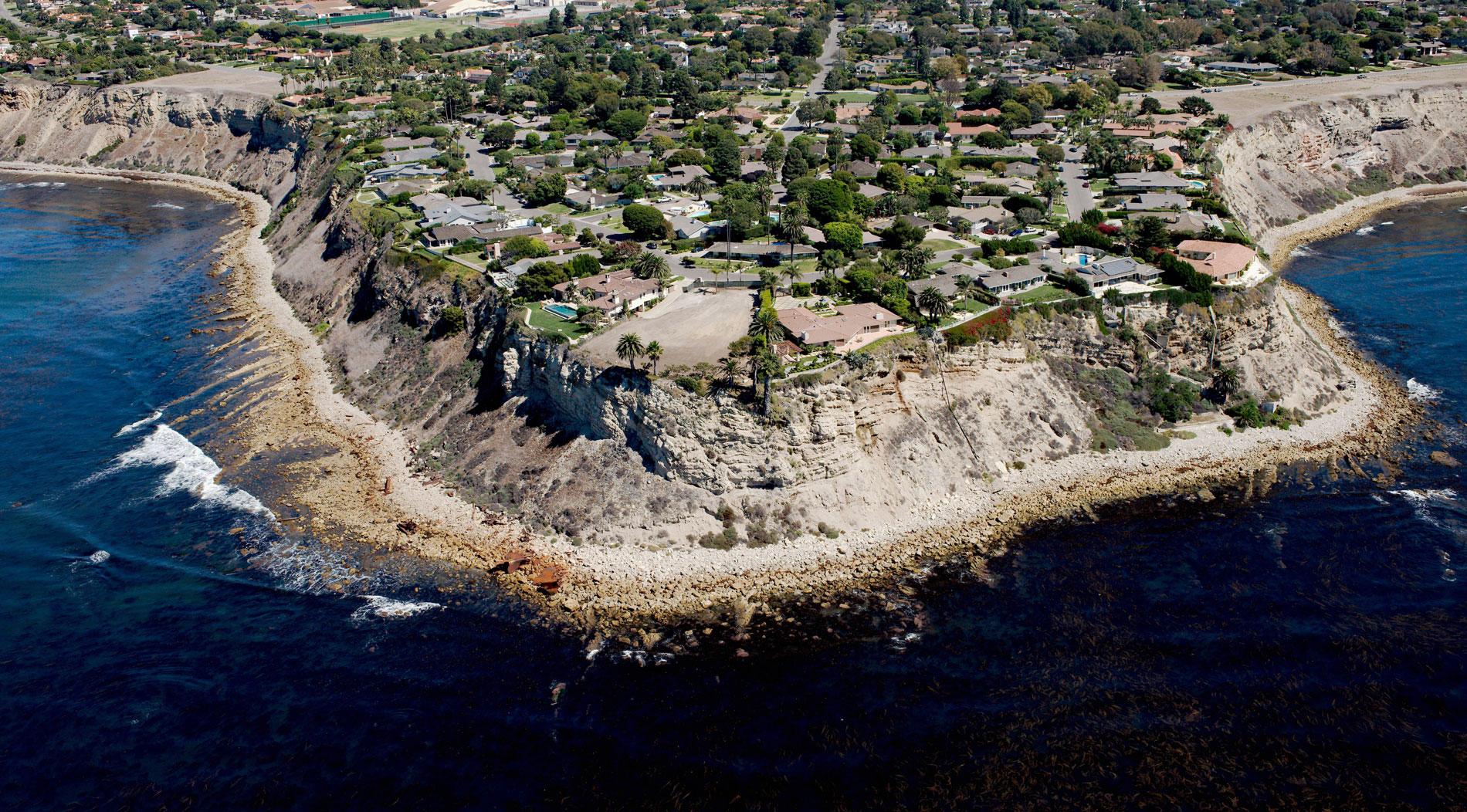
SS Dominator is a shipwrecked freighter that ran aground in 1961 on the Palos Verdes Peninsula, about 13 miles (21 km) west of Long Beach and 5.6 miles (9 km) south-southwest of Redondo Beach, California. The U.S. Coast Guard attempted to refloat the vessel but eventually, the effort was abandoned and the ship broke up in the surf. Today, large pieces of wreckage are scattered along the shore. The Palos Verdes Peninsula is formed by the Palos Verdes Hills, a low mountain range that geologically represents a continuation of the Channel Islands and part of the Transverse Ranges.
The Dominator was originally the American Liberty ship Melville Jacoby, built during World War II at the Walsh-Kaiser Company shipyard in Providence, Rhode Island, and launched on 31 March 1944. It was named after the journalist Melville Jacoby, who after reporting on the war in China and narrowly escaping capture at Corregidor, was killed in an air crash in 1942. During the war, the ship was operated by the Wilmore Steamship Company of Boston, on behalf of the War Shipping Administration. In 1947 she was sold into commercial service, and flying the Panamanian flag, was renamed SS Victoria. She changed hands in 1950, and was renamed SS North Queen, then again in 1953 became SS Dominator. On March 13, 1961, the Dominator was en route to Los Angeles from Vancouver with a cargo of wheat and beef and encountered thick fog off the Palos Verdes Peninsula. A navigational error caused the ship to go aground, and for two days the U.S. Coast Guard and tugboats attempted to refloat her, but heavy seas and high winds only forced the wreck higher onto the rocks. The wreck was auctioned with the hull and cargo sold separately, leading to conflicting claims among the salvors.
The Palos Verdes Peninsula was the homeland of the Tongva-Gabrieliño Native American people for thousands of years. Their first contact with Europeans occurred in 1542 with Juan Cabrillo. In 1846, José Dolores Sepúlveda and José Loreto received a Mexican land grant from Alta California Governor Pío Pico for a parcel from the huge original 1784 Spanish land grant of Rancho San Pedro to Manuel Dominguez. It was named Rancho de Los Palos Verdes, or ‘ranch of the green sticks’, which was used primarily for raising cattle. It was also briefly used as a whaling station in the mid-19th century. By 1882, ownership of the land had passed from the Sepulveda family through various mortgage holders to Jotham Bixby of Rancho Los Cerritos, who leased the land to Japanese farmers. In 1913, Frank Vanderlip, representing a group of wealthy east coast investors, purchased 16,000 acres (6,475 ha) on the peninsula and quickly started the development of a new subdivision which opened in 1923. Read more here and here. Explore more of Palos Verdes here:

