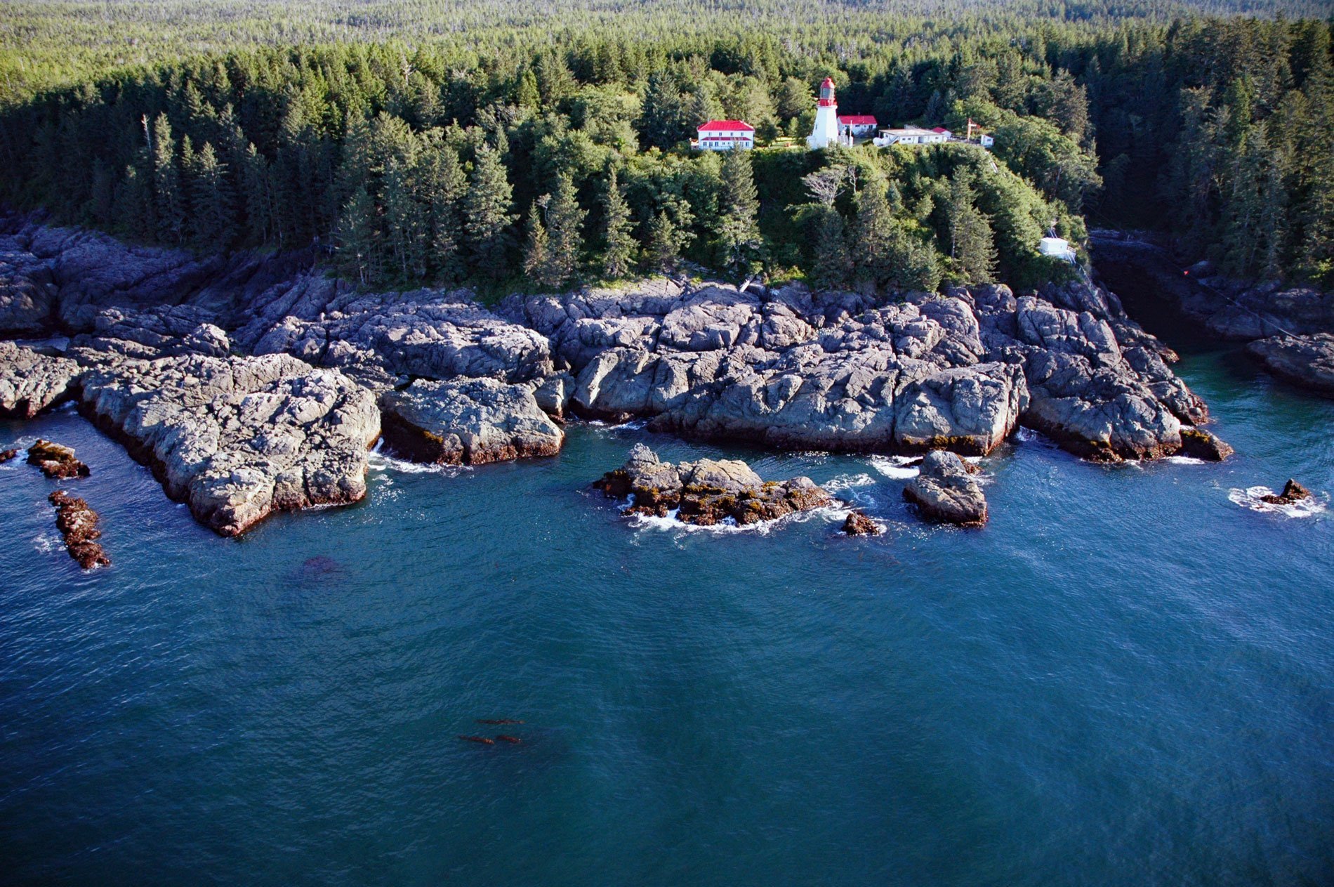
Pachena Point Light Station is located on the west coast of Vancouver Island in Pacific Rim National Park Reserve, about 82 miles (132 km) northwest of Victoria and 8 miles (13 km) south-southeast of Bamfield, British Columbia. The light station is situated on Pachena Point, a headland where high cliffs meet an often turbulent sea. Pachena is an anglicized version of a Ditidaht language name meaning ‘foam on the rocks’ and represents both the character of the place and the First Nation Pacheedaht Tribe. The rocks of Pachena Point represent the Westcoast Crystalline Complex, an igneous intrusion in the surrounding Wrangellia terrane that is exposed on Vancouver Island for 174 miles (280 km) between Port Renfrew and the Brooks Peninsula at the northern tip of the island. The rocks associated with this pluton include gneisses, migmatites, amphibolites, and metamorphosed calcareous sediments.
Pacheedaht people inhabited a territory from Sooke to Pachena Point, and Ditidaht territory overlapped, extending from Bonilla Point to Pachena Point. According to Ditidaht oral tradition, the people originally came from Cape Flattery in Washington, but fighting with the Makah forced a move, first to the Jordan River where they clashed with the Clallam, Sooke, and Saanich, and were forced westward to Nitinat Lake. The exact date of the Makah and Ditidaht separation is unknown; however, the two languages diverged roughly 1000 years ago. The Pacheedaht originated from the east and spoke the Coast Salish language. In the early historical period, there were about five Pacheedaht villages, with the largest village at Port San Juan. In the spring, the people dispersed to seasonal fishing camps where they caught halibut, red snapper, and cod, and dried them for storage. Sockeye salmon fishing occurred between April and July. By September, the people returned to their inside winter village to get ready for the fall salmon runs of steelhead, coho, Chinook, pink, and chum salmon. Beach foods constituted a significant part of their diet. Like other Bands on the west coast of Vancouver Island, the Pacheedaht were also whalers. By the 1850s, the entire Pacheedaht population had been decimated by diseases and numbered no more than 60, mostly living on a reservation at the head of Port San Juan.
The light station at Pachena Point was built in 1908. The original lantern and first-order Fresnel lens are housed in the original octagonal wood tower 66 feet (20 m) tall with a focal plane of 154 feet (47 m). The light station is staffed and has two keeper’s houses and other buildings. The station has changed little in more than a century, and the Canadian Coast Guard carried out a major restoration of the lighthouse in 2015-16. The seas surrounding Pachena Point are littered with the wreckage of scores of ships that tried to navigate the entrance to the Strait of Juan de Fuca. The Graveyard of the Pacific is a somewhat loosely defined portion of the Pacific Northwest coast stretching from near Tillamook Bay on the Oregon Coast northward past the treacherous Columbia Bar and Juan de Fuca Strait, up the rocky western coast of Vancouver Island to Cape Scott. Unpredictable weather conditions, including storms and fog, and dangerous coastal characteristics, including shifting sandbars, tidal rips, and rocky reefs and shorelines, have caused thousands of ships to wreck in the area since European exploration of the area began in earnest in the 18th century. Read more here and here. Explore more of Pachena Point and Pacific Rim National Park Reserve here:

