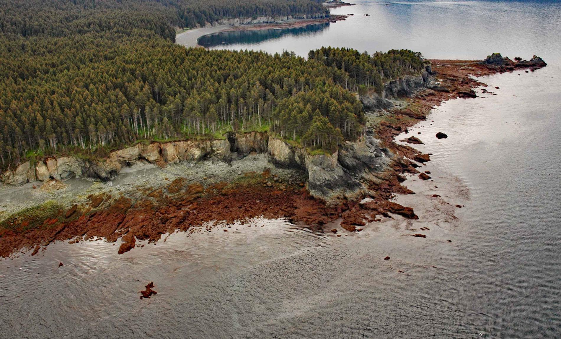
Dangerous Cape is a headland with an elevation of 66 feet (20 m) on the southern Kenai Peninsula, at the northern entrance of Port Graham near the mouth of Kachemak Bay, about 22 miles (35 km) southwest of Homer and 4 miles (6.5 km) northwest of the community of Port Graham, Alaska. The headland name is a translation from the Russian published by Captain Mikhail Tebenkov as ‘Mys Onasnoy’ and first published in its present form by U.S. Coast and Geodetic Survey in 1883. The headland and reef are formed by rocks of the Tyonek Formation that developed during the Miocene and Oligocene and are part of the coal-bearing Kenai Group. The Tyonek Formation is identified by massive sandstone beds and low-grade lignitic to sub-bituminous coal beds as much as 30 feet (9 m) thick.
Port Graham is an embayment that extends southwest for about 6 miles (10 km) from Kachemak Bay. Captain Nathaniel Portlock originally named the deglaciated fjord ‘Grahams Harbour’. The Russians called this ‘English Bay’, probably because of the mapping and visitation there in the late 18th century by the expeditions of Cook and Vancouver. Coal Cove is a small bight, about 0.5 miles (0.8 km) wide, on the north shore of Port Graham, named ‘Coal Bay’ by Portlock, who found coal there on July 25, 1786. This was the site of a small Russian coal mining operation until 1867. Coal Cove is protected by Dangerous Cape Reef, a submerged part of Dangerous Cape that extends southwest into Kachemak Bay for 0.5 miles (0.8 km) and is the site of the Torrent shipwreck of 1868.
After the Alaska Purchase transferred the territory from Russia to the United States in 1867, the U.S. Army dispatched several batteries of soldiers from the Second Artillery to Alaska to protect American interests. Batteries were garrisoned at Sitka, Kodiak, Tongass, Wrangell, and Kenai, and provided detachments to enforce the seal hunting regulations on the Pribilof Islands in the Bering Sea. Battery F with approximately 125 Army officers and soldiers commanded by Lieutenant John McGilvray, many of who were American Civil War veterans, sailed for Cook Inlet aboard the chartered, civilian-owned sailing bark Torrent with instructions to scout locations for an army fort near Kachemak Bay. Torrent was under the command of Captain Richard Carlton with a civilian crew of around 12 sailors. While attempting to enter Coal Cove, the Torrent struck the reef extending off Dangerous Cape and began to take on heavy seas. All the property and records were lost when the vessel broke apart and sank, but all personnel escaped in the ship’s boats and were rescued two weeks later by Captain Snow on Milan, and Captain Erskine on the steamer Fidelater. In 2007, a team of divers found the ship’s remains, possibly the oldest American shipwreck ever found in Alaskan waters. Read more here and here. Explore more of Dangerous Cape and Port Graham here:

