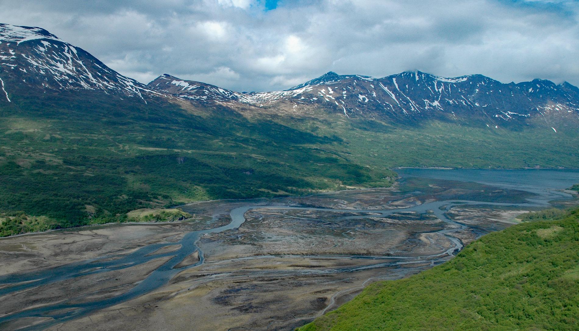
Terror Bay is on the northern coast of Kodiak Island and extends about 7 miles (11 km) south from Uganik Passage to the mouth of Terror River in Kodiak National Wildlife Refuge, about 32 miles (52 km) east-northeast of Larsen Bay and 30 miles (48 km) west-southwest of Kodiak, Alaska. Kodiak National Wildlife Refuge includes 1,990,418 acres (805,494 ha) of the southwestern two-thirds of Kodiak Island, Uganik Island, the Red Peaks area of Afognak Island, and all of Ban Island in the archipelago. Terror River starts from an unnamed glacier on the eastern flank of Mount Glottof at an elevation of 3,200 feet (975 m) and flows generally north-northeast for 5 miles (8 km) to Terror Lake, which is about 3 miles (5 km) long, and then flows another 7 miles (11 km) northwest to Terror Bay draining a watershed of 31,391 acres (12,704 ha). The lake and river were named after the bay, which was named in 1909 by William C. Hodgkins of the U.S. Coast and Geodetic Survey.
The headwaters of the Terror River flow through the exposed rocks of an igneous intrusion that consists mainly of quartz diorite with some diorite and gabbro that formed during the Late Cretaceous and early Tertiary. Below Terror Lake, the river flows through marine sedimentary rocks, mostly greywacke, slate, and argillite that developed during the Late Cretaceous. The Terror River watershed vegetation includes salt marshes in the bay to hillsides covered with dense shrub thickets interspersed with meadows. Alpine vegetation includes low willow, sedges, and heath. The refuge contains seven large rivers and about 100 streams which are spawning grounds for all five species of Pacific salmon, steelhead, and Dolly Varden. Salmon in Terror River are abundant throughout the summer with pink, chum, and coho salmon being the most common. An estimated 2,300 brown bears inhabit the refuge with a density in the Terror Lake watershed of 1 bear per 247 acres (100 ha). Terror River is within the traditional territory of the Koniag Alutiiq people; however, the general scarcity of food resources, other than bears and a sparse cover of salmonberries, suggests that human utilization of the area may have been limited.
Terror Lake is a natural lake in a glaciated valley with a hydroelectric power project that was built in 1985 and expanded in 2013. The project diverts water from the Terror River Valley into a tunnel that discharges water into the Kizhuyak River. The hydroelectric plant at Terror Lake replaced earlier diesel engine generators at Kodiak, which are now used only for peak electricity loads during the fishing season. The principal loads for the utility are the city, the U.S. Coast Guard base, and the airport. The hydroelectric station is operated by the Kodiak Electric Association, an electrical cooperative owned by the customers. Kodiak Electric also operates six 1.5 MW wind turbines on Pillar Mountain and a 3-megawatt battery bank. Read more here and here. Explore more of Terror River and Kodiak National Wildlife Refuge here:

