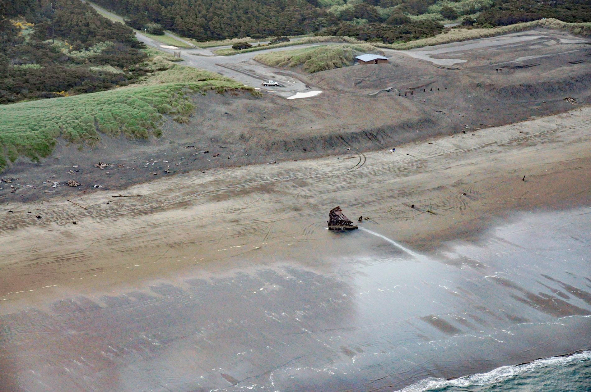
Peter Iredale was a British four-masted bark-rigged sailing ship with a length of 275 feet (84 m) that ran aground in 1906 and wrecked on Clatsop Spit, about 7 miles (11 km) west of Astoria and 2 miles ( km) southwest of Hammond, Oregon. The ship was named after the owner, the Peter Iredale & John Porter Line, and was part of the Pacific Coast grain fleet, also called the wheat fleet. The grain trade was fueled by hundreds of thousands of acres of wheat fields in eastern Oregon, Washington, and Idaho, and grew to become Oregon’s single largest export during the early years of the 20th century. Up to 10,000,000 bushels of wheat per year were loaded onto dozens of ships at Portland and transported to Europe, Asia, and ports in South America and Australia. Navigating the Columbia River to Portland required these sailing ships to cross the dangerous sandbars between Cape Disappointment and Clatsop Spit, often in poor weather conditions.
Clatsop Spit is a massive sand deposit that extends north from Tillamook Head to the Columbia River. The northern end of the spit, before the construction of a jetty, was Point Adams, a navigational landmark first documented in 1775 by Spanish explorer Bruno de Hezeta y Dudagoitia. The point was the site of a prominent village called Klaát-sop, for which the Clatsop people were named. The village was a fishing place of great importance, and Klaát-sop was a reference to the salmon that were caught, processed, and traded from this location. In 1852, President Millard Fillmore authorized the construction of Fort Stevens on Point Adams to defend American interests in the Oregon territory. In 1855, the U.S. Army Corps of Engineers began constructing the South Jetty at Point Adams, which was extended in 1913 and again in 1936 and today is 3,900 feet (1,188 m) long. In 1875, the U.S. Lighthouse Service built a light station on a low, sandy ridge about 1 mile (1.6 km) south of Point Adams. In 1886, Congress approved the construction of the Point Adams Life-Saving Station on the waterfront near the north edge of what became the town of Hammond. By 1899, the new jetty had caused massive sand accretion resulting in the light becoming too far from the sea, and it was decommissioned. The life-saving station was decommissioned in 1967 and is now used by the National Marine Fisheries Service for use as a research station.
On October 25, 1906, Peter Iredale was heading for the Columbia River to meet a pilot schooner that would guide them over the bar. Captain H. Lawrence began steering toward land when the Tillamook Rock Lighthouse was spotted. But the pilot schooner was undergoing repairs and was not on station when Peter Iredale arrived at the south jetty. Within an hour, strong gale-force winds developed, and despite all efforts of the crew, the ship struck the sandy beach near the jetty. The impact was so great that three of the four masts snapped immediately. News of the disaster reached both the Cape Disappointment and the Point Adams Life-Saving stations shortly after Peter Iredale was wrecked. The Point Adams station crew loaded their lifeboat on a cart and pulled it across several miles of sand to render assistance to the stricken vessel. By nine o’clock that morning, several surf boats were starting to bring the shivering seamen ashore. The ship’s hull survived intact, but a salvage operation had to wait several weeks for favorable conditions, and the ship became deeply embedded in the sand. The ship was eventually sold for scrap, and what wasn’t taken was left to rust on the beach which became an immediate tourist attraction. Today, the shifting sands of Clatsop Spit repeatedly bury and uncover the remains of the wreck. Read more here and here. Explore more of Peter Iredale and Clatsop Spit here:

