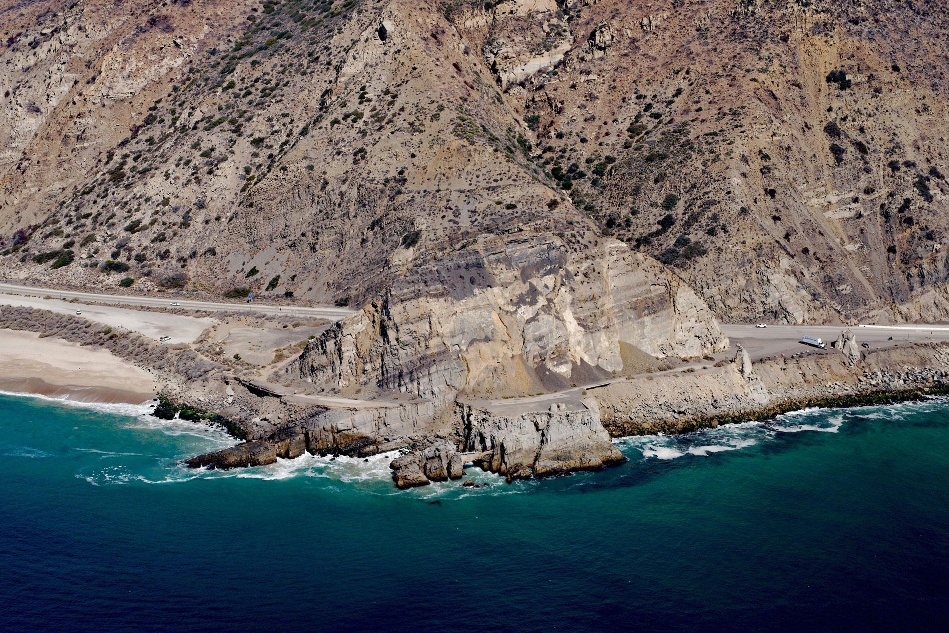
Mugu Rock is a distinctive feature at Point Mugu, a headland in Point Mugu State Park, situated between Thornhill Broome Beach to the east and Mugu Beach to the west in Santa Monica National Recreation Area, about 17 miles (27 km) west-northwest of Malibu, and 9 miles (14.5 km) southeast of Port Hueneme, California. The name is reputedly derived from the historical village of Muwu which was a coastal settlement and ceremonial center of the Chumash people. The name may also refer to the Chumash language word for ‘beach’, which was first mentioned by Juan Rodríguez Cabrillo in journals from his explorations in 1542. Point Mugu is formed by a series of erosion-resistant igneous dikes that intruded the softer sediments of the Lower Topanga Formation during the middle Miocene epoch. In the early 20th century, the headland presented a formidable barrier to the planned coastal highway. In 1923-24, highway engineers blasted a narrow platform around the base of the headland creating a roadbed but this proved to be too dangerous for regular vehicle traffic. In 1937, the headland was cut by an excavation 200 feet (61 m) deep that was blasted from the rock with 107 tons of explosives to create a new roadway 60 feet (18 m) wide effectively isolating Mugu Rock.
The traditional territory of the Chumash people extended west from modern-day Los Angeles along the coast to Santa Barbara. In 1782, Mission San Buenaventura was founded by the Spanish priest Junípero Serra. The mission was named after Saint Bonaventure, a 13th-century Franciscan saint. In 1834, Mexico became independent from Spain and the new government secularized the missions and redistributed mission lands to army veterans. In 1836, Rancho Guadalasca was a Mexican land grant of 30,594 acres (12,381 ha) given to Ysabel Yorba by Governor Mariano Chico. Yorba had petitioned for the land based on the military service of her deceased husband who had been stationed at the Presidio of Santa Barbara. The land grant was along the southeastern border of the mission lands and included part of the Calleguas Creek watershed on the western flank of the Santa Monica Mountains, and extended north from the coast for about 10 miles (16 km) and east for about 8 miles (13 km). After Yorbas death, the rancho was broken up and in 1871, 23,000 acres (9,307 ha) were purchased by William R. Broome. In 1967, the State Division of Beaches and Parks, the forerunner of California State Parks, acquired title to 6,700 acres (2,700 ha) acres of the Broome Ranch, which became the first acquisition for Point Mugu State Park.
Mugu Beach extends west from Mugu Rock along the Pacific Coast Highway to the mouth of Calleguas Creek. The creek drains a watershed of 198,394 acres (80,287 ha) and flows generally south-southwest for 10 miles (16 km) to Mugu Lagoon. Historically, Calleguas Creek flooded seasonally across the Oxnard Plain and deposited sediments that created rich agricultural lands. Concrete channels and dirt levees were built to contain the flow which decreased flooding of agricultural lands but increased sedimentation at Mugu Lagoon. The lagoon is a salt marsh located within the Naval Base Ventura County. In 1941, as the United States entered World War II, Point Mugu became a training area for the Seabees. The facility at Point Mugu started as an anti-aircraft training center and was developed in the late 1940s as the U.S. Navy’s major missile development and test facility since it is one of the few non-agricultural areas. The test range extends offshore and includes San Nicolas Island in the Channel Islands. In 2000, Naval Base Ventura County was formed when Naval Air Station Point Mugu merged with Naval Construction Battalion Center Port Hueneme. Read more here and here. Explore more of Mugu Rock and Point Mugu State Park here:

