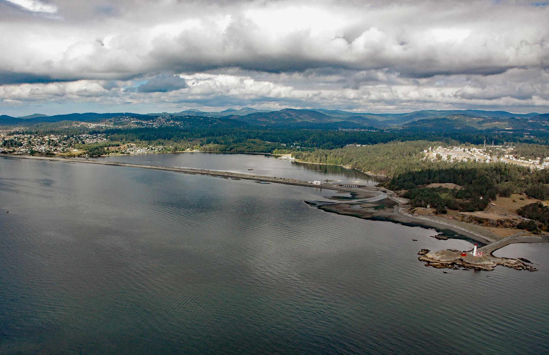
Esquimalt Lagoon is formed by the Coburg Peninsula, a sand and gravel barrier spit 1.2 miles (1.9 km) long at Royal Roads on Vancouver Island, about 4.4 miles (7.3 km) west of Victoria in the city of Colwood, British Columbia. The word ‘Esquimalt’ is a transliteration of the First Nations ‘Ess-whoy-malth’ a phrase usually translated as ‘place of the shoaling waters’. Colwood Creek, Bee Creek, and Selleck Creek drain a watershed of 4,571 acres (1,850 ha) into the lagoon which connects with the sea through a tidal channel at the northeast end of the spit. The spit is a depositional feature principally resulting from the longshore transport of sediment eroded from 1.8 miles (3 km) of backshore representing the Colwood Delta, a massive glacial-fluvial deposit covering an area of 4,127 acres (1,670 ha). The delta formed near the limit of a glacial marine transgression at the end of the last ice advance in the Late Wisconsin period. At that time, the area was isostatically depressed and the relative sea level was approximately 246 feet (75 m) higher than today. The main source of meltwater feeding the delta was glacial ice in the mountains west of Victoria.
Esquimalt Lagoon and surrounding lands are part of the traditional territory of the Xwsepsum and Lekwungen peoples. The lagoon is adjacent to Royal Roads, a large bight at the southern tip of Vancouver Island that was first discovered by Europeans in 1790 when Don Manuel Quimper of the Spanish navy anchored his ship Princess Royal. He named the bight Rada de Valdes y Bazan for Antonio Valdés y Fernández Bazán and claimed the territory for Spain. In 1846, the bight was named Royal Bay by Captain Henry Kellett of the British survey ship HMS Herald. The ‘Royal’ part of the name is probably a reference to Queen Victoria, and her husband Prince Albert, since this stretch of coast lies between the city of Victoria to the east and Albert Head to the south. The ‘Roads’ part of the name was adopted later by mariners and is a variant of ‘roadstead‘, a place where ships may safely lie at anchor close to the shore but is less secure than a harbor. In 1851, the Puget Sound Agricultural Company, a subsidiary of the Hudson’s Bay Company, operated a farm of 600 acres (243 ha) named ‘Colwood’ in the watershed above the lagoon. In 1858, following the Fraser Canyon Gold Rush, settlers started migrating to the lagoon area which led to the establishment of several smaller farms, a tannery, and in 1863, a sawmill was opened on Colwood Creek above the Indian burial site on Esquimalt Lagoon. In 1883, a southeasterly gale swept through the roadstead causing several ships to go aground on the spit at Esquimalt Lagoon including Southern Chief, Gettysburg, Connaught, and Tiger.
Royal Roads University is a public university located on the grounds of the former Royal Roads Military College at Hatley Park National Historic Site. The university’s main building, Hatley Castle, was completed in 1908 for coal and rail baron James Dunsmuir, who was Premier of British Columbia and then Lieutenant Governor during the first decade of the 1900s. At the outbreak of World War II, plans were made for the British royal family to reside in Canada at Hatley Castle; however, they ultimately chose to stay in London. After the death of Dunsmuir, the family sold the estate to the federal government for use by the military. The institution had several names before it eventually became Royal Roads Military College in 1968. In 1995, the military college was decommissioned and Royal Roads University became a public degree-granting university. Read more here and here. Explore more of Esquimalt Lagoon and Royal Roads here:

