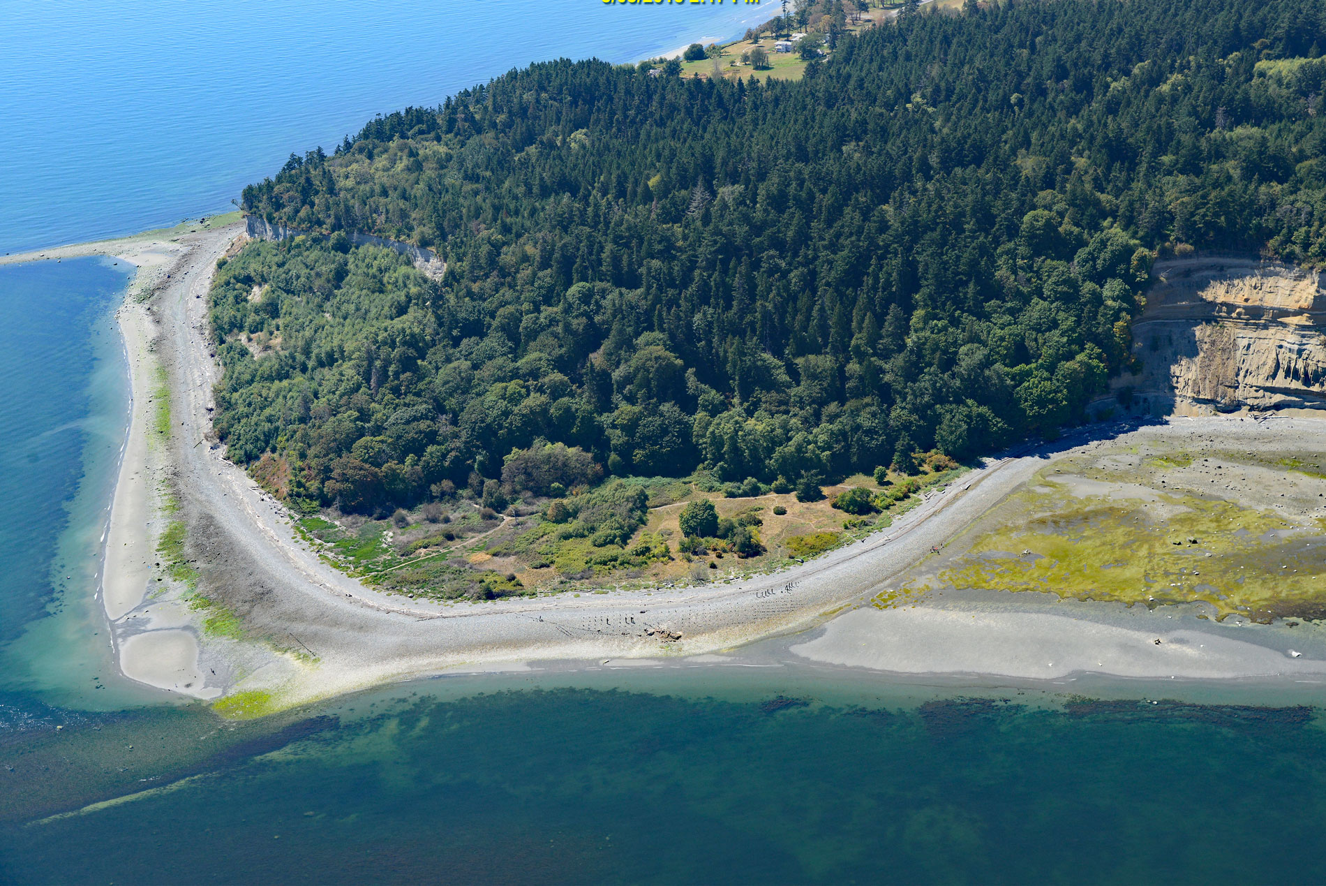
Lily Point Marine Reserve is a park located on Boundary Bay at the southeastern tip of Point Roberts, an exclave of the United States on the southern coast of the Tsawwassen Peninsula, about 22 miles (35 km) south-southeast of Vancouver and 30 miles (48 km) northwest of Bellingham, Washington. The park encompasses over 275 acres (111 ha) with 1.4 miles (2.3 km) of tidal lands and uplands. The Coast Salish name for the point, a historical village site, is ‘Chelhtenem’, meaning ‘hang salmon for drying’, referring to the practice of placing cleaned and flayed salmon on racks to dry in the sun and wind. Boundary Bay is situated on the border between the province of British Columbia in Canada and the state of Washington in the United States. Point Roberts comprises outwash plain deposits called the Vashon Drift consisting of one or more layers of glacial till deposited during the Vashon Glaciation. About 14,500 years ago, when ice sheets covered the lower coast of British Columbia, pieces of the Cordilleran ice sheet broke off and melted, leaving sand, silt, and gravel to accumulate as a recessional moraine. The Fraser River then deposited sediments on the north and east sides of the deposit so that it eventually attached to the mainland to form Point Roberts and the Tsawwassen Peninsula.
According to Coast Salish oral tradition, Point Roberts is where the first ancestors of the Tsawwassen and Cowichan descended from the skies. Point Roberts was a favored fishing spot for the Cowichan, Lummi, Saanich, and Semiahmoo people, and for thousands of years, family groups established fish camps when the salmon were running, although few people lived there year-round. Lily Point was historically an important reef net fishery and sites were owned and inherited within family groups. In 1791, Spanish explorer Francisco de Eliza named the peninsula Isla de Zepeda, believing it was an island. In 1792, Captain George Vancouver anchored in Birch Bay to the south and gave Point Roberts its present name as a tribute to his friend Henry Roberts. In 1846, the Oregon Treaty established the 49th parallel as the boundary between United States territory to the south and British territory to the north, effectively isolating Point Roberts, and the point became a no man’s land and a haven for smugglers.
In 1859, during the Fraser River Gold Rush, the United States established a military reserve at Point Roberts, although there was never a military presence. In 1879, the Pacific Fishing Company established the first store and trading post on Point Roberts, and fish traps soon replaced the traditional reef nets. The military reserve was vacated in 1892, and a town slowly formed on the western shore. In 1893, Edmund Wadhams built a cannery at Lily Point that was supplied entirely by salmon caught by fish traps. The cannery was sold the next year to Alaska Packers Association. By the late 1910s, the salmon runs around Point Roberts were depleted, and in 1917, Alaska Packers closed the cannery. In 1934, fish traps were outlawed in Washington state, sounding the death knell for the fishing industry at Point Roberts. Welsh Development, Inc. acquired the Lily Point property and a major development was approved including condominiums, a golf course, 74 residential lots, and a regional recreational resort. However, the permits expired in 2003 and the property was sold in 2008 to Whatcom County with the assistance of The Nature Conservancy and Whatcom Land Trust. Major goals in the planning process included creating a park and marine reserve to preserve the site’s natural and cultural heritage and public access. Read more here and here. Explore more of Lily Point and Boundary Bay here:

