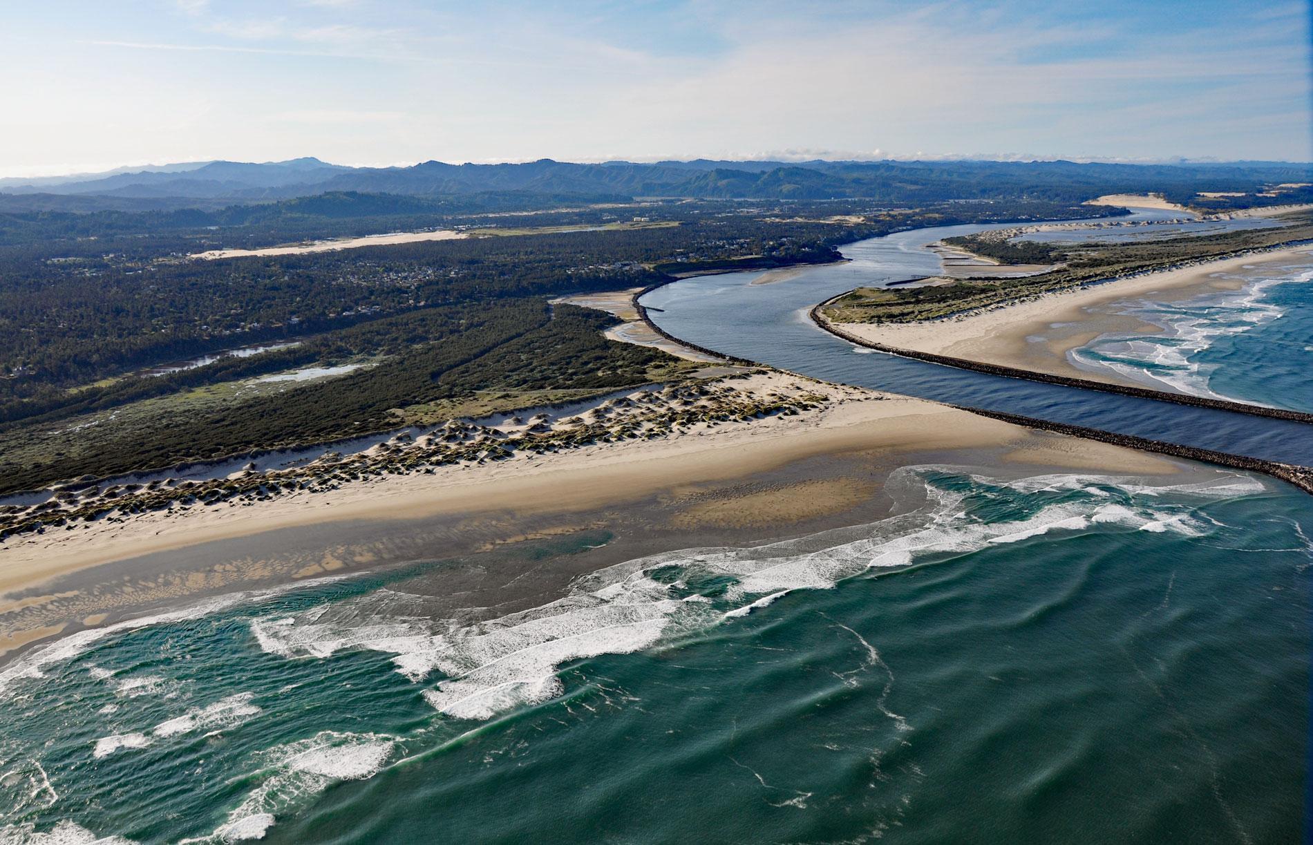
Siuslaw River starts at an elevation of 636 feet (194 m) in the Coast Range and flows generally west-northwest for 110 miles (177 km) to the Pacific Ocean at Florence, draining a watershed of 494,720 acres (200,206 ha), about 53 miles (85 km) west of Eugene and 43 miles (69 km) south of Newport, Oregon. The river is named after the Siuslaw people who are a Yakonan tribe. The first mention of the name was by Lewis and Clark with the Corps of Discovery Expedition in 1805, and another variant of the name was recorded by Lieutenant Charles Wilkes of the U.S. Exploring Expedition in 1842. Florence is a community along the river estuary that historically was the site of a Siuslaw village. The estuary extends 26 miles (42 km) upstream to the head of tide. The watershed is underlain by sedimentary rocks representing the Tyee Formation that developed during the Eocene from marine turbidite deposits. At the river mouth, the bedrock is covered by aeolian deposits of fine sand that create coastal dunes. The youngest dunes are nearest to the ocean and were formed over the last 7,000 years. Dunes further inland were formed more than 20,000 years ago, and the tops of some of the highest dunes were last active more than 100,000 years ago. The source of the sand is mostly the Umpqua and Siuslaw Rivers.
The Siuslaw people inhabited cedar plank houses in about 50 villages and many more seasonal camps while utilizing resources throughout the Siuslaw watershed. An estimated 900-2,100 individuals were present at the time of Euro-American contact in the early 19th century. Winter villages were located near the estuary, where salmon, shellfish, and other tidewater and marine foods were available year-round. Fish weirs in the river estuary have been used for at least 1,000 years and were built with wooden stakes hammered into the mud flats. From spring through autumn, the Siuslaw people moved upriver to take advantage of plants, berries, and anadromous fish, including Pacific lamprey. Euro-American settlement occurred in the upper reaches of the basin near the Willamette Valley in the 1850s. The Coos, Lower Umpqua, and Siuslaw tribes maintained peaceful relations with settlers as they began to stream in from the east. In 1855, a treaty was drafted by the federal government to allow for the peaceful acquisition and settlement of traditional tribal lands in exchange for compensation but was never ratified by Congress. In 1860, the coastal tribes were forcibly removed and marched 60 miles (100 km) north to the Alsea subagency, a reservation on the Yachats River, and their lands were made available for settlement.
In 1876, the first salmon cannery and fishery opened on the shifting sands but closed 3 years later because of sand blowing into the machinery. Reports of huge runs of spawning salmon attracted others who built canneries on the estuary. In 1884, William Kyle opened a cannery and store in Florence, and a cooperative cannery was built near the mouth of the North Fork of the Siuslaw River in 1887. These canneries imported Chinese laborers to process the fish and prepare the cans, bringing in all the necessary equipment and supplies from Astoria and San Francisco. The Kyle cannery packed about 350 cases of salmon a day with 48 1-pound cans per case. From 1887 to 1892, 68,762 cases of salmon were canned and shipped from the Siuslaw River. Kyle also owned the steam tug Robarts, the three-masted lumber schooner Bella, and the Florence Lumber Company. Bella was 121 feet (37 m) long and built in 1897 upriver of Florence at Acme, now known as Cushman. The schooner transported lumber from Florence to San Francisco and brought supplies back to Florence since the town had no road access at the time. In 1906, Bella arrived at the Siuslaw mouth when the bar was rough and hove to offshore waiting for better weather but was blown ashore. The crew reputedly walked through the surf, and all the supplies were salvaged, but the ship was lost. Today, the shipwreck is occasionally visible after winter storms shift the beach sand. Read more here and here. Explore more of the Siuslaw River and Florence here:

