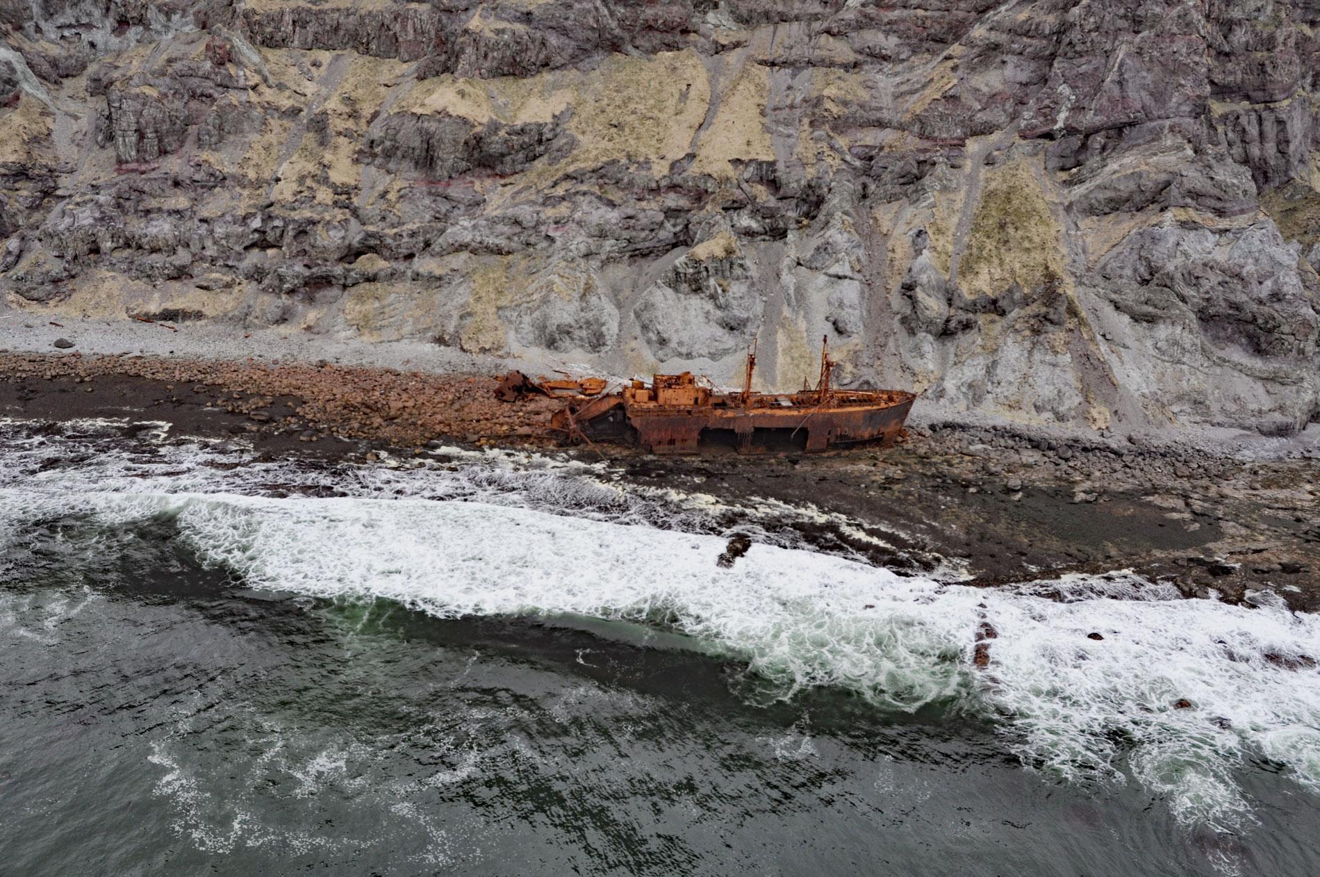
Cape Pankof is a point of land situated at the eastern tip of the lkatan Peninsula on Unimak Island and the site of the shipwrecked SS Oduna, about 148 miles (239 km) northeast of Dutch Harbor and 18 miles (29 km) southeast of False Pass, Alaska. Unimak Island is about 67 miles (108 km) long and 22 miles (35 km) wide, and part of the Fox Islands in the Eastern Aleutians. The Unangan Aleut name was recorded by Captain James Cook in 1785 as ‘Oonemak’. The Russian Orthodox priest Father Ioann Veniaminov first reported the name for the Ikatan Peninsula as ‘Ikatok’ in the 1830s. The Russian name for the cape was first published in 1847 as ‘Pankof’s Cape’. The Ikatan Peninsula is formed by three mountain masses connected near sea level by Quaternary sediments. The westernmost mountain is composed of rocks representing the Belkofski Formation that developed during the Miocene or Oligocene and consists of volcaniclastic sandstone, siltstone, and conglomerate containing tuff and breccia. The eastern portion of the peninsula is composed of breccia and lava flows that were intruded by a quartz diorite pluton. Cape Pankof terminates in three massive cliffs on the southern coast, the westernmost has an elevation of 852 feet (260 m), the easternmost is 1,243 feet (379 m) high, the middle cliff rises to 1,070 feet (326 m).
Unangan people historically hunted sea lions on the rocks and reefs of the Ikatan Peninsula but there were no permanent villages. In 1917, a salmon cannery was built on the north coast of the peninsula in Ikatan Bay by Pacific American Fisheries of Bellingham, Washington and it operated until 1934. On November 26, 1965, Oduna stranded in heavy seas when the radar aboard became inoperative and strong currents swept the ship onto the wave-cut platform at the base of the towering sea cliffs on the south coast of Cape Pankof. Adeline Foss received a distress call from Oduna while towing a barge from Adak to Seward, Alaska. Captain Guy H. Johnson anchored the barge in a nearby bay and attempted to reach Oduna but the seas were running 15 to 20 feet (4-6 m) and breaking violently onshore. Four crewmen volunteered to go ashore in a relatively protected bay with a small work boat, then hike 2 miles (3.2 km) across the island and descend the sea cliff where Oduna was grounded. They managed to rig a breeches buoy and bring 17 of the crew safely to shore, and then the weather improved allowing a U.S. Air Force helicopter to transfer the remaining 20 crewmembers to the U.S. Coast Guard Cutter Storis and Adeline Foss. In 1967, the Maritime Administration awarded Meritorious Service Medals to Adeline Foss and its crew.
Oduna was a steel steamship of 422 feet (129 m) built in 1944 as a Liberty ship type EC-S-C1 for the United States Maritime Commission by the New England Shipbuilding Corporation in South Portland, Maine, one of 18 American shipyards that built 2,710 Liberty ships between 1941 and 1945. The ship was one of the last produced and launched in 1945 as the Francia A. Retka and decommissioned in 1947. In 1954, the ship was owned by Tramp Cargo Carriers Company and named Liberty Bell. The ship was sold several times and in 1964 was owned by the Alaska Steamship Company and renamed Oduna and modified to carry refrigerated shipping containers. Following the successful rescue of the shipwrecked crew from Cape Pankof, the company initially thought that the cargo was lost, but 200,000 pounds (90,718 kg) of frozen crab in refrigerated container vans were salvaged resulting in large holes being cut from the starboard hull to access and extract the containers. Read more here and here. Explore more of Cape Pankof and Unimak Island here:

