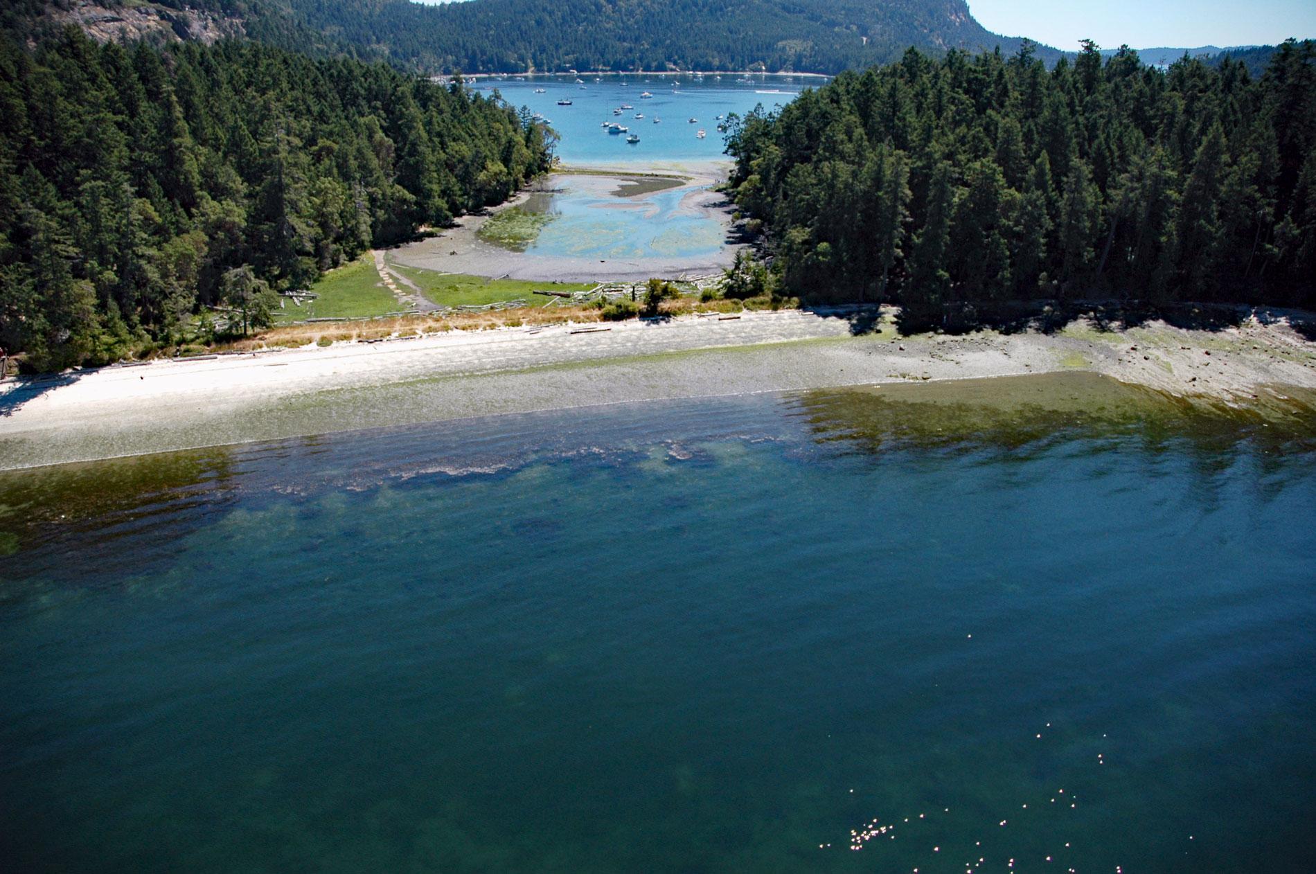
Montague Harbour is a provincial marine park located on Trincomali Channel on the southern coast of Galiano Island, one of the Gulf Islands in the Strait of Georgia, about 32 miles (52 km) north of Victoria and 30 miles (48 km) south-southwest of Vancouver, British Columbia. Montague Harbour is an embayment well protected on the west by the Gray Peninsula, which is connected to Galiano Island by a low isthmus, and to the south by Parker Island which forms two narrow channels leading to the harbor. Galiano Island was named in 1859 by Captain George H. Richards on HMS Plumper after the Spanish explorer Dionisio Alcalá Galiano, who explored the area in 1792. Galiano Island is long, narrow, and broken up into a series of ridges and valleys that control the local drainage patterns. These topographic features were formed by sedimentary rocks of the Nanaimo Group that developed during the Late Cretaceous and consist of alternating sequences of sandstone and siltstone, and mudstone and shale. These rocks are covered by Quaternary glacial deposits of glacial till or fluvial sands and gravels deposited by glacial meltwater. Small wetlands, bogs and creeks are common across the island.
Montague Harbour has a white shell beach on the north shore that contains several prehistoric middens representing 3,500 years of human occupation. Local collectors have recovered artifacts from these beaches for decades probably because of the middens being eroded and redeposited by winter storm surges and cumulative sea-level rise. In the 1960s, major archaeological excavations on the beach found arrowheads, spearheads, and stone carvings. The Gray Peninsula on the western shore of the harbor consists of a substantial bedrock island, and a coastal spit creating an isthmus with an intertidal lagoon and a freshwater bog. Seventeen archaeological sites have been found including a possible fish trap, extensive shell middens, and habitation sites representing the Marpole culture. These people are associated with complex hunter-gatherers exhibiting traditions of hereditary matrilineal inequality, multi-family housing, resource ownership, and wealth accumulation. Coast Salish nations inhabited Galiano Island since before the arrival of Spanish explorers, and in historical times, the Penelakut First Nation inhabited the Gray Peninsula and other locations on the island. Galiano Island was mostly isolated from European settlers until 1858 when gold was discovered in the Fraser Canyon. Poor soil on the island limited the development and early settlers resorted to fishing and logging. In 1871, the confederation of British Columbia into Canada and the subsequent completion of the Canadian Pacific Railway in 1885, caused a rapid influx of pioneers to Galiano Island and a small community became established.
Montague Harbour Park was established in 1959 and expanded in 1978 to 25 acres (10 ha). In 1982, the name was changed to Montague Harbour Marine Park and today extends from a depth of 16 feet (5 m) below sea level to an elevation of 590 feet (180 m) on a steep rocky precipice and now includes approximately 252 acres (102 ha) with 173 acres (70 ha) of uplands and 79 acres (32 ha) of foreshore. The marine park is designated Category II by the International Union for Conservation of Nature. The enlisting of protected areas is part of a strategy being used toward the conservation of the world’s natural environment and biodiversity. The main objective of a Category II wilderness area is the protection of a functioning ecosystem, but the classification implies more leniency with human visitation and its supporting infrastructure. These parks are managed in a way that may contribute to local economies through promoting educational and recreational tourism on a scale that will not reduce the effectiveness of conservation efforts. The surrounding areas of a park may be for consumptive or non-consumptive use but should nevertheless act as a barrier for the defense of the protected area’s native species and communities to enable them to sustain themselves in the long term. Read more here and here. Explore more of Montague Harbor and Galiano Island here:

