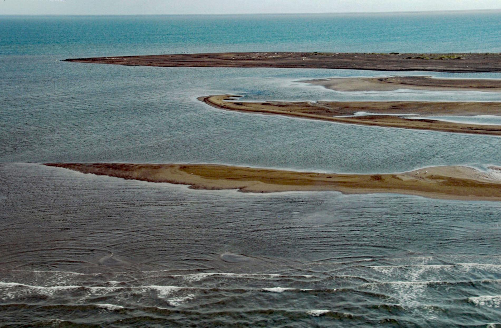
Point Franklin is the site of several whaling shipwrecks at the end of a barrier spit that extends 13 miles (21 km) northeast from the Arctic Coastal Plain, and together with the Seahorse Islands, separates Peard Bay from the Chukchi Sea, about 54 miles (87 km) southwest of Utqiaġvik and 33 miles (53 km) northeast of Wainwright, Alaska. The point was originally named Cape Franklin in 1826 by Captain Frederick W. Beechey after Sir John Franklin. Peard Bay was named after Lieutenant George Peard. The Arctic Coastal Plain is composed of unconsolidated Quaternary sediments overlying rocks that developed during the Cretaceous period, or 145 to 66 million years ago. The surface sediments are covered by tundra and permafrost with numerous streams and thaw lakes. The barrier spit is composed of fine sand mixed with some coal that eroded from tundra bluffs and was transported by coastal currents that set to the north. The Chukchi Sea is generally ice-covered from December to June; however, the area between Icy Cape and Point Barrow is known for a recurring polynya. Polynyas are areas of year-round open water or thin ice found at predictable and recurrent locations in sea ice-covered regions. They are formed either because of oceanic properties such as temperature and salinity that prevent ice formation, or by winds that cause ice divergence. These open water areas in an otherwise frozen world attracted marine mammals such as walruses, seals, and whales, and the Iñupiat and 19th century whalers that hunted them.
Peard Bay is a traditional hunting area for the Iñupiat who have an ancient encampment called Tatchim Isua meaning ‘end of the bay’ on the eastern shore of the bay. In 1825, Beechey was appointed to command HMS Blossom to explore the Bering Strait and proceed north to rendezvous with Franklin who descended the Mackenzie River and traveled west exploring the Beaufort Sea coast. Beechey did not get far beyond Icy Cape due to ice and shoal water and sent a small boat north under the command of Thomas Elson and William Smyth who made it the settlement of Nuvuk at Point Barrow. At Peard Bay they purchased a ‘baidarka’ from a group of Iñupiat who were eager to trade. By the mid 19th century, European Americans had started whaling in the Western Arctic, a region that had not been commercially exploited. Largely disregarding the Indigenous communities, who relied on the whales and walrus for food and sustaining cultural traditions, whaling ships arrived in the Western Arctic in increasing numbers. Within two decades, the bowhead whale population in this region was reduced by approximately two-thirds. Getting the valuable oil and baleen was extremely hazardous, and between 1850 and 1900, around 42 whaling ships were lost along this stretch of the Chukchi Sea coast. In 1957, an intermediate site of the Distant Early Warning Line was established at Peard Bay near Tatchim Isua. The station was crewed by 5 full-time staff who operated a radar system, tropospheric scatter communication systems, and an airstrip until the facility was abandoned in 1963.
Point Franklin was the site of a whaling disaster when a fleet of 33 American whaling ships was trapped in the Chukchi Sea ice and subsequently abandoned. In August 1871, the fleet was in the polynya near Wainwright when a stationary high-pressure weather system reversed the normal wind pattern and pushed the pack ice toward the Alaskan coast. Seven ships were able to escape to the south, but 33 others were trapped. By mid-September, all 1,219 people aboard the ships evacuated in small whaleboats with a three-month supply of provisions, crossed 70 miles (110 km) of ocean, and were eventually brought to safety. Wreckage from several ships was recently found between Point Franklin and Wainwright. In 1876, another 20 whaling vessels were enticed to proceed north in the polynya when the wind shifted trapping all but one ship in ice 20 miles (32 km) offshore. The captains decided to abandon the ships and head for shore and around 300 men, dragging whaleboats and as much of the ship’s provisions as they could, proceeded to Point Barrow. In 1897, eight more whaling ships were trapped in ice near Point Barrow and the owners were concerned that the 265 crew would starve during the winter. They appealed to President William McKinley to send a relief expedition, and the US Revenue Cutter Bear was dispatched, but the rescue was halted at Cape Vancouver by ice. Captain Michael A. Healy then sent an overland party to trek 1,500 miles (2,400 km) north, picking up a herd of reindeer at Teller on the way, and reached the stranded whalers 3 months later. These events decimated the whaling fleet and contributed to the subsequent demise of the industry. Read more here and here. Explore more of Point Franklin and Peard Bay here:

