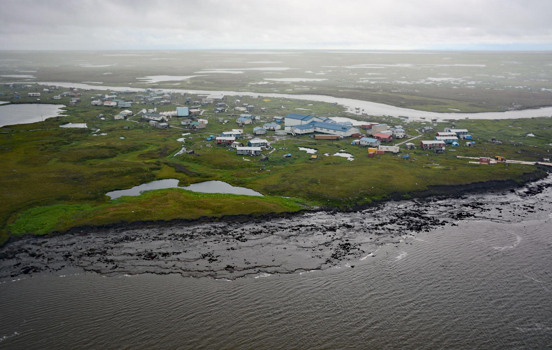
Newtok is a Central Yup’ik community located between the Ningaluk River to the south and a tidal slough to the north, 19 miles (31 km) upstream from the Bering Sea in the Yukon-Kuskokwim Delta, about 125 miles (202 km) south of Emmonak and 96 miles (155 km) west of Bethel, Alaska. Ningaluk River flows west for about 44 miles (71 km) from Baird Inlet to Hazen Bay on the Bering Sea. Baird Inlet is about 35 miles (56 km) long and is bordered to the south by Nelson Island. The inlet was named in 1880 by Ivan Petrof after Spencer F. Baird, an American naturalist the first curator for the Smithsonian Institution. Newtok is situated in one of the largest river deltas in the world, an area of low elevation and topography represented by wetlands and tundra with many ponds and meandering rivers that are tidal up to 12 miles (20 km) inland. The ground at the village is mostly unconsolidated Pleistocene glacial sands and silts transported from interior Alaska by the Yukon and Kuskokwim rivers. The surrounding area is represented by marine terraces, uplifted ancient shorelines composed of many types of surficial deposits, which are primarily estuarine, tidal flat, and alluvial deposits, but may include glacial debris and outwash. Permafrost in this part of the delta is sporadic to discontinuous and melting because of current climate conditions. The melting of permafrost on the delta and loss of sea ice on the Bering Sea has resulted in increased soil erosion on the banks of the Ningaluk River at Newtok.
Archaeological research along the Bering Sea coast of the Yukon-Kuskokwim Delta and the adjacent inland area suggests that Norton tradition peoples living inland along lakes and rivers gave rise to the coastal Central Yup’ik peoples. Before 2400 years ago, small numbers of people probably were present at prime coastal locations and at about that time there was a population increase and the number of coastal villages increased, including at more marginal localities along the coast. Nets were first used to catch salmon and this new technology may have triggered population growth. Nets were also used to catch migratory birds and land mammals which may have facilitated expansion inland to the tundra wetlands of the Yukon-Kuskokwim Delta and adjacent areas that previously had not been permanently occupied. The people from the villages of Nelson Island and the Ningaluk River are known as Qaluyaarmiut, or ‘dip net people’. When the first Russian explorers entered the region in the late 1700s and established trading posts from 1819 to 1851, manufactured goods were already present due to trade across Bering Strait that originated in prehistoric times. The original Qaluyaarmiut settlement on the north bank of the Ningaluk River was called Kealavik and located about 6 miles (10 km) upstream from the Bering Sea. In the late 1950s, the village was relocated to its present location to escape flooding. A school was built in 1958, although high school students were required to travel to Bethel, St. Mary’s, Sitka, or Anchorage for their education. In 1960, the village name was changed to Newtok.
Newtok experienced about 650 feet (200 m) of shore erosion between 2005 and 2019. In 2003, Newtok negotiated a land transfer with the U.S. Fish and Wildlife Service for a new site about 10 miles (16 km) away on Nelson Island at an elevation of 400 feet (122 m) and located on bedrock. In 2019, 137 residents from 21 households, out of 321 residents and 63 households, moved to the new town, called Mertarvik. The relocation of Newtok involved land acquisition, building new infrastructure, and the transfer of an entire population at a cost of about $350K per resident to address climate driven sea-level rise, flood risk, and loss of property and infrastructure. The process was initiated and led by the Newtok community that developed a plan and set the direction and priorities, pushed for funding, and trained a skilled labor force to implement the move and maintain the new community. The focus of this managed retreat approach and relocation is to make the retreating communities more resilient to future losses, but the costs will be an obstacle. Seven villages in Alaska have been identified as threatened by coastal erosion, and the threat is imminent at Kivalina and Shishmaref that have populations of 374 and 563, respectively. Read more here and here. Explore more of Newtok and the Yukon-Kuskokwim Delta here:

