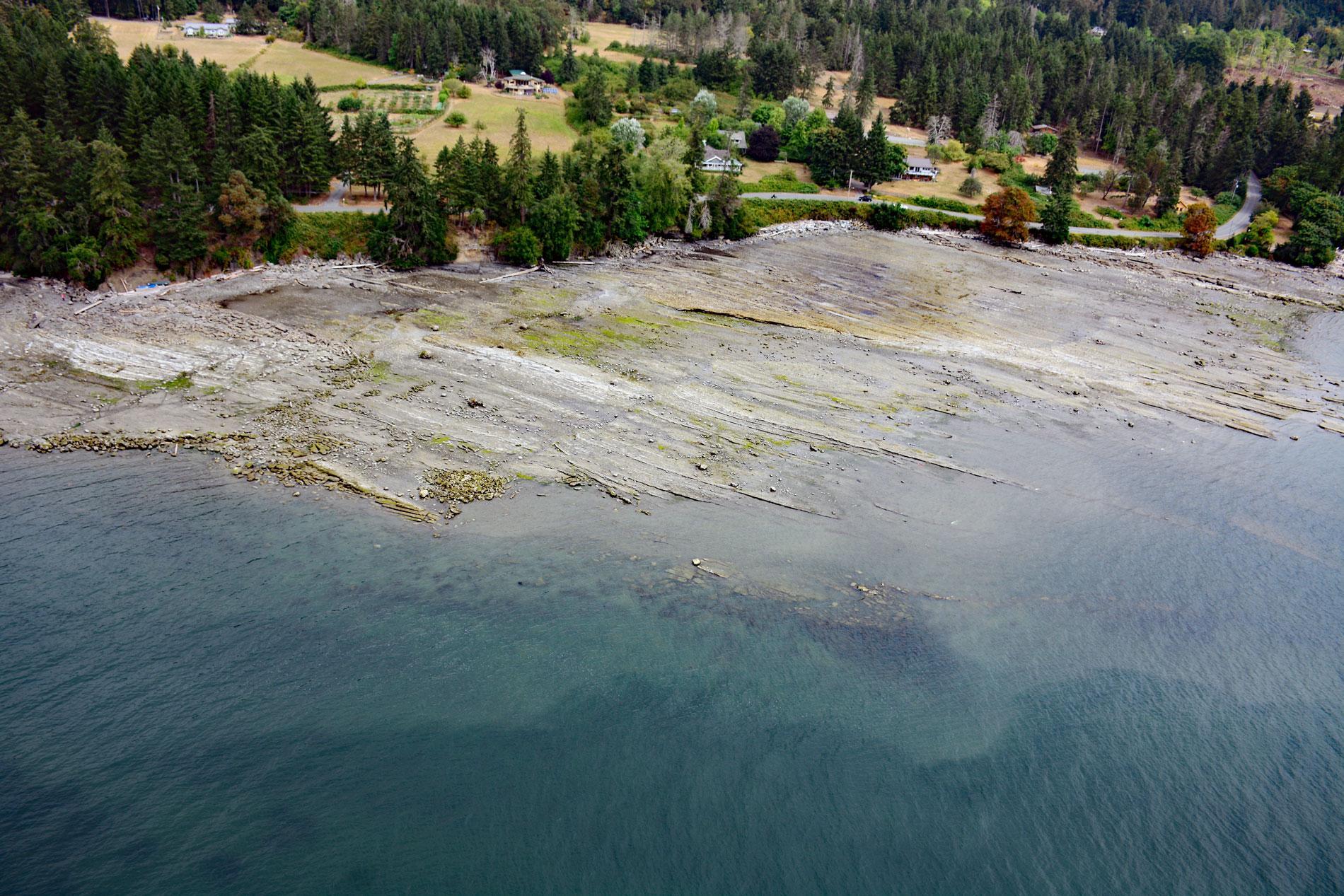
False Narrows is a waterway between 10 and 30 feet (3-9 m) deep, navigable only by small boats and with local knowledge, and about 1.3 miles (2 km) long that separates Gabriola Island to the north from Mudge Island to the south, about 37 miles (60 km) northwest of Sidney and 8 miles (13 km) southeast of Nanaimo, British Columbia. The name dates to British Admiralty Charts from 1859. Mudge Island was named in 1859 by Captain George H. Richards after William F. Mudge, an officer on HMS Plumper. The southeastern tip of Gabriola Island reputedly was named Punta de Gaviola in 1791 by José María Narváez, a Spanish explorer on the schooner Santa Saturnina, and over time the name was corrupted to ‘Gabriola’ and applied to the whole island. The bedrock of the islands is represented by different layers or formations within the Nanaimo Group that developed during the Late Cretaceous. These rock formations consist mostly of sandstone, siltstone, and mudstone that were formed by the deposition of sediments in an elongated trough-shaped basin. Sedimentation was probably triggered by the collision and subsequent accretion of the Wrangellia Terrane onto the edge of North America. The collision would have created significant uplift and mountain building resulting in a period of rapid erosion and high sedimentation. The sediments were derived largely from volcanic, igneous intrusive and metamorphic rocks of the mainland, with some minor contribution from Vancouver Island rocks. The Nanaimo Group includes conglomerate, sandstone, mudstone, and shale.
Gabriola Island is part of the traditional territory of the Snunéymux First Nations. Before the arrival of Europeans, several thousand people lived on Gabriola Island in several villages and the largest was situated on False Narrows known as Senewelets. The term is a Halkomelem word meaning ‘go inside narrows via the back part’. Archaeological investigations at this site indicate it was inhabited for at least 2,000 years by prehistoric Marpole and historic Coast Salish peoples who were dependent mostly on food from the sea and the coastal fringe. Europeans began settling on Gabriola Island shortly after coal was discovered in the Nanaimo area in 1852. Coal miners, ex-gold miners, and pre-emptors started farms to supply the growing population of Nanaimo. By 1874, 17 settlers were working the land on Gabriola, and ten years later the number of settlers had doubled. In 1887, a sandstone quarry was operating at Descanso Bay on the western end of the island to supply dimension stone for major buildings in Victoria and Vancouver. Later in the 20th century, the quarry was used to produce mill stones and pulp stones for local paper production. In 1911, a brickyard operation was built at the western end of False Narrows. The bricks were made from crushed shale that was mixed with water to make clay and then pressed before being fired in a kiln. After World War II, a shipyard operated at Silva Bay on the eastern end of the island and became the major employer until the 1970s. The quarry operated until 1936 and the brickyard was shut in the early 1950s.
About 3 miles (5 km) of the southern shore of Gabriola Island west of False Narrows is used as a temporary moorage for log rafts waiting to be processed at the Nanaimo Forest Products Harmac pulp mill on the east coast of Vancouver Island near Nanaimo. The mill produces wood pulp made from Douglas fir, western hemlock, balsam fir, and western red cedar which is sold to markets in Asia, Europe, North America, and Latin America. The mill is situated on a deep-water port to facilitate the handling of logs delivered in rafts, as well as other raw materials such as wood fiber, and the export of pulp. Since the early 1900s, log towing was a common means of transporting bulk timber from remote areas of British Columbia to lumber and pulp mills. As this practice evolved and tugboats became larger and more powerful, the log rafts also became larger and more expensive if lost or broken up in stormy weather. In the 1920s, loggers developed various types of rafting configurations to minimize loss. Davis rafts are up to 250 feet (76 m) long, 60 feet (18 m) wide, and 30 feet (9 m) deep, and a raft can contain nearly a million feet of timber. Timber rafts reached enormous proportions, sometimes thousands of logs were contained in rafts up to 2,000 feet (600 m) long, 160 feet (50 m) wide, and stacked over 6 feet (2 m) high. Read more here and here. Explore more of False Narrows and Gabriola Island here:

