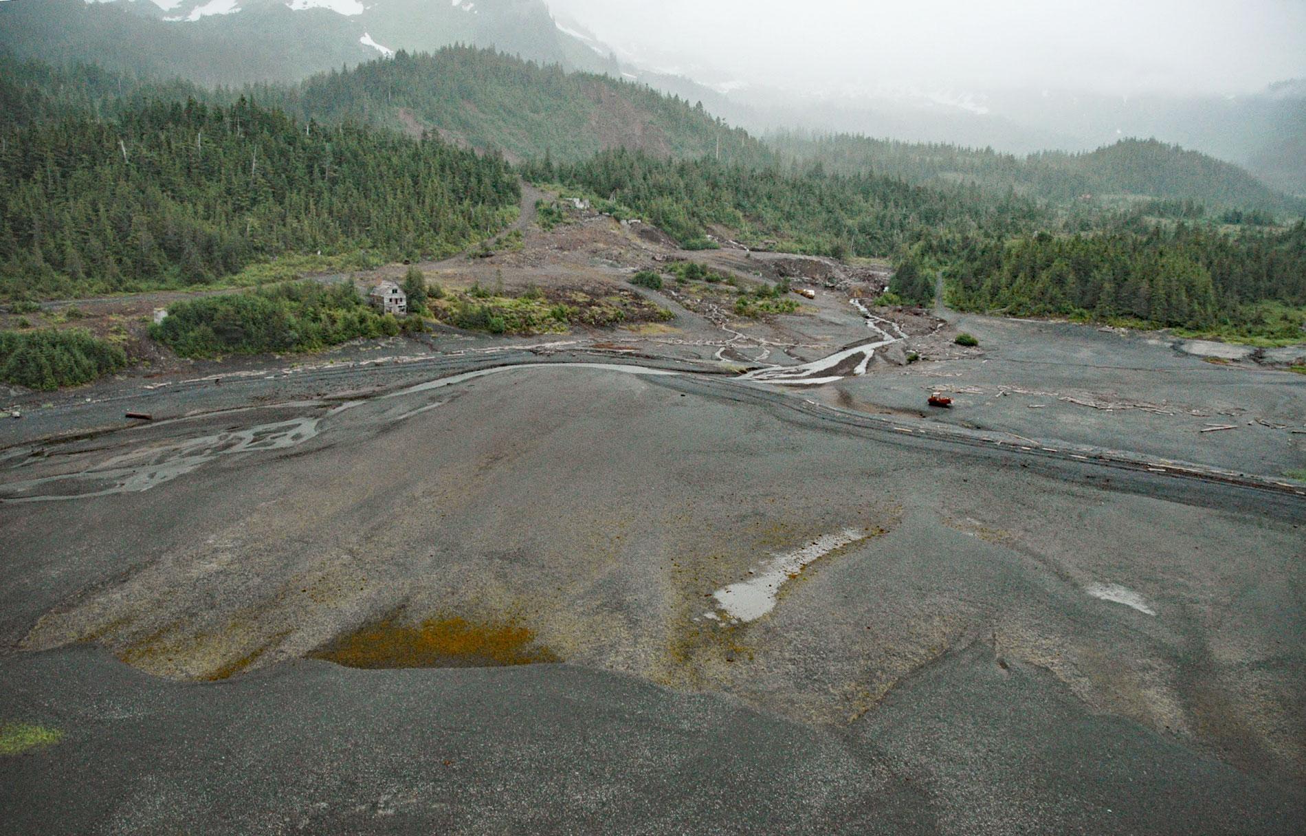
Beatson Copper Mine and the abandoned mining community of Latouche are situated at the base of Mount Beatson and adjacent to Powder Point near the northwest tip of Latouche Island in Prince William Sound, about 82 miles (132 km) southwest of Cordova and 57 miles (92 km) southeast of Whittier, Alaska. Latouche Island is between Montague Strait to the east and Latouche Passage to the west and was first named Foot Island in 1787 by Captain Nathaniel Portlock. The island was named Latouche in 1794 by Captain George Vancouver, presumably after the famous French naval commander of that time, Louis-René L. de Latouche Tréville. The mine was named after Andrew K. Beatson, a prospector and miner who discovered and staked a series of ore deposits on Latouche Island in the late 1890s. The islands and mountains in Prince William Sound represent a major portion of one of the world’s largest accretionary complexes now called the Southern Margin Composite terrane that comprise rocks of the Orca Group, Valdez Group, and McHugh Complex. Latouche Island is formed by the Orca Group and consists of turbiditic sedimentary rocks that developed during the late Paleocene to early Eocene, mostly greywacke sandstone, siltstone, mudstone, slate, and some conglomerate. The ore bodies at Latouche are in a fault zone that extends almost the full length of Latouche Island. The Beatson mine is on the Beatson Fault, one of the major faults in the fault zone, where the principal ore body consisted of chalcopyrite, pyrrhotite, and pyrite in grains scattered through the altered country rock and in small veinlets associated with quartz.
Production of copper sulfide ore was started by the Beatson Mining Company in 1904. In 1907, the Alaska Syndicate owned by John P. Morgan and the Guggenheim family purchased the mine, and in 1910, the mine was owned by the Kennecott Copper Corporation. From 1904-1930, the Beatson Copper mine was Alaska’s largest copper mine in terms of ore extracted, with more than 6 million tons processed at Beatson compared to about 4.5 million tons mined and milled from the Kennecott mines near McCarthy. Kennecott mixed the lower grade sulfide copper ore from the Beatson Mine with the much higher-grade copper sulfide concentrates from the McCarthy area to provide an appropriate metallurgical feed for smelters in Tacoma, Washington. The main ore body at the Beatson mine was accessed from a vertical shaft 325 feet (100 m) deep, and two horizontal adits with a combined length of 1,000 feet (304 m) at 250 feet (76 m) below sea level. A major engineering challenge was to keep the underground workings from being flooded with sea water. In 1910, Frank Rumsey Van Campen was hired as the chief mining engineer and he designed a sophisticated cofferdam system to prevent the mine from flooding. He was married to Helen Van Campen who documented her life at Latouche with stories and photographs that were published in national periodicals. The mine peaked from 1917 to 1918 when there were about 300 people working at the Beatson Mine and about 4,000 people living on Latouche Island. The mine closed in 1930, reportedly due to low copper prices and little remaining high-quality ore, and water flooded the glory hole when the pumps were stopped.
In 1962, the Kennecott Copper Corporation retained the mineral rights but sold the property and surface rights to James Sumpter, operating as the Latouche Island Development Corporation, and demolished the mine-related structures. In 1971, Chugach Alaska Corporation acquired the land surrounding the former mining area under the Alaska Native Claims Settlement Act, and the State of Alaska owns the intertidal lands and the nearby Horseshoe Bay State Marine Park. The mine property was sold in 1976 and again in 1978. Donald Marino, operating as Rare Earth, Inc., subdivided the property, built roads and an airstrip using waste rock from the mine, and began selling parcels for residential or recreational use. In 1989, the mineral rights were purchased by Minaska, Inc., a subsidiary of Rio Tinto Corporation. In 2013, the Alaska Department of Environmental Conservation was informed of potential contamination from mine tailings at the former Beatson Mine property. A large volume of copper tailings is present in the uplands and marine intertidal area. The oxidation of iron sulfide ore such as pyrite and pyrrhotite due to weathering releases small quantities of sulfuric acid. This was exacerbated by crushing the host rock during the ore concentration process which increased the surface area exposed to weathering and subsequently the rate of acid formation. Acid mine drainage is visible throughout the mine area and consists of yellow and orange precipitates in the surface water. Since 2016, Rio Tinto has been investigating possible environmental impacts at the site and has purchased many of the residential lots impacted by the former mine. Read more here and here. Explore more of Beatson Copper Mine and Latouche Island here:

