
Alaska
Recent Articles
More Articles
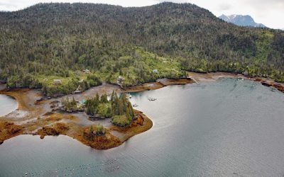
Peterson Bay, Kachemak Bay
Peterson Bay extends approximately 2 miles (3.2 km) from Peterson Point into the Kenai Peninsula on the southeastern shore of Kachemak Bay in lower Cook Inlet, about 18 miles (29 km) northeast of Seldovia and 10 miles (16 km) southeast of Homer, Alaska.
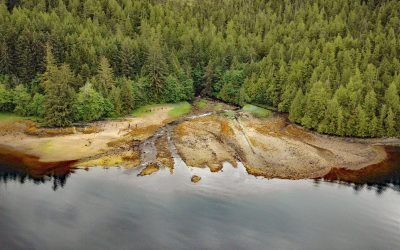
Cape Fox Packing Company Cannery, Boca de Quadra
The Cape Fox Packing Company operated a cannery from 1883 to 1886 on the north shore of Boca de Quadra, a fjord on the Portland Peninsula, about 59 miles (95 km) north-northwest of Prince Rupert and 36 miles (58 km) southeast of Ketchikan, Alaska.
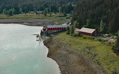
Letnikof Cove, Chilkat Inlet
Letnikof Cove is a small embayment about 0.5 miles (0.8 km) across on the eastern shore of Chilkat Inlet, approximately 70 miles (113 km) north-northwest of Juneau and 5 miles (8 km) south-southeast of Haines, Alaska.
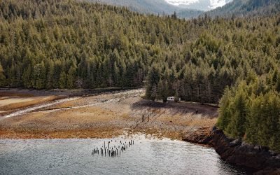
Union Bay Cannery, Ernest Sound
Union Bay is located on the lower Cleveland Peninsula at the southern entrance to Ernest Sound, between Lemesurier Point to the west and Union Point to the east, about 3 miles (4.8 km) northeast of Meyers Chuck and 34 miles (55 km) northwest of Ketchikan, Alaska.
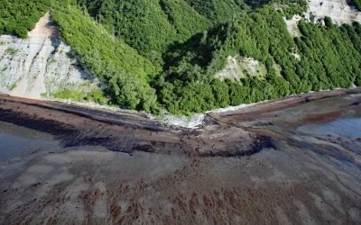
Cottonwood Creek, Kachemak Bay
Cottonwood Creek is a stream on the Kenai Peninsula in Kachemak Bay State Park that flows south for about 2 miles (3.2 km) to the northern shore of Kachemak Bay, about 13 miles (21 km) northeast of Homer and 6 miles (10 km) southwest of Voznesenka, Alaska.
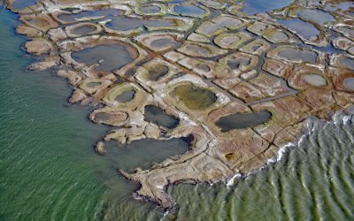
Fish Creek, Harrison Bay
Fish Creek flows generally northeast for approximately 110 miles (177 km) to Harrison Bay at the western edge of the Colville River Delta, about 141 miles (230 km) southeast of Utqiaġvik and 12 miles (19 km) north-northwest of Nuiqsut, Alaska.
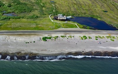
Swanberg Dredge, Rocker Gulch
Swanberg Dredge is a historic placer mining machine, located in a small artificial pond at Rocker Gulch, that once extracted gold from sand and gravel on the Seward Peninsula, about 18 miles (29 km) west of Safety and 1 mile (1.6 km) east of Nome, Alaska.
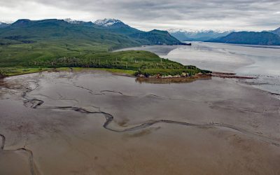
Fossil Point, Tuxedni Bay
Fossil Point is a prominent landmark in Lake Clark National Park and Preserve on the southern shore of Tuxedni Bay, at the north end of Tuxedni Channel and west of Chisik Island, about 56 miles (90 km) southwest of Kenai and 54 miles (87 km) northwest of Homer, Alaska.
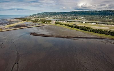
Mud Bay, Kachemak Bay
Mud Bay is a tidal flat about 0.6 miles (1 km) wide, partially enclosed by sand spits and situated at the sheltered base of the Homer Spit on the northwest shore of Kachemak Bay, about 2.7 miles (4 km) southwest of Millers Landing and 1.5 miles (2.4 km) southeast of Homer, Alaska.
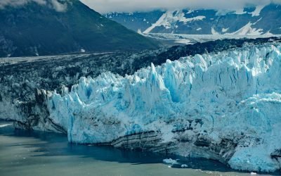
Valerie Glacier, Disenchantment Bay
Valerie Glacier is formed by several tributary glaciers that flow from the south flank of Mount Vancouver in the Saint Elias Mountains of the Icefield Ranges, and the merged ice streams flow generally southeast for about 14 miles (22.5 km) to laterally join with the Hubbard Glacier and terminate in Disenchantment Bay, about 154 miles (248 km) northwest of Haines and about 33 miles (53 km) north-northeast of Yakutat, Alaska.
About the background graphic
This ‘warming stripe’ graphic is a visual representation of the change in global temperature from 1850 (top) to 2019 (bottom). Each stripe represents the average global temperature for one year. The average temperature from 1971-2000 is set as the boundary between blue and red. The colour scale goes from -0.7°C to +0.7°C. The data are from the UK Met Office HadCRUT4.6 dataset.
Click here for more information about the #warmingstripes.