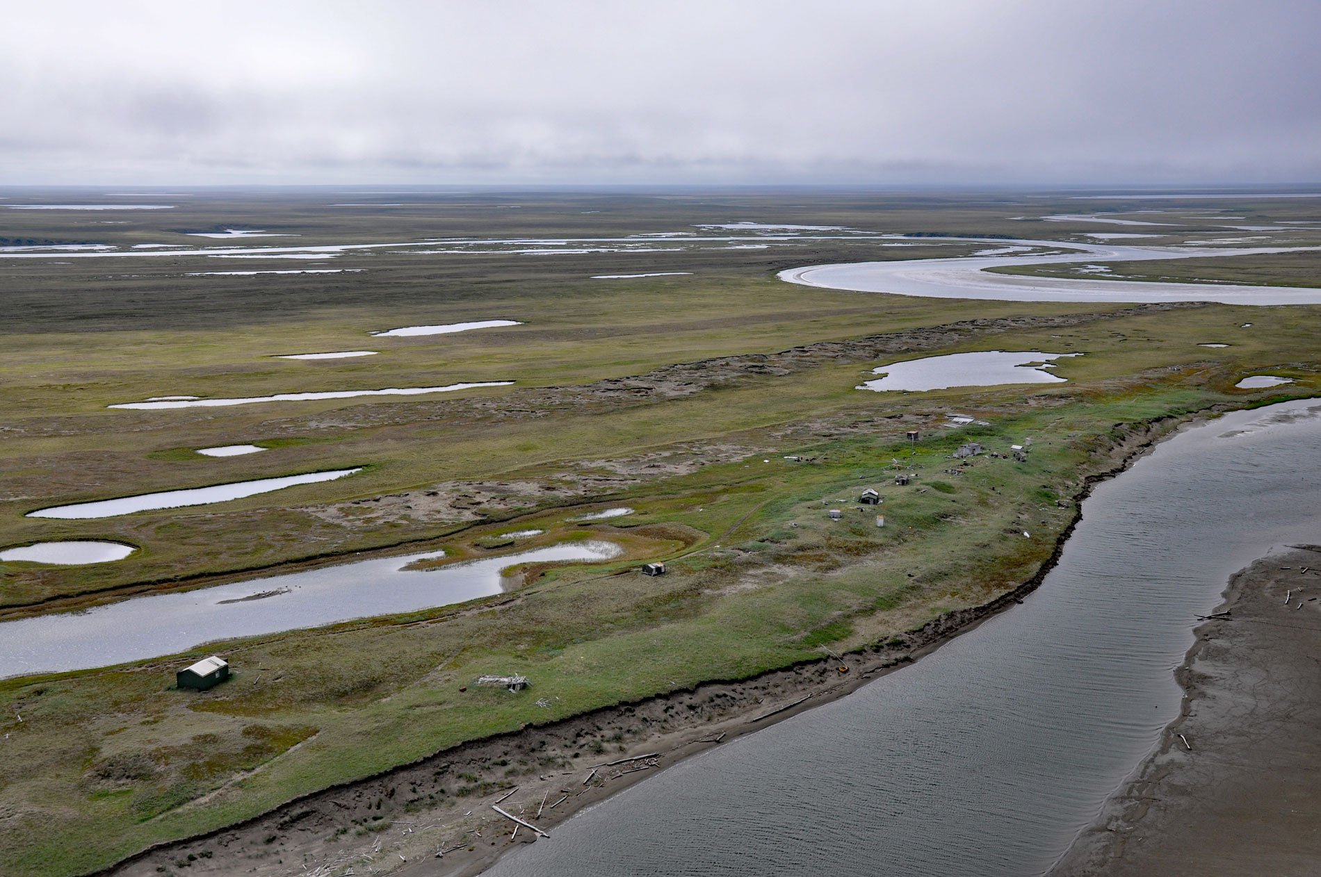
Espenberg is a historic Iñupiaq settlement and present-day fish camp at Cape Espenberg, a peninsula composed of a series of dune-covered beach ridges on the Chukchi Sea coast of the Seward Peninsula that extends eastward into Kotzebue Sound, about 63 miles (101 km) east-northeast of Shishmaref and 43 miles (69 km) southwest of Kotzebue, Alaska. The cape was named in 1816 by Lieutenant Otto von Kotzebue for Dr. Karl Espenberg, a surgeon who accompanied Admiral Adam J. von Krusenstern on his voyage around the world in 1803-1806. The settlement is situated at the mouth of the Espenberg River that flows generally northeast for 21 miles (34 km) to the Chukchi Sea. The river starts from an elevation of 200 feet (61 m) between Devil Mountain Lakes to the west and Killeak Lakes to the east, which are some of the largest maars on Earth, and drains a watershed in the Espenberg volcanic field. The field includes the northernmost volcanoes in North America that were last active during the late Pleistocene until 17,500 years ago. The large size of these maars has been attributed to the interaction between permafrost and rising magma intrusions, which caused intense explosive eruptions. The volcanic field is part of the Bering Land Bridge National Preserve.
The Seward Peninsula is a remnant of a land bridge called Beringia that spanned the Bering Strait and linked Siberia with North America during periods of continental ice advance which lowered global sea levels. During successive glacial epochs, this bridge became a migration route for people, animals, and plants. The earliest artifacts found in the area are modified animal bones interpreted as evidence of human presence dating to about 13,000 years ago. Early humans likely traveled along the coast and across the interior of Beringia while following food resources. People of the Arctic Small Tool tradition exploited sea mammals and spread across the Arctic about 4200 years ago, as far east as Hudson Bay and as far south as the Alaska Peninsula. Remains of this culture have been found on the Seward Peninsula at Cape Espenberg, and several other sites. The final phase of the Arctic Small Tool tradition is represented by the Ipiutak culture, appearing about 1900 years ago and continuing until about 1000 years ago. The Northern Maritime tradition followed the Arctic Small Tool tradition, which includes Birnirk, Western Thule, and Kotzebue Period cultures, dating from approximately AD 600 to the early 19th century. This tradition is considered to be the prehistoric expression of the modern historic Iñupiaq culture in North America.
European exploration and development began in the 1700s when Russian and then English explorers mapped the Bering Strait and the land to the north. The traditional lifestyles of the Iñupiat remained fairly stable until the mid-19th century. Although Russian trade goods had reached northwest Alaska during the 1700s through trade with Siberian peoples, it did not seem to have a significant effect. The first direct European contact with Iñupiat of the Seward Peninsula occurred in 1816 when Lieutenant Otto von Kotzebue landed at several places on the northern coast. The situation changed rapidly after 1850, with the arrival of Yankee whalers and others. Fur trade expanded in economic importance, missionary activity increased, and the use of sophisticated dog-sledding methods became common. In the late 1890s, the gold rush in the southern portion of the Seward Peninsula attracted thousands of miners, who quickly spread over the peninsula to search for gold. Mining camps were set up at Deering, Taylor, and Serpentine Hot Springs, and other sites. The Alaska Road Commission marked cross-peninsula trails, and remnants of shelter cabins built along these trails still exist within the preserve. Mining continued at a high level on the peninsula until the 1920s. During World War II and the subsequent Cold War, the peninsula became an important base of military operations and there was another major influx of nonnatives into the area. The war, post-war military construction, recent oil and gas operations, and the opening up of the Russian Far East have all affected the Seward Peninsula by disrupting the traditional subsistence lifestyle. Read more here and here. Explore more of Cape Espenberg and the Seward Peninsula here:

