
Alaska
Recent Articles
More Articles
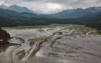
Seldovia River, Kenai Mountains
Seldovia River drains a watershed of 16,980 acres (6,872 ha) and flows generally northwest for 5 miles (8 km) from Seldovia Lake in the Kenai Mountains to Seldovia Bay on the south shore of Kachemak Bay and Lower Cook Inlet, about 18 miles (29 km) south-southwest of Homer and 3.6 miles (6 km) south-southeast of Seldovia, Alaska.
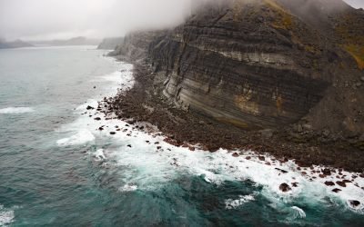
Castle Cape, Chignik Bay
Castle Cape extends about 10 miles (16 km) northeast from the Alaska Peninsula and forms the southern entrance to Chignik Bay, separating Castle Bay to the northwest from the Pacific Ocean to the southeast, about 45 miles (72 km) northeast of Perryville and 9.5 miles (15 km) southeast of Chignik, Alaska.
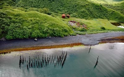
Port Hobron, Sitkalidak Island
Port Hobron is an abandoned whaling station on the south shore of a fjord with the same name situated on the north coast of Sitkalidak Island, about 6 miles (10 km) southeast of Old Harbor and 48 miles (77 km) south-southwest of Kodiak, Alaska.
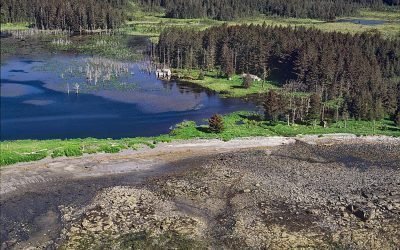
Afognak Village, Marmot Bay
Afognak, located at the head of Marmot Bay on the southeast coast of Afognak Island in the Kodiak Archipelago, is a historic village abandoned after the 1964 tsunami, about 122 miles (196 km) south-southwest of Homer and 20 miles (32 km) northwest of Kodiak, Alaska. Read more here: https://coastview.org/2025/04/28/afognak-village-afognak-strait/
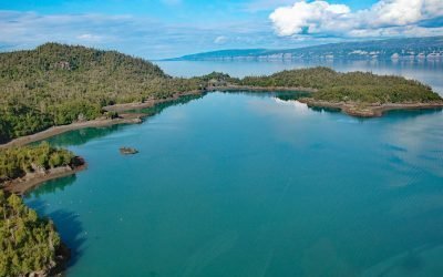
Bear Cove, Kachemak Bay
Bear Cove is a small embayment on the Kenai Peninsula that extends southeast for 1.5 miles (2.4 km) from the southeastern coast of Kachemak Bay between Bear Island to the south and Chugachik Island to the north, about 57 miles (92 km) south of Kenai and 18 miles (29 km) northeast of Homer, Alaska.
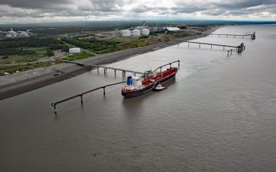
Nikiski Terminal Wharf, East Foreland
Nikiski Terminal Wharf forms part of the Port of Nikiski petroleum facility in upper Cook Inlet on the west coast of the Kenai Peninsula at East Foreland, about 63 miles (101 km) southwest of Anchorage and 10 miles (16 km) north-northwest of Kenai, Alaska.
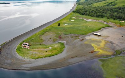
Shearwater Bay Cannery, Observation Point
Kadiak Fisheries operated a remote salmon cannery at Observation Point from 1926 until 1964 when it was destroyed by a tsunami, on the north shore of Shearwater Bay on Kodiak Island, about 36 miles (58 km) south-southwest of Kodiak and 18 miles (29 km) northeast of Old Harbor, Alaska.
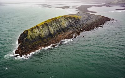
Ark Island, Aniakchak River
Ark Island is situated at the mouth of the Aniakchak River on the north shore of Aniakchak Bay and on the southeastern coast of the Alaska Peninsula, about 205 miles (330 km) southwest of Kodiak and 47 miles (75 km) northeast of Chignik, Alaska.
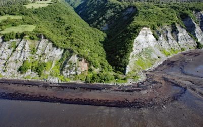
McNeil Canyon, Kachemak Bay
McNeil Canyon is on the Kenai Peninsula and the northern shore of Kachemak Bay and trends south for about 2 miles (3.2 km) following the lower course of McNeil Creek, about 57 miles (92 km) south of Kenai and 12 miles (19 km) northeast of Homer, Alaska.
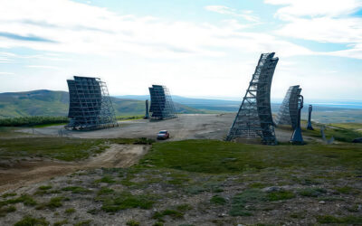
White Alice, Anvil Mountain
White Alice is a historical communication station situated on Anvil Mountain at an elevation of 1,134 feet (345 m) on the Seward Peninsula, about 180 miles (290 km) southwest of Kotzebue and 5 miles (6.5 km) north-northeast of Nome, Alaska.
About the background graphic
This ‘warming stripe’ graphic is a visual representation of the change in global temperature from 1850 (top) to 2019 (bottom). Each stripe represents the average global temperature for one year. The average temperature from 1971-2000 is set as the boundary between blue and red. The colour scale goes from -0.7°C to +0.7°C. The data are from the UK Met Office HadCRUT4.6 dataset.
Click here for more information about the #warmingstripes.