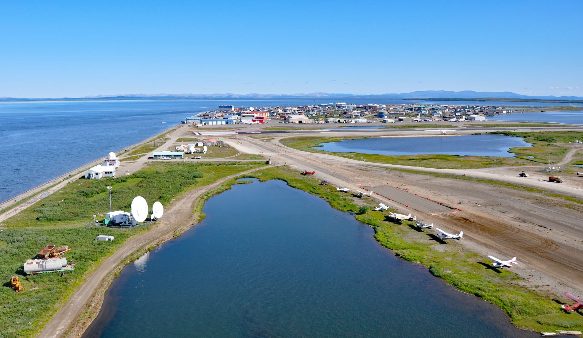
Kotzebue is a community situated between Cape Blossom to the south and Pipe Spit to the east near the tip of the Baldwin Peninsula that separates Kotzebue Sound from Hotham Inlet, about 149 miles (240 km) southeast of Point Hope and 73 miles (117 km) west-northwest of Selawik, Alaska. The community was named in 1899 after Kotzebue Sound, which in turn was named by Lieutenant Otto von Kotzebue, a Baltic German who explored the sound while searching for the Northwest Passage in the service of Russia in 1818. The Baldwin Peninsula was named in 1933 by Carl J. Lomen of the Lomen Reindeer Corporation for Leonard D. Baldwin, a New York City attorney and investor who with the Lomen brothers introduced domesticated reindeer to Alaska. The peninsula extends northwest for 61 miles (98 km) from the mainland creating an estuary for the Selawik, Kobuk, and Noatak rivers. The peninsula is a flat-topped mass of poorly consolidated surficial deposits of Pleistocene sediments consisting of silt to coarse gravel.
Evidence from the oldest sites in northwest Alaska suggests that humans were in the area 6,000 years ago, and perhaps as early as 8,000 to 10,000 years ago. Continuous occupation of the Kotzebue Sound area can be linked to the Arctic Small Tool tradition from 4,200 to 1,000 years ago and the Northern Maritime tradition from 1,400 years ago to the present. The oldest excavated site on the Baldwin Peninsula is dated to 1400 AD and the Kotzebue area has been occupied for the past 600 years. The end of the Baldwin Peninsula was known as Qikiqtagruk, meaning ‘place that is almost an island’, and the people living in the area were the Qikiqtagrugmiut. For many generations before European contact, Qikiqtagruk was a trading hub, bringing together peoples from dispersed settlements and encampments across a large region to exchange a wide variety of food resources and home-manufactured products. In 1847, Lieutenant Lavrenty Zagoskin noted a summer fish camp here named ‘Kikikhtagyut’. During the 1800s, whalers and others made occasional forays into Kotzebue Sound, bringing measles and smallpox which decimated local populations that had no resistance to the diseases. In 1897, Kotzebue became a permanent village when the Religious Society of Friends missionaries established a school, church, and reindeer station. Today, most residents still follow the traditional seasonal cycle of hunting and food gathering. Marine mammals such as seals and beluga whales are of primary importance, as are salmon, whitefish, sheefish, and Arctic char.
Kotzebue Sound is a large embayment of the southeastern Chukchi Sea. The strong current flowing north through the Bering Strait and along the eastern Chukchi Sea creates a large eddy that spins generally counterclockwise in Kotzebue Sound. It is one of the first coastal areas in Alaska to form ice due to its latitude and large volume of surface freshwater with the first ice forming in October and breakup starting in May and often lasting through June. The three rivers entering Hotham Inlet create a net outflow that keeps a channel open at the Kotzebue dock; however, sand and gravel are deposited which creates shallow water and a shipping problem for offloading freight. Ocean-going vessels anchor about 15 miles (24 km) offshore and are met by local river barges that have a shallower draft for navigating the waters in and around Kotzebue. Erosion in Kotzebue is episodic, driven by storm surges and beach souring from sea ice. Despite these seasonal events, there is little net erosion due to the accumulating sediments and some areas show accretion rates of between 1 and 2.3 feet (0.3 to 0.7 m) per year. The majority of Kotzebue’s infrastructure is protected from erosion by a seawall and boulders that have been placed along the front of the community since the 1980s. Read more here and here. Explore more of Kotzebue and Baldwin Peninsula here:

