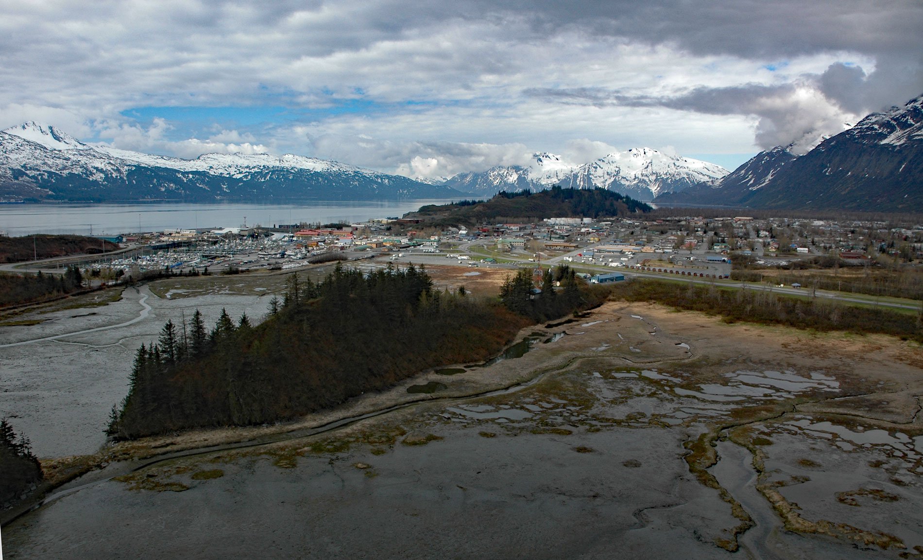
Valdez is a community situated on the outwash fan of Mineral Creek on the north shore and near the head of Port Valdez in northeastern Prince William Sound, about 82 miles (132 km) east-northeast of Whittier and 46 miles (74 km) north-northwest of Cordova, Alaska. Port Valdez is a deglaciated fjord named in 1790 by the Spanish explorer Salvador Fidalgo after the Spanish Royal Navy officer Antonio Valdés y Fernández Bazán. In 1898, Port Valdez became a debarkation point for prospectors seeking a route to the Klondike gold fields, and a community called ‘Copper City’ quickly developed on this ice-free port, but the name was changed to ‘Valdez’ when a post office was established in 1899. This town was destroyed during the 1964 Alaska earthquake and subsequently rebuilt further west near the mouth of Mineral Creek. The creek starts from the terminus of Mineral Creek Glacier at an elevation of roughly 2,600 feet (793 m) on the southern flank of the Chugach Mountains, between Valdez Glacier to the east and Shoup Glacier to the west, and flows generally south for 11 miles (18 km) to Port Valdez. The bedrock underlying the glacier in this part of the Chugach Mountains is metasedimentary rock and oceanic metabasaltic rock of the Valdez Group, which is part of the Southern Margin composite terrane. Rocks of the Valdez Group consist primarily of greywacke, carbonaceous slate, phyllite, and schist. The new townsite on the Mineral Creek outwash fan is underlain by stable, coarse alluvial gravels that showed no evidence of ground breakage during the 1964 earthquake. The site is also less vulnerable to tsunamis because of its higher elevation and a series of bedrock ridges that separate the site from tidewater.
The outer coast of the Kenai Peninsula and all of Prince William Sound is the traditional territory of an Alutiiq people called Chugach Sugpiaq and specifically Chugachmiut to distinguish themselves from broader regional and subregional groups. They are further subdivided by village loyalties and Prince William Sound was historically occupied by at least eight distinct Chugachmiut groups with each group claiming a territory near their village. Port Valdez and the northeastern area of Prince William Sound are within the territory of the Tatitlaymiut or Tatitlek People and their main village was Kunin, north of Ellamar. They also inhabited at least 10 camps at sites including Fidalgo, the Islands of Boulder Bay, Tatitlek Narrows, Galena, and Bligh Island, but there are no known sites in Port Valdez. Relationships with neighboring Eyak, Ahtna, Dena’ina, and Tlingit peoples were not always friendly and although trading occurred there are historical accounts of frequent internecine raids and skirmishes. The arrival of Europeans significantly changed this cultural landscape by introducing diseases that decimated the village populations and forced consolidation of villages so that today, the only Chugachmiut villages remaining in Prince William Sound are at Chenega and Tatitlek, and the mixed communities of Cordova and Valdez.
Fort Liscum was established on the south shore of Port Valdez in 1900, and a sled route followed by a wagon road was constructed to Fort Egbert in Eagle on the Yukon River by the U.S. Army to bring order to the Yukon gold fields. The Alaska Road Commission further developed the road for automobile travel to Fairbanks, and by 1920, the Richardson Highway connected Valdez to Fairbanks. The completion of the Alaska Railroad from Seward to Fairbanks in 1923 led to a decline in the importance of Valdez as a transportation center. Valdez prospered for a time as a commercial center, especially after gold and copper were discovered on Mineral Creek. In 1937, the principal activity was around Brevier Creek with the Big Four and Hercules mines on the west side of Mineral Creek and the Little Giant and Cash mines on the east side of the creek. Six or seven men were employed at the Little Giant where practically all the workings were underground. A roadhouse named McIntosh operated for many years about 4 miles (6 km) north of tidewater on Mineral Creek. Commercial fishing began to gain importance in the local economy in the early 1900s. The first cannery was built in Valdez in 1917 and historically salmon and herring were the primary fisheries. In 1993, the herring population crashed and finally closed in 1998. Today, the most active commercial fisheries are salmon, halibut, and sablefish. Read more here and here. Explore more of Valdez and Mineral Creek here:

