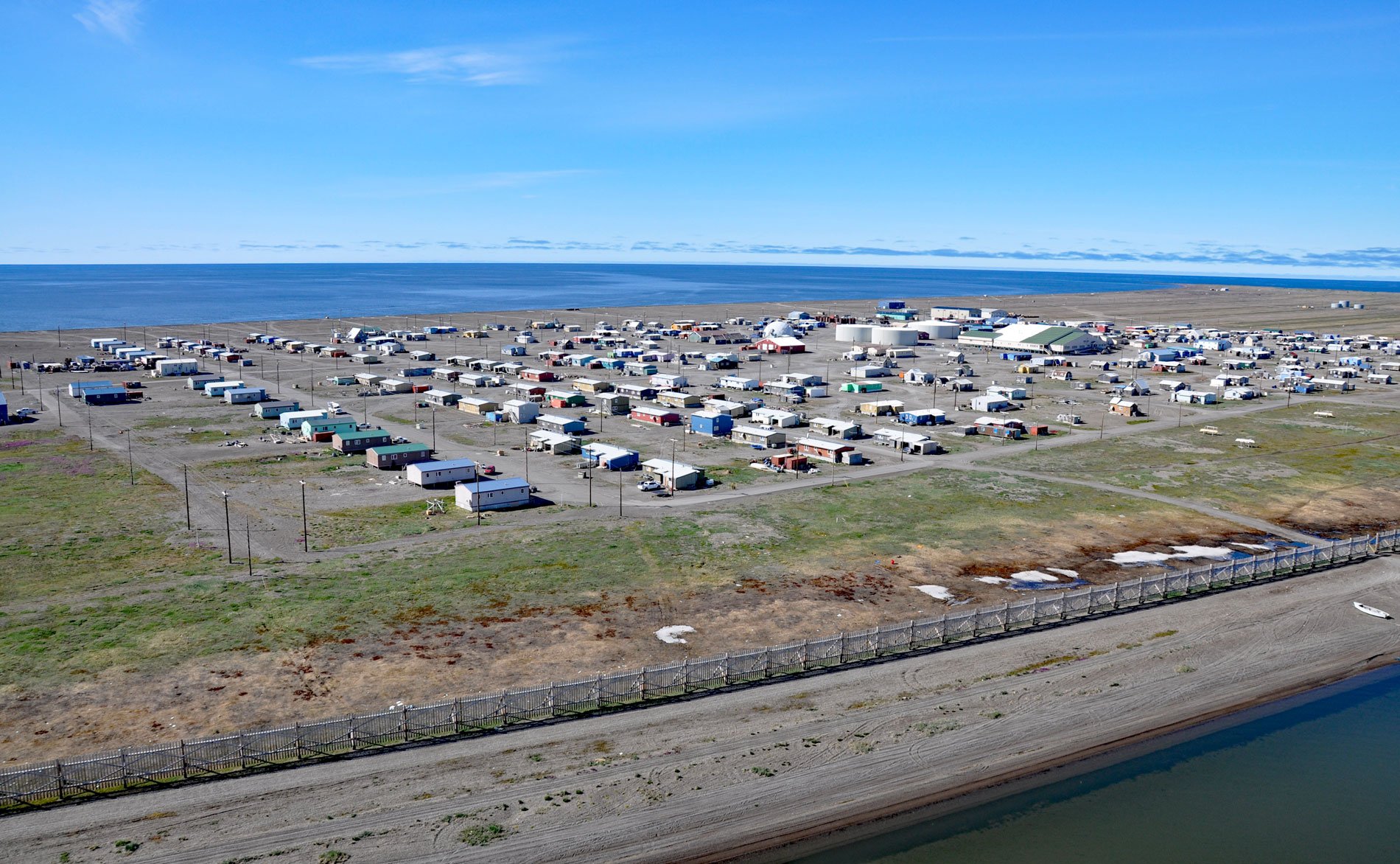
Point Hope is an Iñupiaq whaling community also known as Tikiġaq or Tigara, situated on a barrier spit that extends northwest from Cape Thompson and joins another spit that extends southwest from the Lisburne Peninsula to enclose several lagoons including Marryat Inlet and forms the Tigara Peninsula, about 228 miles (367 km) southwest of Wainwright and 73 miles (118 km) northwest of Kivalina, Alaska. Point Hope was named in 1826 by Captain Frederick W. Beechey of the Royal Navy for Sir William J. Hope, a prominent British Royal Navy officer and politician. The Tigara Peninsula extends into the Chukchi Sea and a recurring polynya that forms here making it an ideal location for hunting marine mammals. The peninsula is formed by a sequence of beach ridges and has been inhabited for thousands of years based on archaeological sites and several historical communities including Ipiutak, Old Tigara, New Tigara, and the present-day village of Point Hope. Beach ridges are coast-parallel deposits of sand and gravel that are emplaced, most often, by waves during storms and occasionally by wind-driven ice-shoving, although the latter is considered a minor factor in beach ridge development. Successions of beach ridges are linked to tidal conditions, the availability of abundant sediment in the nearshore, regressive or near constant sea levels, and alternations in the periodicity of high-magnitude storms and wave systems.
The Tigara Peninsula has a high density of cultural resources, much of which is located within the Ipiutak Archaeological District. The cultures represented in the district include Norton from 600 to 100 BC, Ipiutak from 400 to 900 AD, Birnirk from 500 to 700 AD, Thule after 900 AD, and late prehistoric and historic Iñupiat. Old Tigara was situated near the tip of the peninsula and was inhabited about 1500 years ago and was reputedly one of the largest Arctic villages with 122 documented house depressions and an estimated population of about 2,000. By the 1850s, Euro-American whalers were in the region and stopped in Point Hope in considerable numbers to trade and fill the ship’s crew roster. Point Hope’s strategic location for easy on-shore access to whales and marine mammals drew whalers to the area throughout the mid to late 19th century. In 1887, Peter Bayne of the S.H. Frank Company established a whaling station 5 miles (8 km) southeast of Tigara and called it Jabbertown. From the 1880s to the turn of the century, marine mammals and caribou herds were depleted resulting in a famine that combined with introduced diseases caused an estimated 50% mortality in northwestern Alaska. The introduction of reindeer herding significantly impacted the Iñupiaq culture and economy, with Point Hope becoming an integral part of the western Alaska reindeer industry.
The Tigara Peninsula is exposed to severe fall storms and flooding, and with a maximum elevation of only 20 feet, flooding and erosion have historically been a constant threat to residents, forcing the village to relocate several times. During summer months when the sea ice has retreated from the Chukchi Sea and the ground has thawed, the community experiences gradual erosion from tidal and wave action, as well as periodic storm surges which causes accelerated erosion and flooding. In 1893, Tigara village at the end of the peninsula was flooded when a storm surge of 10 feet (3 m) covered the spit. During the early 1960s, the village council attempted to slow the erosion near the former village location. Three thousand steel drums were filled with sand and gravel and set in varying patterns in the exposed swales. However, fall storms and erosion caused most drums to scatter along 15 miles of beach. By 1976, under the constant threat of erosion and flooding, the village of Tigara decided to move from the eroding north margin of the spit to the present-day location 3 miles (5 km) east. Houses were moved on runners to the new site and a riprap seawall was constructed between the coast and the airport runway to mitigate storm damage. Yet persistent erosion continues to plague the community and may necessitate another move in the future. Read more here and here. Explore more of Point Hope and Marryat Inlet here:

