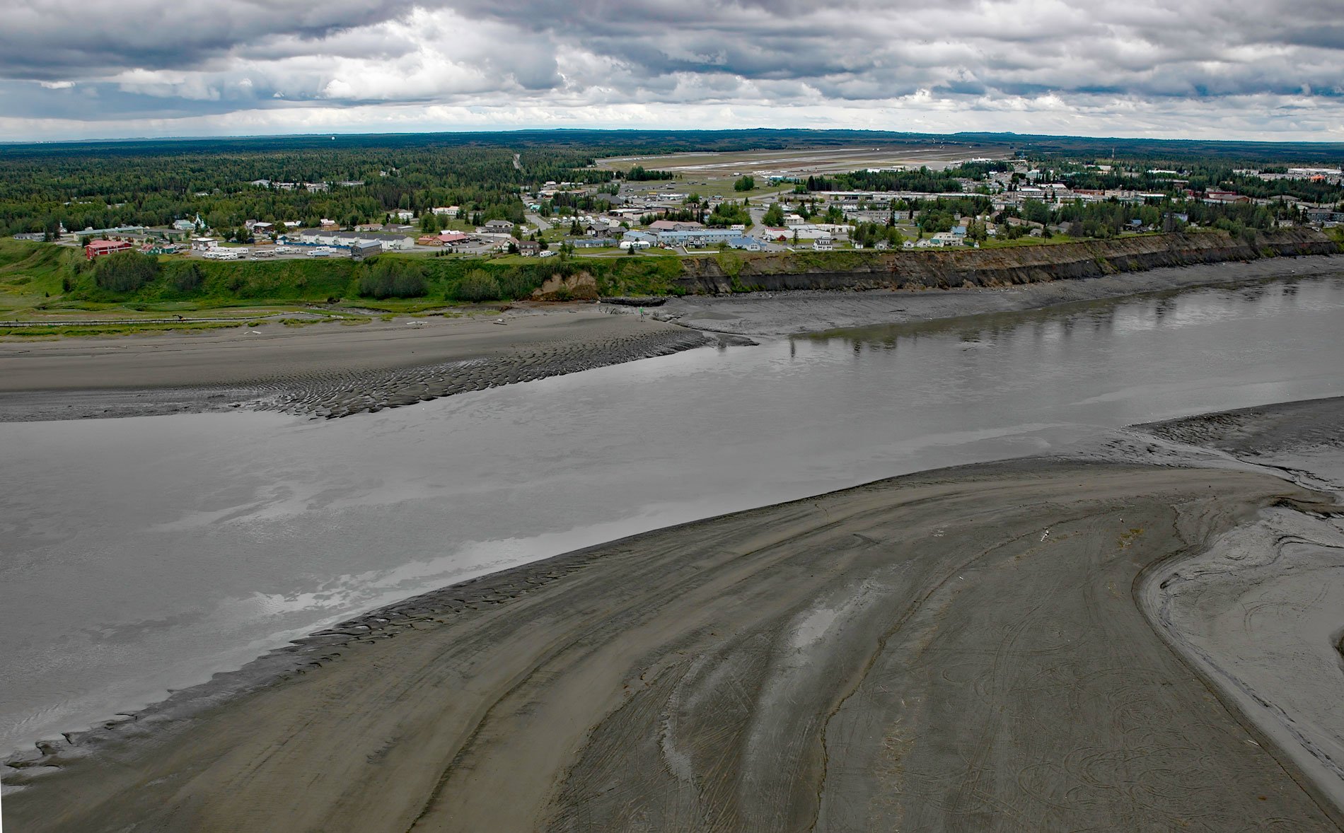
Kenai is a community situated at the site of Shk’ituk’t, a historical Dena’ina village located on the west coast of the Kenai Peninsula, on the eastern shore of Cook Inlet at the mouth of the Kenai River, about 65 miles (15 km) southwest of Anchorage and 64 miles (103 km) north of Homer, Alaska. The name ‘Kenai’ is derived from the Dena’ina word ‘ken’ or ‘kena’, which means ‘flat, meadow, open area with few trees’ and is descriptive of the landscape at the mouth of the river. The name ‘Shk’ituk’t’ for the Dena’ina village means ‘where we slide down’. The Kenai River starts from the outlet of Kenai Lake at an elevation of 430 feet (131 m) and flows generally west for 82 miles (132 km), draining a watershed of roughly 1,286,400 acres (520,588 ha) on the Kenai Peninsula. The peninsula is about 150 miles (241 km) long and separates Cook Inlet to the west from Prince William Sound to the east. It is roughly aligned with and bisected by the Border Ranges Fault that separates the glacier-covered metasedimentary rocks including the McHugh Formation that form the Kenai Mountains to the southeast from the flatter and marshy landscape dotted with numerous small lakes and underlain by glacial deposits of the late Pleistocene to the northwest.
The Cook Inlet basin provides a rare pathway unimpeded by ice-capped mountain ranges for the migration of humans from the interior to the Gulf of Alaska. On the Kenai Peninsula, prehistoric cultures from the interior that were dependent on terrestrial resources for food were juxtaposed with maritime cultures normally dependent on marine resources. The earliest documented presence of humans in upper Cook Inlet occurs at sites in Turnagain Arm and near the source of the Kenai River at a site known as ‘Sqilantnu’, a Dena’ina placename meaning ‘ridge place river’, where archaeological evidence suggests that the area was first occupied by the marine adapted Kachemak people from 1000 BC until they were displaced by the terrestrial adapted Dena’ina Athabaskan people around 1000 AD. In 1787, the Siberia-based Pavel Lebedev-Lastochkin Company vessel St. Pavel arrived at the mouth of the Kenai River and the crew consisting mostly of promyshlenniki built a settlement that later became Fort Nikolaevskaia. They explored the shores of Cook Inlet, took hostages from the neighboring Dena’ina they called Kenaitzy to guarantee their safety, built several small fortified fur trading posts called artels, and traded or otherwise procured furs. In 1840, Russian America became a diocese of the Russian Orthodox Church and in the same year, the first chapel was built at Fort Nikoleavskaia which continued as a base for trapping operations on Cook Inlet until the Alaska Purchase in 1867.
For many decades after the United States took responsibility for the new territory, the remote parts of Alaska such as Kenai, were too far from the capitol at Sitka to maintain effective civil order and the Russian Orthodox Church continued providing religious and educational services. From 1895 to 1896, the Holy Assumption of the Virgin Mary Church was built on the Kenai Bluffs overlooking the confluence of the Kenai River and Cook Inlet and is now the oldest standing Orthodox church in Alaska. The rectory is the oldest building on the Kenai Peninsula. The Chapel of St. Nicholas was built from logs in 1906 on the site of the original chapel and over three graves of prominent monks. In 1940, homesteads were opened in the area, and in 1951, the first road was constructed linking Kenai to Anchorage. The Kenai Bluffs range in height from 55 to 70 feet (16-21 m) and are receding at an approximate average rate of 3 feet (1 m) per year, threatening public and private property. The bluff is exposed to coastal storms and extreme flood tides that have a range of over 31 feet (9.5 m). Tidal currents and wave action during flood tides attack the toe of the bluff, removing sediments and resulting in bluff failure. For the bluff to stabilize, a shore protection structure will need to prevent the removal of accumulated sediment at the bluff and this presents an ongoing concern for the City of Kenai. Read more here and here. Explore more of Kenai and Cook Inlet here:

