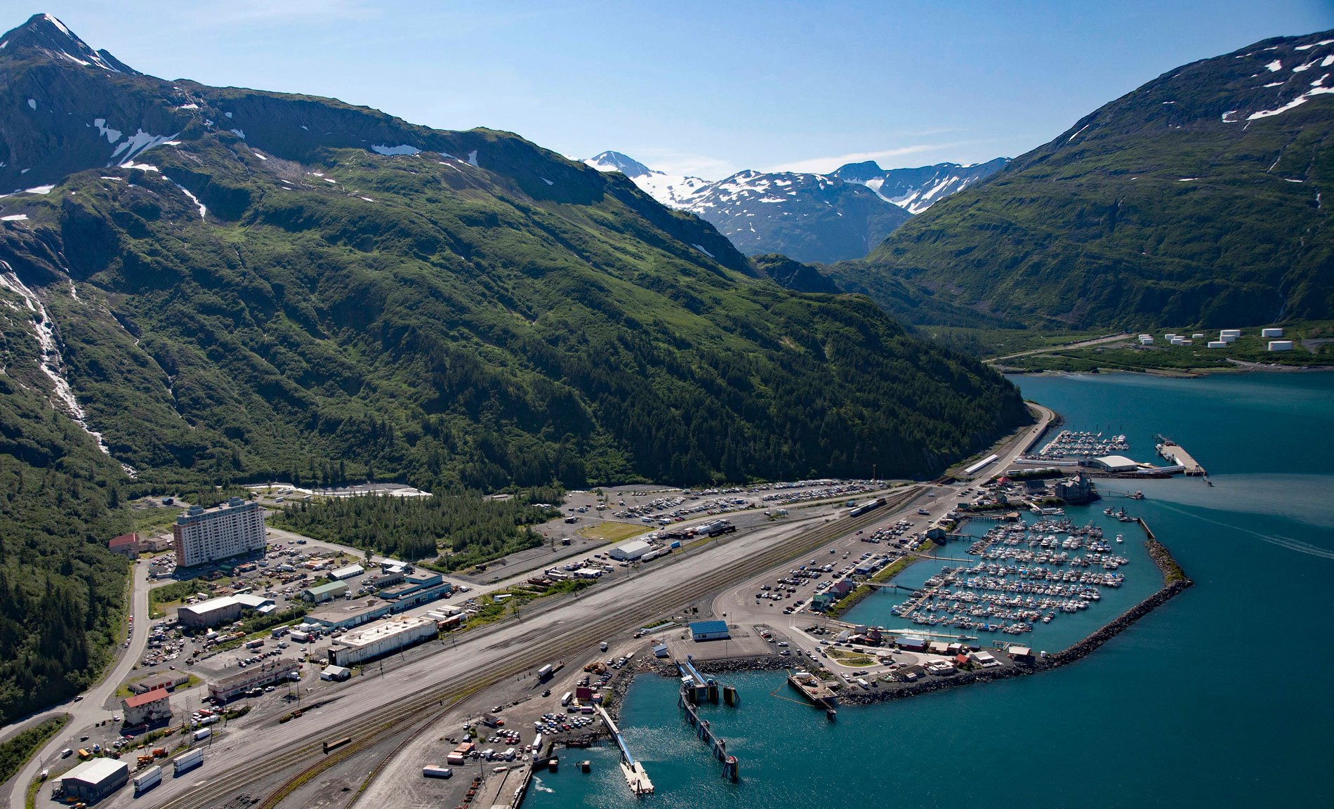
Whittier is a community and marine terminal for the Alaska Railroad and cruise ships, situated on the alluvial fan of Whittier Creek on the south shore of Passage Canal, a deglaciated fjord in northwestern Prince William Sound, about 82 miles (132 km) west-southwest of Valdez and 51 miles (82 km) southeast of Anchorage, Alaska. Whittier Creek starts from a cirque at an elevation of 1680 feet (512 m) and flows generally north for 1.5 miles (2.4 km) to Passage Canal, joining with several tributaries along the way emanating from the terminus of Whittier Glacier. The glacier was named after the American poet John G. Whittier in 1915, reputedly for his book Snow-Bound. The surrounding mountains are part of the Chugach Range and comprise metasedimentary rocks of the Valdez Group that consist primarily of complexly deformed metasedimentary greywacke, siltstone, and shale generally considered to be deposits of turbidity currents in an oceanic trench during the Late Cretaceous. These rocks were subsequently part of a larger accretionary complex called the Southern Margin composite terrane that extends roughly 1400 miles (2200 km) along the southern Alaskan margin. Passage Canal is an estuarine fjord about 14 miles long that connects with Port Wells and was named in 1794 by Captain George Vancouver presumably because of a well-used historical portage at the head of the fjord that connects Prince William Sound with Cook Inlet.
The head of Passage Canal was historically called Portage Bay and was used by Chugach Sugpiaq and Dena’ina Athabascans, Russian fur traders, and after the Alaska Purchase in 1867, by Euro-American miners and prospectors searching for gold. A portage trail connected the head of the bay to Turnagain Arm via Portage Pass with an elevation of 800 feet (244 m), followed historically by a crossing of Portage Glacier and a descent of Portage Creek to reach tidewater. The glacier crossing was made in winter or spring when the crevasses were filled with snow and prospectors followed a path marked by spruce branches. In response to the gold strikes made on the Klondike and the ensuing stampede of gold seekers in 1896 and 1897, the U.S. government sent several parties to Alaska equipped for geographic and geologic survey work. In 1898, a team led by Walter C. Mendenhall of the U.S. Geological Survey accompanied a U.S. Army detachment led by Captain Edwin F. Glenn to map northwestern Prince William Sound and Turnagain Arm. They traveled from Seattle to Valdez on the SS Valencia and the steamer Salmo to ‘Portage Bay’, and then made two round trips across Portage Glacier to Turnagain Arm. In 1914, it was still possible to cross Portage Glacier, but by 1939, recession and ablation of the glacier had made this route impracticable because of the numerous large crevasses and serac ice on the surface of the glacier and the unscalable cliffs.
In 1939, the Alaska Railroad and U.S Geological Survey began investigating the feasibility of connecting the existing railway at the head of Turnagain Arm with Passage Canal, and in 1942, the rail extension of 11.5 miles (19 km) was completed with tunnels through Begich Peak and Maynard Mountain. In 1943, the U.S. Army Camp Sullivan was built on Passage Canal to support the Aleutian Islands Campaign during World War II. In 1946, a post office was established with the name ‘Whittier’. During the Cold War, the U.S. Army built reinforced concrete buildings to house administrative offices, military families, and civil service employees. One of those buildings is now called ‘The Begich Towers‘ and was converted to condominiums. For many years, the Alaska Railroad provided flatbed rail cars to shuttle private vehicles through the tunnels. In 1964, the Alaska earthquake severely damaged Whittier by ground shaking and the subsequent tsunami killed 13 people. In 2000, the railroad tunnel under Maynard Mountain was upgraded and can now accommodate either eastbound or westbound vehicle traffic, or the Alaska Railroad trains but only one at any given time. This link allowed an expansion of the ice-free deep-water marine terminal and Whittier became an attractive destination for cruise ships, and a new terminal is under construction at the head of the bay. Read more here and here. Explore more of Whittier and Passage Canal here:

