
Alaska
Recent Articles
More Articles
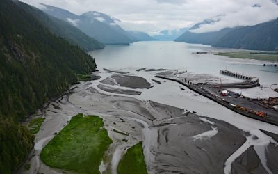
Portland Canal, International Boundary
Portland Canal is a deglaciated fjord that extends south-southwest for 65 miles (105 km) from the community of Stewart in the north to the head of Portland Inlet in the south, forming part of the international boundary between Southeast Alaska and British Columbia, Canada.
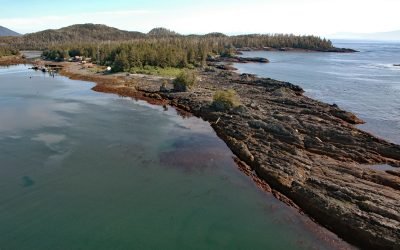
Port Alexander, Baranof Island
Port Alexander is an embayment and small community on the southern tip of Baranof Island in the Alexander Archipelago of Southeast Alaska, about 133 miles (214 km) northwest of Ketchikan and 62 miles (100 km) south-southeast of Sitka, Alaska.
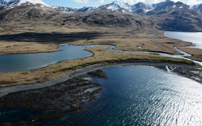
Kashega, Unalaska Island
Kashega is an abandoned Unangan Aleut village on the Bering Sea coast of Unalaska Island, situated on a spit between Brennan Lake and Kashega Bay, about 79 miles (127 km) northeast of Nikolski and 39 miles (63 km) southwest of Dutch Harbor, Alaska.
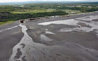
Ninilchik, Kenai Peninsula
Ninilchik is a community at Cape Ninilchik at the mouth of the Ninilchik River on the Kenai Peninsula, on the eastern shore of Cook Inlet, about 99 miles (160 km) southwest of Anchorage and 30 miles (48 km) north-northwest of Homer, Alaska.
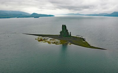
New Eddystone Rock, Behm Canal
The New Eddystone Rock is a pillar of basalt 237 feet (72 m) high, situated in Misty Fjords National Monument and in the eastern arm of Behm Canal, about 87 miles (140 km) north-northwest of Prince Rupert and 32 miles (52 km) northeast of Ketchikan, Alaska.
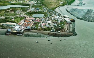
Egegik, Bristol Bay
Egegik is a small Yup’ik village on the south bank of Egegik Bay on the eastern shore of Bristol Bay, about 69 miles (111 km) southeast of Dillingham and 37 miles (60 km) south-southwest of Naknek, Alaska.

Biorka, Sedanka Island
Biorka is an abandoned Unangan Aleut village on the northwest coast of Sedanka Island in the Fox Islands of the Eastern Aleutians, situated between Udamat Bay and Sisek Cove, about 27 miles (44 km) southwest of Akutan and 14 miles (23 km) east-southeast of Unalaska, Alaska.
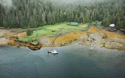
Saltery Cove, Skowl Arm
Saltery Cove is an embayment that extends southeast for 1.5 miles (2.4 km) off Skowl Arm on the east coast of Prince of Wales Island, about 26 miles (42 km) west of Ketchikan and 10 miles (16 km) south-southeast of the Organized Village of Kasaan, Alaska.
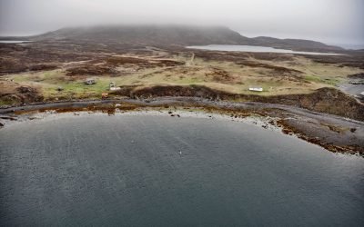
Pauloff Harbor, Sanak Island
Pauloff Harbor is a historic community established as a codfish station in 1886 on the north coast of Sanak Island and the west shore of Pavlof Harbor, about 160 miles (257 km) east-northeast of Dutch Harbor and 45 miles (72 km) south-southwest of King Cove, Alaska.

Rudyerd Bay, Misty Fjords National Monument
Rudyerd Bay is a deglaciated fjord in the Coast Range of Southeast Alaska in Misty Fjords National Monument, about 89 miles (143 km) north-northwest of Prince Rupert and 39 miles (63 km) northeast of Ketchikan, Alaska.
About the background graphic
This ‘warming stripe’ graphic is a visual representation of the change in global temperature from 1850 (top) to 2019 (bottom). Each stripe represents the average global temperature for one year. The average temperature from 1971-2000 is set as the boundary between blue and red. The colour scale goes from -0.7°C to +0.7°C. The data are from the UK Met Office HadCRUT4.6 dataset.
Click here for more information about the #warmingstripes.