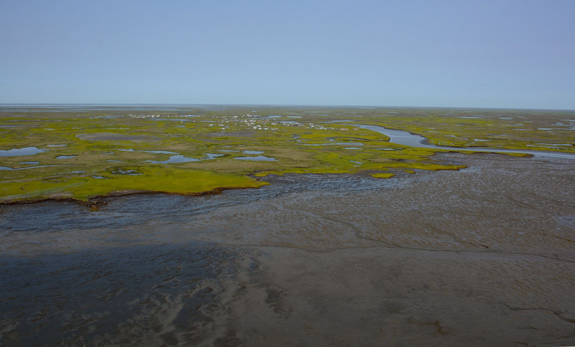
Kwigillingok is a Central Yup’ik community situated on the west bank of the Kwigillingok River about 2 miles (3.2 km) inland from the northern shore of Kuskokwim Bay, about 80 miles (129 km) south-southwest of Bethel and 45 miles (72 km) west-northwest of Quinhagak, Alaska. The village was first reported as ‘Quillingok’ in 1927 on a map in the Annual Report to the Governor of Alaska. In the Yup’ik language, the village name is ‘Kuigilnguq’ which means ‘no river’. The Kwigillingok River starts from the outlet of Kolekfikpuk Lake and flows generally south for 17 miles (27 km) through the Yukon-Kuskokwim Delta to Kuskokwim Bay. The headwaters flow through a watershed formed by Quaternary alluvial, colluvial, glacial, marine, lacustrine, aeolian, and swamp deposits. The watershed along the north coast of Kuskokwim Bay and at the village of Kwigillingok is formed by raised marine terraces composed of many types of surficial deposits, which are primarily estuarine, tidal flat, and alluvial deposits, but may include glacial debris and outwash.
The Yukon-Kuskokwim Delta has been inhabited by Yup’ik people for thousands of years. In 1891, Moravian missionaries built a station at the present-day location of Kwigillingok, and in 1914, they built one of the first homes. Between 1929 and 1950, the village population grew from 104 to 215, possibly because of an abundance of seals along the coast that drew people to the area. In the late 1960s, tidal waters reached the village and many residents relocated to higher ground in an area that is now the neighboring village of Kongiganak. The local economy of Kwigillingok is characterized as a ‘mixed subsistence-based’ referring to the use of local wild resources obtained by hunting, trapping, fishing, and gathering with some income secured by primarily seasonal wage employment, commercial sale of halibut, salmon, herring, and furs and cottage industries. Village residents depend heavily on salmon, halibut, clams, herring, whitefish, and marine mammals for food.
Kwigillingok experiences floods on an annual basis as a result of ice jams, ice override, and storm surges usually in the winter and spring. Ice override occurs when onshore winds cause ice sheets to slide along or override the beach and move inland up to several hundred feet. The frequency and intensity of flooding in Kwigillingok is likely to increase dramatically as a result of climate change. At least fourteen recorded flooding events affected Kwigillingok between 1966 and 2018, including seven flooding events between October 2016 and August 2019. River bank erosion typically accompanies flooding events. During the spring, the breakup of river ice scours the banks resulting in erosion. In the fall, storm surges combined with high tides erode the coastal shoreline and the river bank. Studies by the U.S. Army Corp of Engineers have estimated erosion rates from 1.4 feet per year to 15 feet per year. These studies have recommended a variety of mitigation measures to protect the community, including the reduction of vehicle and boat traffic on the river banks and the placement of riprap revetments, but no financial resources or technical assistance have been provided to the community to implement these measures. Read more here and here. Explore more of Kwigillingok and Kuskokwim Bay here:

