
Alaska
Recent Articles
More Articles
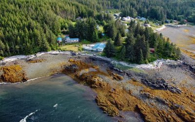
Kasaan, Prince of Wales Island
Kasaan is a small community on the north shore of Kasaan Bay and the southern shore of the Kasaan Peninsula, on the east coast of Prince of Wales Island, about 65 miles (105 km) south of Wrangell and 33 miles (53 km) west-northwest of Ketchikan, Alaska.

Beloit Glacier, Blackstone Bay
Beloit Glacier flows northeast for about 2 miles (3.2 km) from an unnamed ice field on the Kenai Peninsula to Blackstone Bay in Prince William Sound, about 86 miles (138 km) southwest of Valdez and 9 miles (15 km) south of Whittier, Alaska.
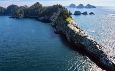
Chiswell Islands, Kenai Fjords
Chiswell Islands are a group of rocky uninhabited islands In the Alaska Maritime National Wildlife Refuge situated at the entrance to Aialik Bay on the south coast of Kenai Fjords National Park, about 67 miles (108 km) east of Homer and 35 miles (56 km) south of Seward, Alaska.
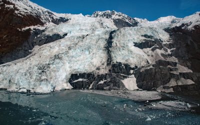
Bryn Mawr Glacier, College Fjord
Bryn Mawr Glacier flows southeast for about 4.5 miles (7 km) to Harvard Arm of College Fjord in northwestern Prince William Sound, about 52 miles (84 km) west of Valdez and 44 miles (71 km) northeast of Whittier, Alaska.
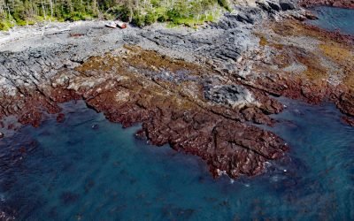
FV Kathy Joanne, Chugach Bay
FV Kathy Joanne is a shipwreck located on Badger Point, a peninsula between Chugach Bay and Windy Bay on the outer coast of the Kenai Peninsula at the southern end of the Kenai Mountains, about 95 miles (153 km) southwest of Seward and 18 miles (29 km) southeast of Seldovia, Alaska.
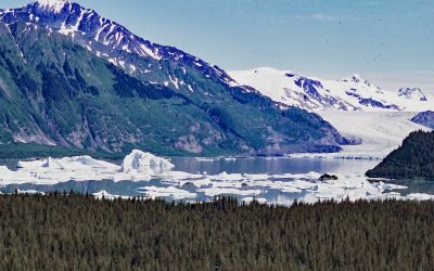
Excelsior Glacier, Johnstone Bay
Excelsior Glacier flows south for about 8 miles (13 km) from the Sargent Icefield on the Kenai Peninsula to its terminus at Big Johnstone Lake, formerly called Excelsior Lake, about 28 miles (45 km) west-southwest of Chenega Bay and 26 miles (42 km) southeast of Seward, Alaska.

Taz Basin, Granite Island
Taz Basin is a small cove on the west coast of Granite Island, one of the Chiswell Islands on the south coast of Kenai Fjords National Park, about 61 miles (98 km) east of Homer and 34 miles (55 km) south-southwest of Seward, Alaska.
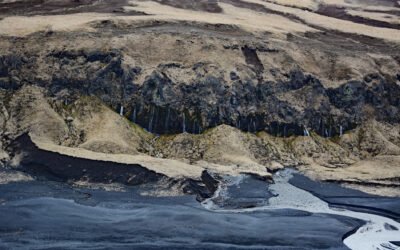
Weeping Wall, Umnak Island
The Weeping Wall is a cliff with water seeps on the northwest side of Okmok Volcano on the northeastern part of Umnak Island, one of the Fox Islands in the Eastern Aleutians, about 73 miles (117 km) west-southwest of Dutch Harbor and 49 miles (79 km) north-northeast of Nikolski, Alaska.
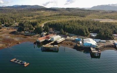
Kake, Kupreanof Island
Kake is a Tlingit village on the northeastern shore of Keku Strait, on the northwest shore of Kupreanof Island in the Alexander Archipelago of Southeast Alaska, about 95 miles (153 km) south-southeast of Juneau and 39 miles (63 km) west-northwest of Peterburg, Alaska.
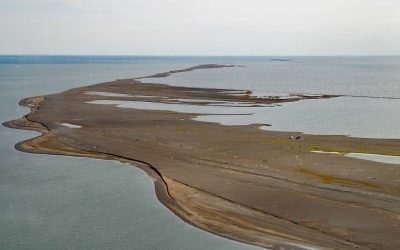
Cooper Island, Beaufort Sea
Cooper Island is an Arctic barrier island and one of the Plover Islands on Elson Lagoon on the Beaufort Sea coast, about 129 miles (208 km) northwest of Nuiqsut and 24 miles (39 km) east of Utqiaġvik, Alaska.
About the background graphic
This ‘warming stripe’ graphic is a visual representation of the change in global temperature from 1850 (top) to 2019 (bottom). Each stripe represents the average global temperature for one year. The average temperature from 1971-2000 is set as the boundary between blue and red. The colour scale goes from -0.7°C to +0.7°C. The data are from the UK Met Office HadCRUT4.6 dataset.
Click here for more information about the #warmingstripes.