
Alaska
Recent Articles
More Articles
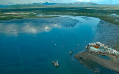
Togiak River, Bristol Bay
Togiak River starts at Togiak Lake and flows southwest for 37 miles (60 km) to a wetland marsh about 4 miles (6 km) wide where the river channel splits, with the east channel flowing past the village of Twin Hills to Togiak Bay, and the main channel flowing 11 miles (18 km) to Togiak Bay near the village of Togiak on Bristol Bay, about 129 miles (208 km) southeast of Bethel and 66 miles (106 km) west of Dillingham, Alaska.
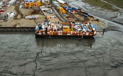
Ship Creek, Knik Arm
Ship Creek flows generally northwest for about 28 miles (45 km) from the Chugach Mountains to Knik Arm, about 22 miles (35 km) southwest of the village of Knik and 0.5 miles (0.8 km north of downtown Anchorage, Alaska.
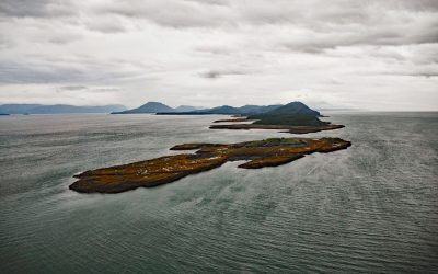
Little Island, Lynn Canal
Little Island is in Lynn Canal at the north end of Favorite Channel, 0.4 miles (0.6 km) north of Ralston Island, and about 67 miles (108 km) south of Skagway and 28 miles (45 km) northwest of Juneau, Alaska.
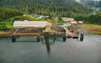
Greens Creek Mine, Hawk Inlet
Greens Creek Mine is the fifth-largest silver producer in the world, located on the eastern shore of Hawk Inlet on Admiralty Island, about 77 miles (124 km) north-northeast of Sitka and 18 miles (29 km) southwest of Juneau, Alaska.
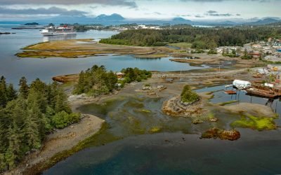
Sitka, Baranof Island
Sitka is a community situated on Sitka Sound on the west coast of Baranof Island, about 185 miles (298 km) northwest of Ketchikan and 95 miles (153 km) southwest of Juneau, Alaska.
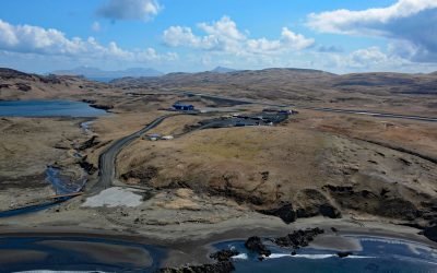
Akutan Airport, Akun Island
Akutan Airport is a State of Alaska owned public-use airport on Akun Island that serves the community of Akutan which is 6 miles (10 km) west-southwest across Akutan Bay on Akutan Island, about 766 miles (1,235 km) southwest of Anchorage and 44 miles (71 km) northeast of Dutch Harbor, Alaska.
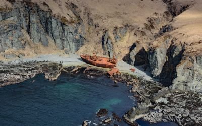
Chil Bo San No. 6, Spray Cape
Chil Bo San No. 6 is a shipwreck on Spray Cape, a conspicuous headland on the west coast of Unalaska Island between Skan Bay to the north and Pumicestone Bay to the south, about 85 miles (137 km) northeast of Nikolski and 32 miles (52 km) southwest of Dutch Harbor, Alaska.
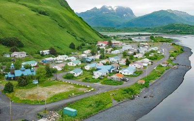
Old Harbor, Kodiak Island
Old Harbor is a small Alutiiq community situated on the western shore of Sitkalidak Strait that separates Sitkalidak Island from Kodiak Island, about 48 miles (77 km) southwest of Kodiak and 40 miles (64 km) northeast of Akhiok, Alaska.
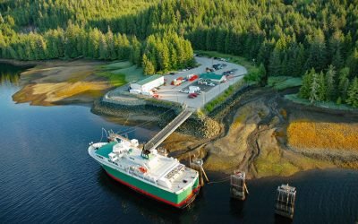
Hollis, Prince of Wales Island
Hollis is a small community on Twelvemile Arm of Kasaan Bay, north of Cat Island, near the center of Prince of Wales Island in the Alexander Archipelago of Southeast Alaska, about 41 miles (66 km) west-northwest of Ketchikan and 20 miles (32 km) east of Craig, Alaska.
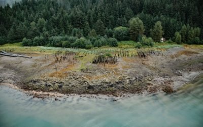
Taku Cannery, Taku Harbor
Taku Harbor is a historical community and the site of an abandoned cannery in a small embayment on the eastern shore of Stephens Passage near Taku Inlet, about 86 miles (138 km) northeast of Sitka and 22 miles (35 km) southeast of Juneau, Alaska. Read more here: https://coastview.org/2024/08/28/taku-cannery-taku-harbor/
About the background graphic
This ‘warming stripe’ graphic is a visual representation of the change in global temperature from 1850 (top) to 2019 (bottom). Each stripe represents the average global temperature for one year. The average temperature from 1971-2000 is set as the boundary between blue and red. The colour scale goes from -0.7°C to +0.7°C. The data are from the UK Met Office HadCRUT4.6 dataset.
Click here for more information about the #warmingstripes.