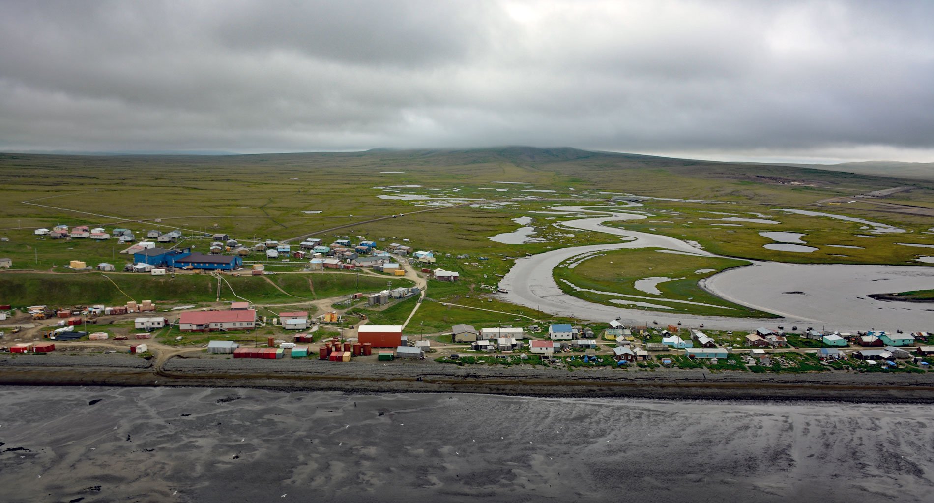
Tununak is a traditional Central Yup’ik community located on the northwest coast of Nelson Island on a narrow barrier spit between the Bering Sea and the mouth of the Tununak River, about 119 miles (192 km) west-southwest of Bethel and 71 miles (114 km) south-southeast of Hooper Bay, Alaska. Tununak River starts near Toksook Bay and flows north for about 8 miles (13 km) to Tanunak Bay. The western shores of Nelson Island face the Bering Sea and are characterized by high and rugged cliffs. The southern portion of the island is low-lying and covered with small lakes and streams. On the north and east, tidal channels separate the island from the vast lowlands of the Yukon-Kuskokwim Delta. The island is formed by Quaternary and Cretaceous olivine basalt and underlying Late Cretaceous fluvial and shallow marine deltaic deposits of sandstone, siltstone, shale, and conglomerate. Pack ice normally begins to form in this part of the Bering Sea in mid-November and break-up generally occurs in early May. Snowfall is not heavy, but strong winds cause drifting in protected sites, and exposed areas are often swept nearly free of snow.
Tununak has a long history of human habitation, probably spanning many centuries. Numerous ancient sod house pits mark the location of former villages aligned parallel to historical beach ridges. In 1878, Nelson Island was named after Edward W. Nelson, with the U.S. Army Signal Corps and later a Smithsonian naturalist, noted six people living in Tununak, including one non-Native trader. In 1889, the Jesuit missionaries opened a small chapel and school, but they found the villagers difficult to convert due to the migratory nature of their traditional subsistence culture and because the shamans were still quite powerful. The mission closed in 1892. In 1925, a government school was built, and a Northern Commercial Company store was opened in 1929. From 1934 to 1962, a missionary named Father Paul Deschout lived on Nelson Island. His long-standing relationship and work with the people in the area had a great influence. The 1950s brought great changes to the islanders’ lifestyle, through their involvement with the Alaska Territorial Guard, fish canneries, high schools, and healthcare treatment for tuberculosis. Today, Tununak residents are still actively engaged in maintaining their traditional culture including a subsistence fishing, hunting and gathering lifestyle. Most of their protein comes from herring, salmon, and seals. Occasionally Steller sea lions, walrus, and beluga are hunted. In addition to the resources of the Bering Sea, the people utilize terrestrial foods such as waterfowl, blackfish, and edible plants from the varied habitats of the island and the vast wetlands of the adjacent delta country.
The village consists of approximately 70 houses, one main road running from the airstrip to the school, a community hall, two stores, and a post office. Most of the village is without running water; families pack water in 5-gallon buckets from wells and use honey buckets for sewage. The largest building in the village is the school and the second largest is the old Bureau of Indian Affairs school building, which now houses staff members and their families in six apartments. The community hall is used for village potlatches, meetings, elections, bingo, and dancing. It is a modern version of the traditional ‘Qasgiq’, or Yup’ik men’s house. Since ancient times, men of the village would make tools for hunting and fishing and weapons for war, ate, and often slept in the qasgiq. They took sweat baths there, played games, smoked pipes, told stories, and performed rites and rituals. Half of the qasgiq was underground, similar to a barabara, or family dwelling. Log walls kept back the dirt and enclosed a square floor covered with planks. Trees do not grow on Nelson Island, but wood for heat and building materials comes from logs that drift down the Yukon and Kuskokwim rivers, into the Bering Sea, and wash up on the beach fronting the village. In the old days, the walls of the qasgiq curved to form a gentle dome with a single window at the top, which was covered with a piece of walrus gut that could be used as a skylight or removed to let in fresh air. Sleeping platforms and benches lined the side and back walls, and a deep firepit gaped in the center of the plank floor. The outside of the qasgiq was covered with a thick layer of tundra sod. For special ceremonies and celebrations, all the people of the village gathered in the men’s house. They came to share a circle of songs, stories, dances, and masks. The historical Tununak village qasgiq was abandoned in the 1970s, and replaced by a frame-and-plywood community hall. Read more here and here. Explore more of Tununak and Nelson Island here:

