
Alaska
Recent Articles
More Articles

Marys Slough, Unalakleet River
Marys Slough is a side channel about 5 miles (8 km) long at the mouth of the Unalakleet River formed by a barrier spit on Norton Sound that creates an extensive tidal wetland, about 46 miles (74 km) northeast of Saint Michael and 1.1 miles (1.8 km) south-southeast of Unalakleet, Alaska.

Cape Tanak, Umnak Island
Cape Tanak is a headland on the north coast of Umnak Island in the Eastern Aleutian Islands between Cape Idak to the east and Ashishik Point to the west, about 64 miles (103 km) southwest of Dutch Harbor and 56 miles (90 km) northeast of Nikolski, Alaska.

Mendenhall Glacier, Juneau Icefield
Mendenhall Glacier starts from an ice divide in the Juneau Icefield at an elevation of 4,300 feet (1,311 m) and flows generally southwest for 15 miles (24 km) to a proglacial lake between McGinnis Mountain to the west and Bullard Mountain to the east, about 11 miles (18 km) north-northwest of Juneau and 5 miles (8 km) northeast of Auke Bay, Alaska.
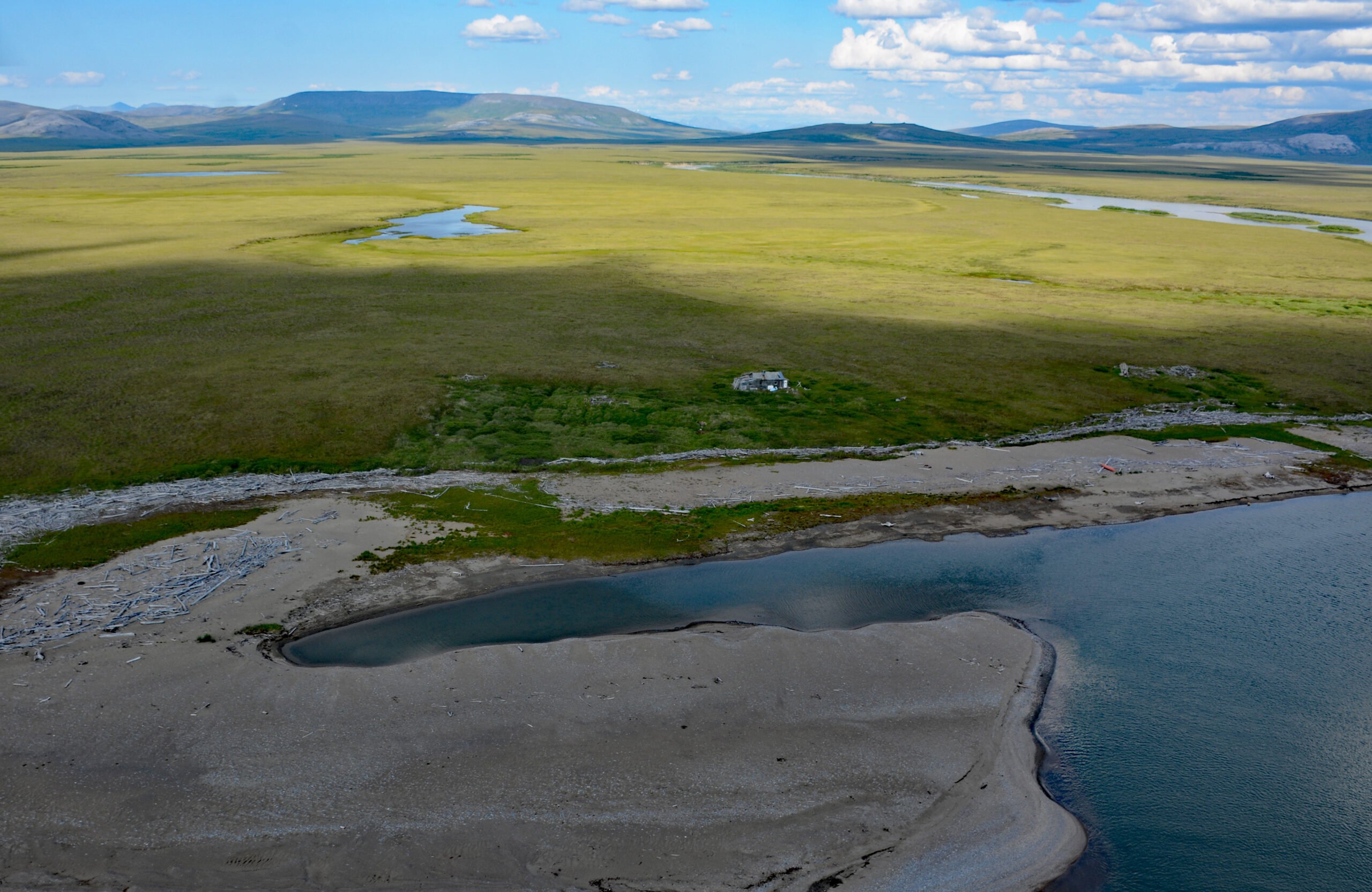
Sinuk River, Cape Rodney
Sinuk River starts from a series of deglaciated cirques at an elevation of 1,890 feet (576 m) on the west flank of Tigaraha Mountain on the Seward Peninsula, and flows generally southwest for 44 miles (71 km), draining a watershed of 190,572 acres (77,122 ha), to the Bering Sea near Cape Rodney and the site of a historic village, about 47 miles (76 km) south of Teller and 26 miles (42 km) west-northwest of Nome, Alaska.

Cape Spencer, Cross Sound
Cape Spencer is a prominent headland in Glacier Bay National Park and Preserve marking the northern entrance to Cross Sound adjacent to an area with numerous offshore islets, rocks, and islands, one of which, near the entrance to Dicks Arm, is the site of a historic lighthouse, about 45 miles (73 km) northwest of Hoonah and 37 miles (60 km) southwest of Gustavus, Alaska.

Goodnews Bay Village, Goodnews Bay
Goodnews Bay is a Central Yup’ik village at the mouth of the Goodnews River where it enters Goodnews Bay, about 117 miles (189 km) south of Bethel and 12 miles (19 km) northeast of Platinum, Alaska.

Cape Saint Elias, Kayak Island
Cape Saint Elias comprises a prominent headland and Pinnacle Rock, and is the site of a historic lighthouse at the southwest end of Kayak Island, 172 miles (277 km) west of Yakutat and 62 miles (100 km) southeast of Cordova, Alaska.

Delarof Harbor, Unga Island
Delarof Harbor is an embayment and the site of the historical village of Unga on the southeast coast of Unga Island, the largest of the Shumagin Islands, about 73 miles (118 km) southwest of Perryville and 9.5 miles (15 km) south of Sand Point, Alaska.

Eldred Rock Lighthouse, Lynn Canal
Eldred Rock is a small island and site of a historic lighthouse situated adjacent to Sullivan Island in Lynn Canal, between the Chilkat Range to the west and the Kakuhan Range to the east, about 55 miles (89 km) northwest of Juneau and 20 miles (32 km) south-southeast of Haines, Alaska.

Sudden Stream, Malaspina Coastal Plain
Sudden Stream drains the Malaspina Coastal Plain, flowing generally south for 2 miles (3.2 km) from the outlet of Malaspina Lake, a proglacial lake at the terminus of the Malaspina Glacier, to a lagoon formed by a barrier spit called Schooner Beach on Yakutat Bay, about 207 miles (333 km) east-southeast of Cordova and 18 miles (29 km) northwest of Yakutat, Alaska.
About the background graphic
This ‘warming stripe’ graphic is a visual representation of the change in global temperature from 1850 (top) to 2019 (bottom). Each stripe represents the average global temperature for one year. The average temperature from 1971-2000 is set as the boundary between blue and red. The colour scale goes from -0.7°C to +0.7°C. The data are from the UK Met Office HadCRUT4.6 dataset.
Click here for more information about the #warmingstripes.