
Alaska
Recent Articles
More Articles

Princeton Glacier, Nassau Fjord
Princeton Glacier is on the east side of the Kenai Peninsula, about 37 miles (60 km) south-southeast of Whittier and 38 miles (61 km) east-northeast of Seward, Alaska.
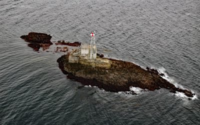
Lincoln Rock Light, Clarence Strait
Lincoln Rock and Lincoln Island are small islets in Clarence Strait in Southeast Alaska, about 63 miles (102 km) northwest of Ketchikan and 31 miles (50 km) southwest of Wrangell, Alaska.
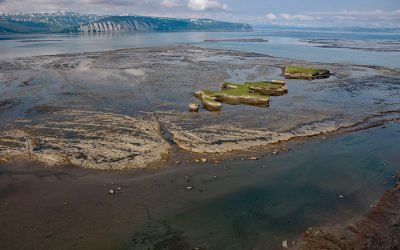
Douglas River Tidal Flats, Kamishak Bay
Douglas River starts at the terminus of an unnamed glacier on the northwest flank of Fourpeaked Mountain in the Aleutian Range on the Alaska Peninsula, and flows north for 28 miles (45 km) to Kamishak Bay, about 108 miles (174 km) northeast of King Salmon and 89 miles (144 km) southwest of Homer, Alaska.
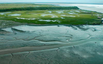
Clark’s Point, Nushagak Bay
Clark’s Point is the site of a historic community and salmon cannery located on the eastern shore of Nushagak Bay at the mouth of Clark Slough, about 57 miles (92 km) west-northwest of Naknek and 14 miles (23 km) south-southwest of Dillingham, Alaska.
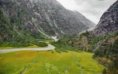
North Dawes Glacier, Endicott Arm
North Dawes Glacier starts from the Stikine Icefield at an elevation of about 5,200 feet (1,585 m) on the western flank of Sheppard Peak and flows generally southwest for 15 miles (24 km) to a proglacial lake at an elevation of 1000 feet (305 m) which is 2 miles (3.2 km) long and drained by a stream 1.3 miles (2.1 km) long at the head of an inlet extending north from Endicott Arm, about 74 miles (119 km) southeast of Juneau and 51 miles (82 km) north of Petersburg, Alaska.

Yahtse Glacier, Icy Bay
Yahtse Glacier starts from the south flank of Mount Miller in Barkley Ridge at an elevation of 8,200 feet (2,500 m) and flows generally southeast for 40 miles (65 km) through Wrangell-Saint Elias National Park and Preserve to a tidewater terminus between Guyot Hills to the west and Karr Hills to the east in Icy Bay, about 152 miles (245 km) east-southeast of Cordova and 71 miles (115 km) northwest of Yakutat, Alaska.
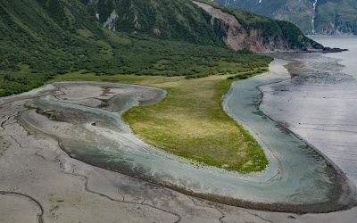
Diamond Point, Iliamna Bay
Diamond Point is a prominent headland situated between Iliamna Bay to the east and Cottonwood Bay to the south, about 126 miles (203 km) northeast of King Salmon and 75 miles (121 km) west of Homer, Alaska.

North Sawyer Glacier, Tracy Arm
Sawyer Glacier, also called North Sawyer Glacier, starts in the Coast Mountains of British Columbia at an elevation of about 6,600 feet (2,012 m) and flows generally west for 14 miles (23 km) to the Alaska border at an elevation of 3,600 feet (1,097 m) and then another 7 miles (11 km) to a terminus at sea level in Tracy Arm, about 78 miles (126 km) north of Petersburg and 53 miles (85 km) southeast of Juneau, Alaska.
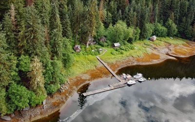
Windham, Windham Bay
Windham is a settlement that historically supported mining operations along Spruce Creek at the head of Windham Bay, about 63 miles (102 km) southeast of Juneau and 57 miles (92 km) north-northwest of Petersburg, Alaska.
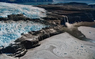
Kashteen Peninsula, Tsaa Fjord
Kashteen Peninsula is located in Wrangell-Saint Elias National Park and Preserve on the eastern shore of Icy Bay, between Tsaa Fjord to the south and Guyot Fjord to the north, and is emerging from under the retreating Guyot Glacier, about 149 miles (240 km) east-southeast of Cordova and 73 miles (118 km) northwest of Yakutat, Alaska.
About the background graphic
This ‘warming stripe’ graphic is a visual representation of the change in global temperature from 1850 (top) to 2019 (bottom). Each stripe represents the average global temperature for one year. The average temperature from 1971-2000 is set as the boundary between blue and red. The colour scale goes from -0.7°C to +0.7°C. The data are from the UK Met Office HadCRUT4.6 dataset.
Click here for more information about the #warmingstripes.