
Alaska
Recent Articles
More Articles
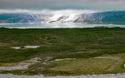
Fourpeaked Glacier, Shelikof Strait
Fourpeaked Glacier starts from the eastern flank of Fourpeaked Mountain with a summit elevation of 6771 feet (2,064 m) and flows generally east for 6 miles (10 km) to a proglacial lake about 2.5 miles (4 km) long that is drained by a river that flows another 0.8 miles (1.3 km) to Shelikof Strait in Katmai National Park and Preserve, about 90 miles (145 km) southwest of Homer and 77 miles (124 km) northwest of Kodiak, Alaska.
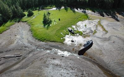
Edna Bay, Kosciusko Island
Edna Bay is a community situated on 17,280 acres (6993 ha) in the Tongass National Forest on the southeast coast of Kosciusko Island off the northwest coast of Prince of Wales Island, about 61 miles (98 km) southwest of Wrangell and 18 miles (29 km) west-northwest of Naukati Bay, Alaska.

Ipiutak, Tigara Peninsula
Ipiutak is the Iñupiaq name for a prehistorical village that is now an archaeological site and National Historic Landmark on the Tigara Peninsula and the southern shore of Ipiutak Lagoon, about 133 miles (215 km) southwest of Point Lay and 1 mile (1.6 km) northwest of Point Hope, Alaska.
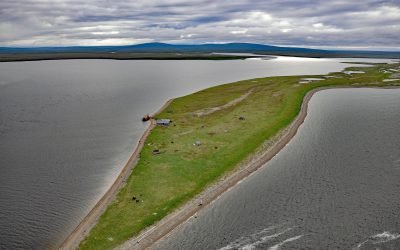
Kiwalik, Spafarief Bay
Kiwalik is a historical Iñupiat hunting and fishing camp, that became a major logistical base for mining activities in the Candle area, situated on a spit between Kawalik Lagoon to the south and Spafarief Bay to the north on the northeast coast of the Seward Peninsula, about 148 miles (238 km) northeast of Nome and 64 miles (103 km) south-southeast of Kotzebue, Alaska.
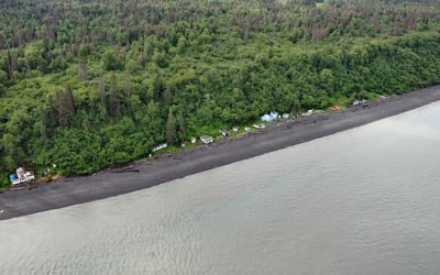
Point Possession, Cook Inlet
Point Possession is a headland on the northern shore of the Kenai Peninsula near the confluence of Cook Inlet and Turnagain Arm, about 44 miles (71 km) northeast of Kenai and 20 miles (32 km) southwest of Anchorage, Alaska.
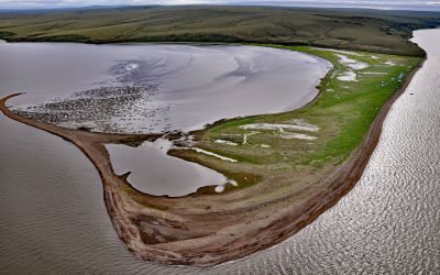
Elephant Point, Eschscholtz Bay
Elephant Point is a headland and the site of a fish camp near a historical reindeer station in Eschscholtz Bay at the head of Kotzebue Sound, about 56 miles (90 km) southeast of Kotzebue and 20 miles (32 km) north-northwest of Buckland, Alaska.
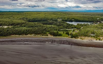
Knik Village, Knik Arm
Knik village is a historic Dena’ina community situated between the northwest shore of Knik Arm in Cook Inlet to the east and Knik Lake to the west, about 18 miles (29 km) north-northeast of Anchorage and 13 miles (21 km) southwest of Wasilla, Alaska.

Cape Pole, Kosciusko Island
Cape Pole is a historical logging community at Cape Pole on the eastern shore of Fishermans Harbor on Kosciusko Island, about 92 miles (148 km) northwest of Ketchikan and 6.7 miles (11 km) west of Edna Bay, Alaska.
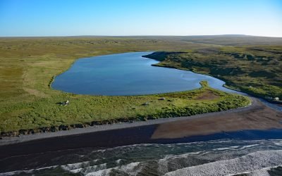
Nash Harbor, Nunivak Island
Nash Harbor is a historic settlement situated at the outlet of a lagoon on the south shore of an embayment also named Nash Harbor bounded by Cape Algonquin to the west and Chingeeruk Point to the east, on the north coast of Nunivak Island, about 96 miles (155 km) south-southwest of Hooper Bay and 30 miles (48 km) southwest of Mekoryuk, Alaska.
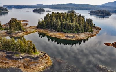
Christmas Island, Security Bay
Christmas Island is the largest of several small reefs and islets on the western coastline and near the entrance to Security Bay on Kuiu Island, about 45 miles (72 km) south of Angoon and 18 miles (29 km) southwest of Kake, Alaska.
About the background graphic
This ‘warming stripe’ graphic is a visual representation of the change in global temperature from 1850 (top) to 2019 (bottom). Each stripe represents the average global temperature for one year. The average temperature from 1971-2000 is set as the boundary between blue and red. The colour scale goes from -0.7°C to +0.7°C. The data are from the UK Met Office HadCRUT4.6 dataset.
Click here for more information about the #warmingstripes.