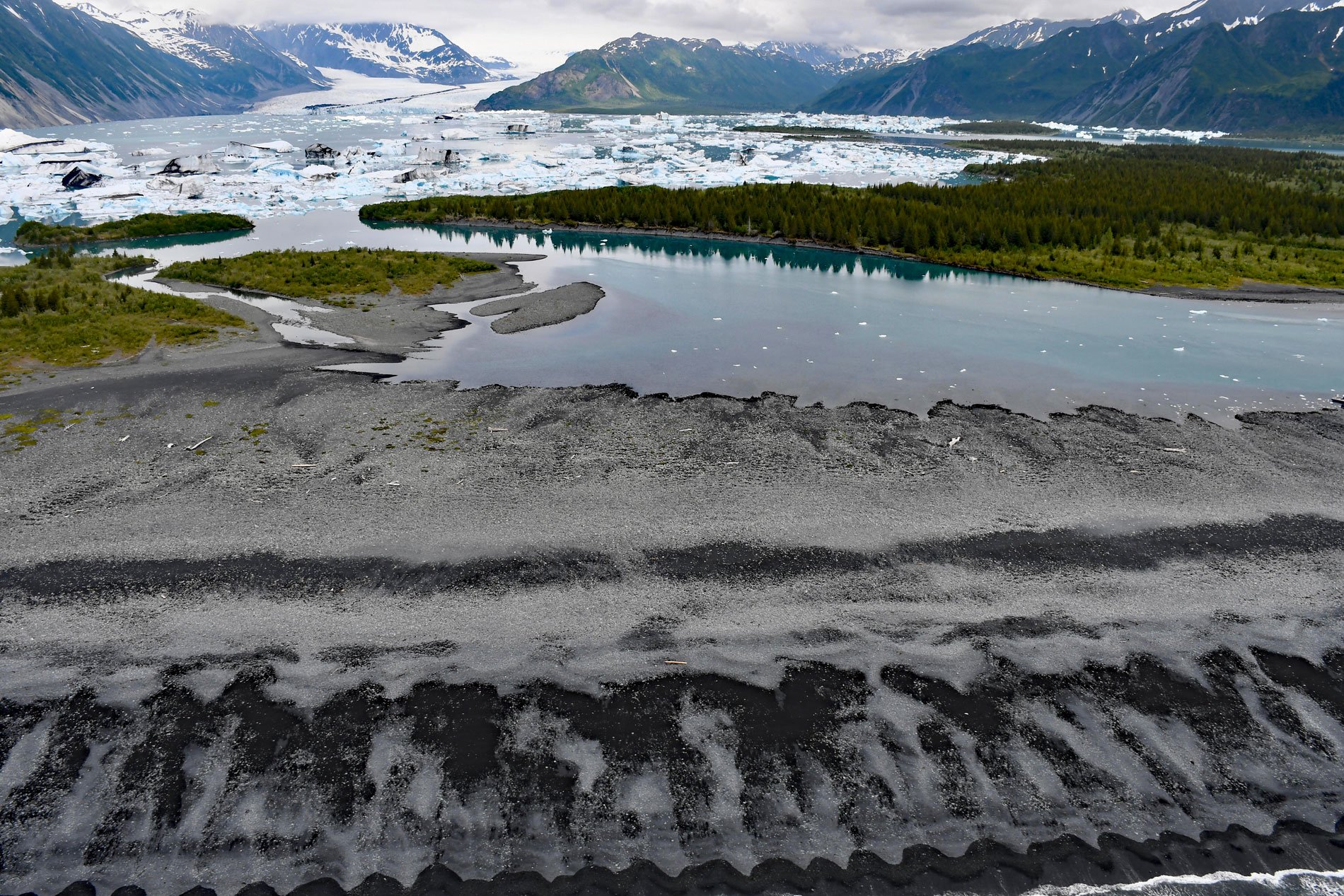
Bear Glacier starts from an elevation of roughly 4,000 feet (1,219 m) on the eastern flank of the Harding Icefield in Kenai Fjords National Park and descends generally southeast for 17 miles (27 km) to a proglacial lake dammed by a terminal moraine between Bear Glacier Point on the Aialik Peninsula to the south and Callisto Head to the north, about 72 miles (116 km) east-northeast of Homer and 13 miles (21 km) south of Seward, Alaska. The glacier’s name was first reported in 1909 by Ulysses. S. Grant and Daniel F. Higgins of the U.S. Geological Survey. The exposed bedrock surrounding the retreating glacier represents the Valdez Group of sedimentary rocks that developed during the Late Cretaceous and consist mostly of greywacke sandstone, siltstone, mudstone, slate, and some conglomerate. Structures such as graded bedding, crossbedding, and ripple marks, along with flute, groove, and load casts, indicate that the sediments were deposited from turbidity currents. These rocks were subsequently uplifted as part of one of the world’s largest accretionary complexes called the Southern Margin composite terrane that dominates the Gulf of Alaska coast.
Kenai Fjords for much of the historical period since the 18th century when Russian fur traders explored the coast has been a dynamic landscape as tidewater glaciers retreated to expose more of the coastline over. In 1909, when Grant described Bear Glacier, it was the largest ice stream to reach the sea on the Kenai Peninsula and the last ice stream on the coast to expose a fjord. At that time, the terminus was at Resurrection Bay and rested on an outwash plain consisting of the terminal moraine covered by a gravel flat that was inundated by high tides that reached the ice front. A combination of high tides and strong southerly wind brought waves over most of the flat. Bear Glacier retreated approximately 1,300 feet (400 m) between 1909 and 1950, and between 1950 and the mid-1990s, the glacier retreated 5,080 feet (1,550 m) with a decrease of 2,162 acres (875 ha) in surface area. This retreat was accompanied by ice thinning at a rate of about 1 foot (0.3 m) per year. An additional 6,600 feet (2,000 m) of retreat occurred by 2004 as a result of ice calving into the proglacial lake which is now 3 miles (5 km) across, separating the terminus from Resurrection Bay, and called Bear Glacier Lake. Concerns surrounding glacial lake outburst floods, their potential links to climate change, and associated hazards have grown in recent years as human encroachment increases.
Glacial lake outburst floods occur when dam-impounded water suddenly drains creating hazardous conditions. Moraine-dammed proglacial lakes form at the terminal margin of retreating glaciers and are dynamic features that experience cycles of filling, drainage, and re-filling. The cycles are influenced by valley topography, freshwater inputs from tributary glaciers and streams, solar radiation which influences melt rates, and changes in the dynamics of both tributary and trunk glaciers. The dam creating Bear Glacier Lake is reinforced each winter by waves that build storm berms on top of the moraine. In the spring, when freshwater is rapidly added to the lake, the increased meltwater leads to increased water pressure, resulting in an outburst flood when the storm berm fails. This was experienced firsthand in July 1984 when the author’s climbing party landed kayaks at the northeastern end of the beach and summited Peak 3698 at the southwestern end of the beach just in time to see the storm berm breach. Read more here and here. Explore more of Bear Glacier and Aialik Peninsula here:

