
Alaska
Recent Articles
More Articles
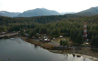
Meyers Chuck, Cleveland Peninsula
Meyers Chuck is a community situated along the shoreline of a natural harbor protected mostly by Misery Island and Meyers Island, on the Cleveland Peninsula with Ernest Sound to the north and Clarence Strait to the west, about 50 miles (80 km) south of Wrangell and 37 miles (60 km) northwest of Ketchikan, Alaska.
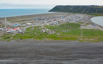
Gambell, Saint Lawrence Island
Gambell is a community on Saint Lawrence Island at Northwest Cape in the northern Bering Sea on a broad, shallow-water continental shelf that extends from western Alaska to northeastern Russia, about 196 miles (316 km) southwest of Nome, Alaska, and 62 miles (100 km) southeast of Provideniya, Russia.

Karluk Village, Kodiak Island
Karluk Village is situated on the southern shore of Karluk Lagoon, an embayment formed by a barrier spit that partially encloses the mouth of the Karluk River, on the Shelikof Strait coast of Kodiak Island, about 77 miles (124 km) west-southwest of Kodiak and 44 miles (71 km) north-northwest of Akhiok, Alaska.
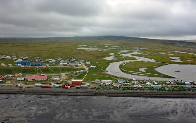
Tununak, Nelson Island
Tununak is a traditional Central Yup’ik community located on the northwest coast of Nelson Island on a narrow barrier spit between the Bering Sea and the mouth of the Tununak River, about 119 miles (192 km) west-southwest of Bethel and 71 miles (114 km) south-southeast of Hooper Bay, Alaska.

Hoonah, Port Frederick
Hoonah is a community situated on the eastern shore of Port Frederick on the northeastern coast of Chichagof Island in the Alexander Archipelago of Southeast Alaska, about 40 miles (64 km) west-southwest of Juneau and 24 miles (39 km) south-southeast of Gustavus, Alaska.
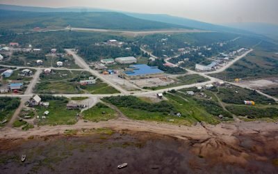
Koyuk, Norton Bay
Koyuk is an Iñupiaq community situated at the head of Norton Bay on the right bank of the Koyuk River estuary on the Seward Peninsula, about 129 miles (208 km) east-northeast of Nome and 40 miles (64 km) north of Shaktoolik, Alaska.

Rolph Slough, Nushagak Point
Rolph, or Ralph Slough is a tidal creek in an area of grass meadows and numerous unnamed sloughs that cut through vast mud flats on the left bank near the mouth of the Nushagak River at Nushagak Point, about 55 miles (89 km) west-northwest of Naknek and 6 miles (10 km) south of Dillingham, Alaska.
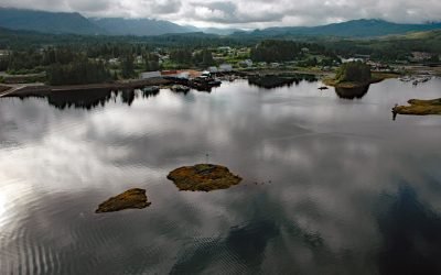
Klawock, Prince of Wales Island
Klawock is a community on the estuary of the Klawock River on the west coast of Prince of Wales Island in the Alexander Archipelago of Southeast Alaska, about 58 miles (93 km) northwest of Ketchikan and 6 miles (10 km) northeast of Craig, Alaska.
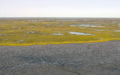
Kongiganak, Kuskokwim Bay
Kongiganak is a Central Yup’ik community situated on the eastern bank of the Kongnignanohk River that flows generally south for 40 miles (64 km) through a watershed of 29,718 acres (12,026 ha) in the Yukon Delta National Wildlife Refuge to the western shore of Kuskokwim Bay, about 69 miles (111 km) southwest of Bethel and 11 miles (18 km) east-northeast of Kwigillingok, Alaska.
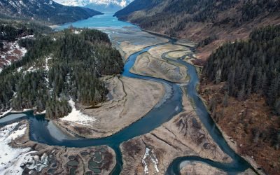
Jack Bay, Valdez Arm
Jack Bay is an estuary surrounded by the Chugach Mountains that extends southeast for 6 miles (10 km) from Valdez Arm in Prince William Sound, about 70 miles (113 km) northeast of Whittier and 12 miles (19 km) southwest of Valdez, Alaska.
About the background graphic
This ‘warming stripe’ graphic is a visual representation of the change in global temperature from 1850 (top) to 2019 (bottom). Each stripe represents the average global temperature for one year. The average temperature from 1971-2000 is set as the boundary between blue and red. The colour scale goes from -0.7°C to +0.7°C. The data are from the UK Met Office HadCRUT4.6 dataset.
Click here for more information about the #warmingstripes.