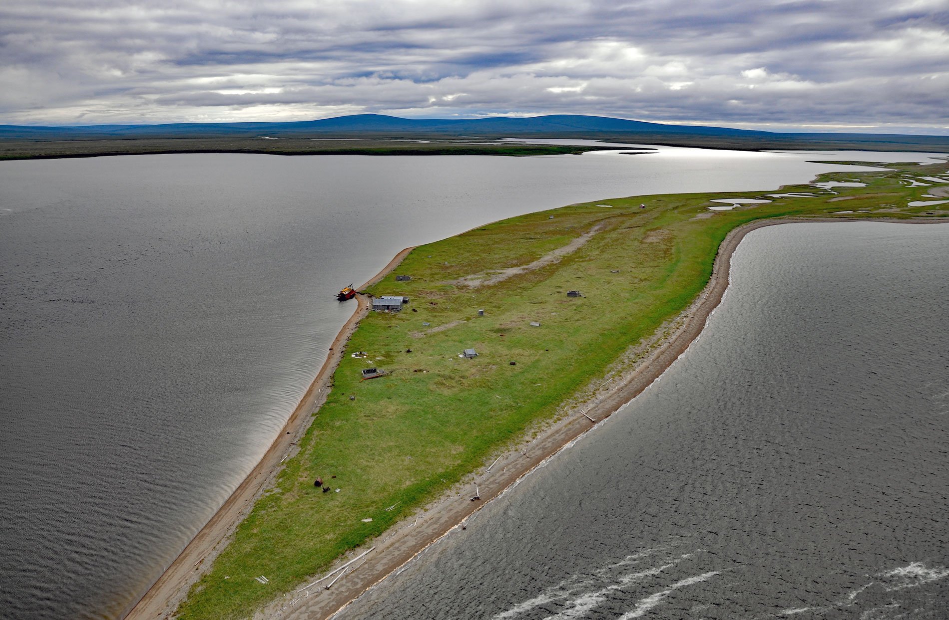
Kiwalik is a historical Iñupiat hunting and fishing camp, that became a major logistical base for mining activities in the Candle area, situated on a spit between Kawalik Lagoon to the south and Spafarief Bay to the north on the northeast coast of the Seward Peninsula, about 148 miles (238 km) northeast of Nome and 64 miles (103 km) south-southeast of Kotzebue, Alaska. The settlement was named for the Kiwalik River which starts on the west flank of Granite Mountain at an elevation of 1,467 feet (447 m) and flows generally north for 58 miles to the lagoon on Spafarief Bay, draining a watershed of roughly 512,000 acres (207,199 ha). Spafarief Bay is in southern Kotzebue Sound and the eastern Chukchi Sea. The bay was named in 1816 by Lieutenant Otto von Kotzebue for Major General Knight Leontiy Spafaryev of the Imperial Russian Navy, who was director of lighthouses in the Gulf of Finland and cartographer of the Russian Admiralty. The spit consists of a series of beach ridges that accreted from west to east. The ridges formed as wave-built intertidal and supratidal berms that became inactive on prograding shores.
The north coast of the Seward Peninsula has been inhabited by two Iñupiat groups. The Kangigmiut occupied the Buckland River drainage, the Kiwalik River drainage, and the coast of Eschscholtz Bay. The Pittagmiut lived to the west along the rivers flowing into Goodhope Bay and the coast from Cape Espenberg to Motherwood Point. They both alternated their residence between inland and coast as they pursued the game and fish resources of their territories, most importantly salmon, caribou, ringed seal, bearded seal, spotted seal, and beluga. The Kangigmiut from the village of Buckland were the principal beluga hunters on Eschscholtz Bay in the 19th century, but non-Kangigmiut, especially Pittagmiut from the village of Deering, were integrated into Kangigmiut beluga drives. Probably the Pittagmiut early summer tent encampments were near those of the Kangigmiut for logistical reasons as well as for socializing. Adjacent drives of beluga were impractical because hunters from one camp would have intercepted or scared away belugas from another. Open-water sealing and beluga hunting took place from kayaks and umiaks. At the beginning of the 20th century, the use of Kiwalik as a beluga and seal hunting camp was adversely impacted by the noise and general takeover of much of the spit by prospectors who needed a staging area for offloading supplies from ships while waiting for the ice to break up on the lagoon and river.
Placer gold was discovered on Candle Creek about 8 miles (13 km) upstream and south of Kiwalik Lagoon on July 23, 1901, and was first staked by Enos Thomas, Alexander Patterson, Robert Schneider, and a Mr. Blankenship. The mining camp of Candle was founded shortly thereafter on the west bank of the Kiwalik River. The placer gold was found in an area generally underlain by late Precambrian to early Paleozoic quartz mica schists which are cut by small quartz stringers and granitic dikes. The schists are overlain unconformably by metamorphosed early to mid-Paleozoic limestones. Igneous rocks of Late Cretaceous to Tertiary age intrude the older metamorphics. The dominant igneous lithology in the Candle area is medium-grained, quartz monzonite which is exposed in placer workings. The creek gravels were first mined by hand and later hydraulic and drift mining was used on bench deposits. A small gold dredge was brought to the creek in 1914 and in the early 1920s, two larger dredges were brought to the creek. To define the reserves for the dredges, shafts were sunk and several lines of holes were drilled. Mechanical dredging continued on Candle Creek until the early 1950s and small-scale placer activities continue today. It is estimated that production from Candle Creek has exceeded 600,000 ounces (17,010 kg) of gold since 1901. Read more here and here. Explore more of Kiwalik and Spafarief Bay here:

