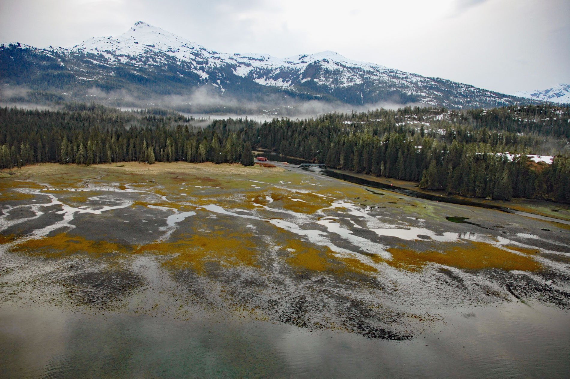
Cannery Creek is the site of a salmon hatchery on the eastern shore of Unakwik Inlet in Prince William Sound and the Chugach National Forest, about 42 miles (68 km) northeast of Whittier and 41 miles (66 km) west-southwest of Valdez, Alaska. The local name is after a salmon cannery that was built here in the early 1900s by the Unakwik Packing Company and later leased to the Pacific American Fisheries of Bellingham, Washington. The local name does not appear on area maps or charts. Unakwik Inlet is a fjord that trends south from the terminus of Meares Glacier for about 22 miles (35 km) to the north coast of Prince William Sound. The Alutiiq name for the inlet was reported in 1898 as ‘Unaguig Inlet’ by Captain Edwin F. Glenn of the U.S. Army and its present spelling was given by Ulysses S. Grant and Daniel F. Higgins of the U.S. Geological Survey in 1910. Northern Prince William Sound is part of the Southern Margin Composite terrane which is dominated by two major geological formations represented by the Valdez Group which formed during the Late Cretaceous, and the Orca Group which formed during the Paleocene and Eocene. The Valdez Group is part of a Mesozoic accretionary complex called the Chugach terrane which extends for 1,367 miles (2,200 km) along the Alaska coastal margin from Baranof Island in Southeast Alaska to Sanak Island in the Aleutians. The Orca Group is part of another accretionary complex that formed during the Paleogene called the Prince William terrane which extends across northern Prince William Sound. Both groups are similar and consist largely of greywacke, siltstone, and shale. The contact between the Orca and Valdez Groups is considered to be the Contact Fault which is roughly aligned with Miners Creek, Miners Lake, and runs through Miners Bay about 4 miles (6 km) north of Cannery Creek. The Valdez Group is north of the Contact Fault and Orca Group rocks are south of the fault. The bedrock underlying Cannery Creek consists of Orca Group turbidites with alternating layers of sandstone, siltstone, and shale. These sediments were probably deposited in the middle part of a deep-sea depositional fan. Surficial unconsolidated sediments covering the bedrock are predominantly Holocene glacial moraine and outwash deposits.
The heavily glaciated north coast of Prince William Sound experienced repeated ice advances through the Neoglacial Period, and despite this hostile environment, humans have inhabited the area for thousands of years. The earliest known occupation of the sound is based on archaeological excavations from a prehistorical village site called Uqciuvit at the northern end of Esther Passage in Port Wells, about 16 miles (26 km) west of Unakwik Inlet. This village was inhabited between about 4,400 and 3,300 years ago. Very little is known about the people of this pre-Neoglacial phase, except that they hunted sea mammals, used red ochre, and were familiar with slate grinding. Historically, Prince William Sound was occupied by eight geographic groups of Chugach people. Although these groups shared the same language and culture, each was politically independent with its own leader and principal village. The Kiniklik people were one of the original Chugach tribes and probably made contact with Europeans in 1790 when the Spanish explorer Salvador Fidalgo reputedly visited Unakwik fjord. In 1794, Lieutenant Joseph Whidbey with the Vancouver Expedition sailed into the bay and found the upper part blocked by ice, but noted the noise made by ice falling from the glacier front. In 1905, Grant and Higgins visited the bay and returned in 1909 to document Meares Glacier. In 1956, Frederica de Laguna inventoried the Chugach settlements of Prince William Sound based on surveys conducted in 1930 and 1933 and described a prehistorical village of the Kiniklik people in Unakwik Inlet on the west shore near the mouth of the fjord. The main historical village called Kiniklik was situated at the end of the peninsula separating Unakwik Inlet from Eaglek Bay to the west and was already abandoned in 1930.
The Cannery Creek Hatchery was built in 1978 by the Alaska Department of Fish and Game as part of the fisheries rehabilitation and enhancement program for pink and chum salmon. In 1988, the State of Alaska contracted the Prince William Sound Aquaculture Corporation to operate and manage the hatchery. The chum program was not successful due to the cold lake water temperatures during the winter months and was discontinued in 1990. The hatchery currently produces 187 million pink salmon fry annually which generates an average return of approximately 6 million adult pink salmon. Pacific salmon are noted for their ability to return to natal streams to spawn. This homing behavior isolates populations from one another and often leads to adaptations to the environmental conditions of a particular watershed. Homing is not perfect and some wild fish stray into non-natal spawning areas. These background levels of natural straying may be adaptive by allowing populations to expand into new habitats and by supplementing populations with low genetic diversities. However, the straying of hatchery-reared salmon may be disruptive to wild populations. Hybridizations between hatchery and wild fish may decrease the adaptive fitness of wild populations. Recent studies have shown that streams throughout Prince William Sound now contain more than 10% hatchery pink salmon. This level of hatchery salmon strays is at a proposed threshold of 2–10% which confounds wild salmon escapement goals and may harm the productivity, genetic diversity, and fitness of wild salmon in this region. Read more here and here. Explore more of Cannery Creek and Unakwik Inlet here:

