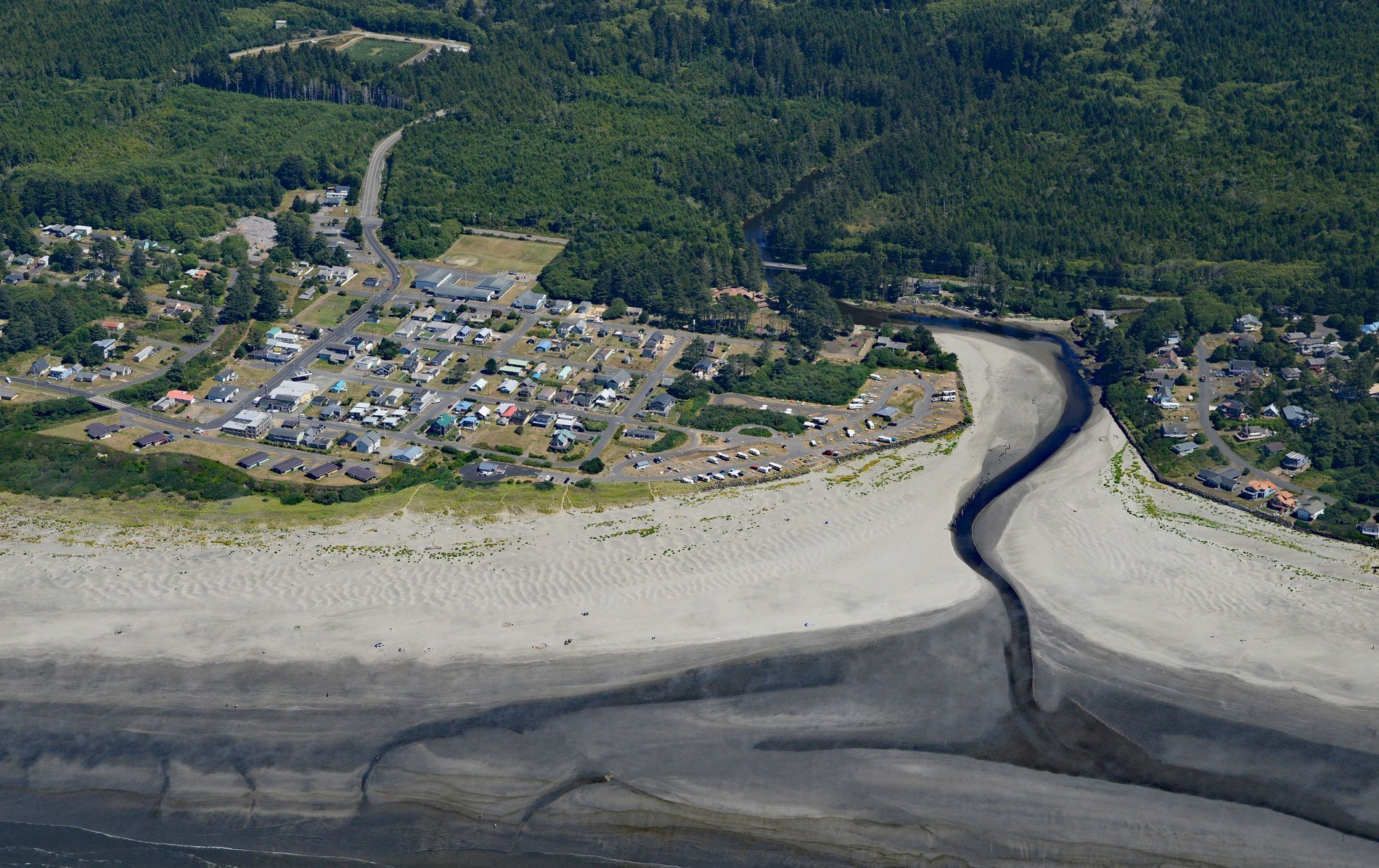
Pacific Beach is a community situated at the mouth of Joe Creek, where the estuary is a strongly stratified lagoon with freshwater overlying saline water caused by a shallow sill that restricts circulation, about 25 miles (40 km) northwest of Hoquiam and 11 miles (18 km) south of Moclips, Washington. Joe Creek starts at an elevation of about 360 feet (110 m) in the southern Olympic Peninsula and flows generally west for about 12 miles (19 km) to the Pacific Ocean. During the Pleistocene, the Olympic Mountains developed a central ice and snow complex drained by peripheral valley glaciers. Moraines mark the positions of successive piedmont glacial lobes that advanced to within a few miles of the ocean. This part of the peninsula is the southernmost extent of piedmont glaciation bordering the Pacific Ocean in western North America and the greatest expanse of glacial deposits on the Olympic Peninsula. The glacial drift or till was mapped and three different drift deposits were identified. Between the Quinault River to the north and the Humptulips River to the south a till deposit called the Humptulips Drift is exposed for more than 12 miles (20 km) including most of the Joe Creek watershed. The Humptulips Drift consists of glacial outwash sand and gravel eroded from the core of the Olympic Mountains, with beds of silt and clay that were likely deposited in outwash plain lakes. The last glaciation ended about 16,000 years ago exposing relative flat land suitable for human settlement.
The Indigenous inhabitants of this area are members of the Quinault tribe including the Chehalis subtribes of Copalis, Wynoochee, and Humptulips who all spoke Coast Salish languages. The Quillayute, Hoh, Queets, and Quinault tribes formed one confederacy, with each tribe managing its own tribal affairs. So great was the power of this league that it controlled the territory between present-day Grays Harbor to the south and Cape Flattery to the north. The Quinault tribes were in charge of the southern coast and had to keep all the Columbia River tribes from encroaching. In 1775, the Quinault made contact with Europeans near Point Grenville when the expedition of Bruno de Heceta on the frigate Santiago was attacked and seven Spaniards and at least seven Quinault were killed. In 1792, Captain Robert Gray discovered Grays Harbor and entered the Columbia River. Contact with Europeans and the frequent interaction between tribes accelerated several epidemics that swept the region, beginning with smallpox in the 1770s and continuing with what was likely malaria in 1829, cholera in 1836, and smallpox again in 1853. In 1855, after the creation of Washington Territory, the Quinault Treaty was signed by Chief Taholah of the Quinault and Chief How-yat’l of the Quileute, along with many other tribal delegates. One result of the treaty was the creation of the roughly triangular-shaped Quinault Indian Reservation about 10 miles (16 km) north of Joe Creek. The mouth of Joe Creek was first settled in 1863 by Henry Blodgett, a pioneer trapper, and hunter. He homesteaded 160 acres (65 ha) and eventually gave part of his land to Patrick H. Roundtree. In 1903, Roundtree began platting the townsite he called Joe Creek which was later changed to Pacific Beach. In 1906, a hotel was built along the bluff called The Quinault Inn and later became the Pacific Beach Hotel.
In 1942, the U.S. Navy opened a gunnery school at the Pacific Beach Hotel, the guest rooms were converted to barracks, the hotel restaurant and ballroom became a large cafeteria to serve the 350 navy personnel, and other hotel spaces became classrooms and offices. In 1948, the U.S Air Force installed radar equipment for aircraft detection and the Pacific Beach station transmitted data to a control center at Paine Field in Everett. The Pacific Beach Hotel again served as barracks and offices, and the former resort’s cottages provided additional housing. In 1958, the U.S. Navy commissioned a Sound Surveillance System at the former radar station at Pacific Beach. This secret facility was identified as a naval facility conducting oceanographic research but was actually technology developed to track Soviet submarines. In 1987, the Pacific Beach facility was turned over to Puget Sound Naval Station at Bremerton and later to Naval Station Everett for use as a military training facility as well as a recreation and conference center. The current military mission consists of providing operational support for a fixed signal emitter for the Electronic Warfare Tactical Training Range used by the Pacific Fleet for training. Commercial and residential development along the coast has created water quality issues, in particular the North Beach area that extends approximately 22 miles (35 km) along the coast between Ocean Shores to the south and Moclips to the north of Joe Creek. In 2011, popular razor clam beaches were closed because of high fecal coliform bacteria concentrations. People and animals are the source of the bacteria that can come from malfunctioning septic systems, leaky sewer infrastructure, and improperly managed dog and horse manure on the beach. Read more here and here. Explore more of Joe Creek and Pacific Beach here:

