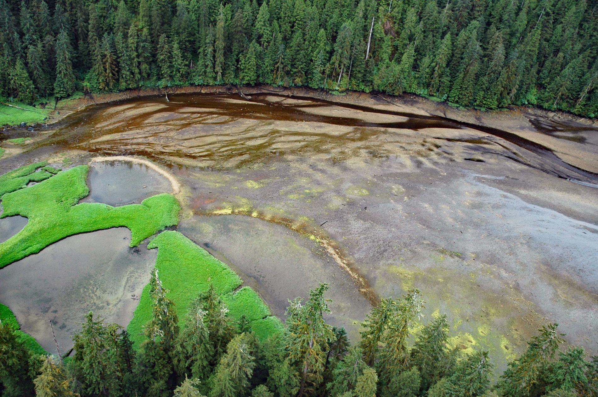
Mink Bay is an estuary that extends south for 5.4 miles (8.7 km) from Boca de Quadra an embayment on the east side of Revillagigedo Channel, about 54 miles (87 km) north-northwest of Prince Rupert and 40 miles (65 km) southeast of Ketchikan, Alaska. Mink Bay was one of many arbitrary names applied to features in this area in 1891 by the U.S. Coast and Geodetic Survey. The mountains to the east of Mink Bay comprise granodiorite and the mountain to the west are quartz diorite, while the rocks immediately surrounding the embayment are a paragneiss that were originally deposited on the Earth’s surface as shales and which now contain high-temperature metamorphic minerals such as biotite, garnet, and cordierite.
Boca de Quadra is a large fjord that extends generally southwest for 39 miles (63 km) from the Keta River to Revillagigedo Channel in Southeast Alaska. The bay was named in 1792 for Juan Francisco de Bodega y Quadra by Jacinto Caamaño, to commemorate Quadra’s expeditions and surveys in the region in 1775-79. Caamaño was the leader of the last great Spanish exploration of Russian America and the coast of what is now British Columbia. He was commanding the Nuestra Señora del Rosario, also known as the La Princesa, a 189-ton frigate built in San Blas, Mexico for the exploration of the northern coast. On the first voyage north in 1790, Caamaño did not go beyond Nootka Sound on Vancouver Island, but on the second voyage in 1792, came as far as Bucareli Bay commanding the frigate Aránzazu, and this expedition did a thorough survey of the coast from Bucareli to Nootka, marking the map of Alaska and British Columbia with many names which are there today
Stone fish traps have been used for thousands of years in many places around the world. A fish weir or trap is generally a wall or barrier placed in tidal waters or rivers to direct the passage of fish into a basket or net. Fish traps in the marine intertidal zone were built to catch migratory fish such as salmon and eels. In the Pacific Northwest, fish traps were constructed of stones to take advantage of the large tidal range and were used to corral salmon. In Mink Bay, stone traps were built in the grassy upper intertidal zone. These sites are stone alignments built to create impoundments in the thick grasses near the stream mouth. The resulting pools are usually free of rocks and many retain water after the tide has receded. The lower edge of the pool is created by an arcing rock barrier and the remainder is formed by the indented edge of the slightly elevated grassy meadow. The upper tidal features that retain water may also have held fish, either dead or alive, after harvest from lower structures. Read more here and here. See a short video of a British Columbia fish trap in action here. Explore more of Mink Bay here:

