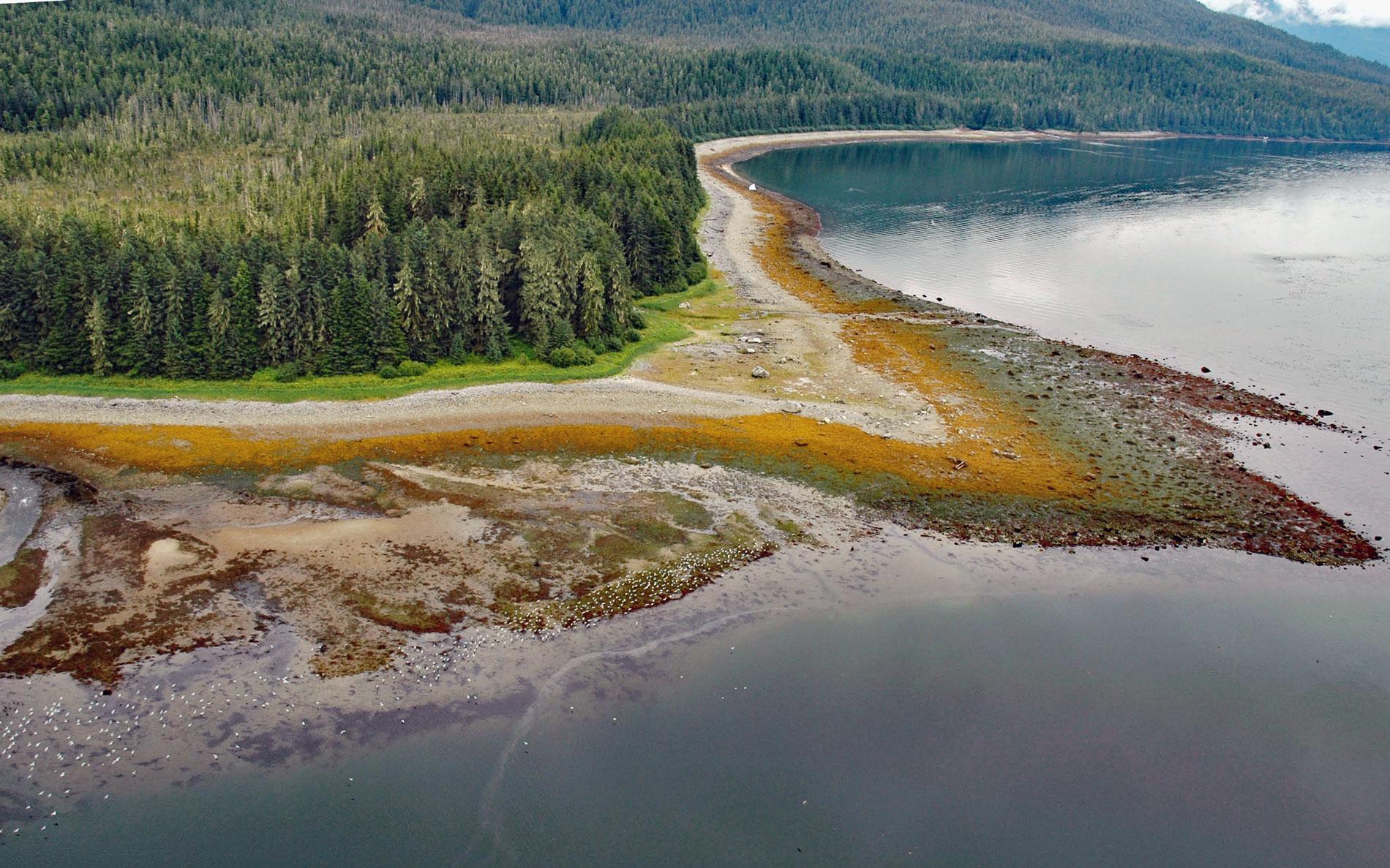
Sumdum is a historical Tlingit village of the S’awdaan Kwáan located north of Powers Creek at the northern end of Endicott Arm where it meets Holkham Bay in Tracy Arm-Fords Terror Wilderness, about 70 miles (113 km) north-northwest of Petersburg and 49 miles (79 km) southeast of Juneau, Alaska. Powers Creek starts at the terminus of Sumdum Glacier and flows southwest for 2 miles (3.2 km) to the eastern shore of Endicott Arm. The Tlingit name for the creek was Si’t-qu. Holkham Bay was named in 1794 by Captain George Vancouver after Holkham, a community in Norfolk, England. The Tlingit knew the bay as Sum Dum, reputedly for the sound of ice calving from glaciers. Endicott Arm was named in 1889 by Lieutenant Commander Henry B. Mansfield on the USCGS Carlile P. Patterson for William C. Endicott who was the Secretary of War under President Grover Cleveland. Powers Creek was named in 1906 by Arthur C. Spencer and Charles W. Wright of the U.S. Geological Survey after a local prospector. The bedrock forming the eastern shore of Endicott Arm is represented by the western metamorphic belt which runs parallel and adjacent to the southwestern side of the coast plutonic complex. At Powers Creek, the rock consists mostly of phyllite and shale that were metamorphosed from sediments during the Permian to Cretaceous time.
At least seventeen geographically distinct Tlingit clans or groups existed in Southeast Alaska prior to Euro-American contact. The Sumdum clan inhabited Holkham Bay and Endicott Arm and used seasonal fish camps in addition to the main village located at Powers Creek below the Sumdum Glacier. Prospectors discovered gold in Powers Creek in 1869 and the placer deposits were worked intermittently until 1911. In 1880, John Muir traveled here and described the Sumdum village as occupied by 37 Tlingit of the Wolf moiety who subsisted mostly on salmon and seals. In 1880, more gold was discovered across the bay from the village at present-day Sanford Cove near a traditional family fish camp. In 1893, a large mining facility was developed at Sanford Cove to support the Bald Eagle mine that employed up to 20 men in 1894. By 1900, the population of the mining settlement, confusingly also called Sumdum, reached 137, the majority of which were Sumdum Tlingit. The large Tlingit population indicates that family groups inhabiting the dispersed Sumdum settlements in Endicott Arm had became centralized at the Sumdum mining camp. The mine continued to operate until 1903, after which a majority of the population moved out of the region. There is little information about the tribe other than by 1931 there were no Sumdum living in the area and by 1946, no one from that village remained alive.
In 1980, the United States Congress designated 653,179 acres as the Tracy Arm-Fords Terror Wilderness. This wilderness area is managed by the Tongass National Forest and can be accessed only by motorboats, large vessels or commercial cruise boats, and floatplanes. Tracy and Endicott are two long and narrow fjords confined by steep rock walls and glacier-covered mountains. About 75 percent of the wilderness area is considered alpine, which includes 20 percent glaciers and snow fields. At the head of both fjords, tidewater glaciers calve regularly into the sea resulting in floating icebergs that often block access to the end of the fjords. The area has breeding colonies of pigeon guillemot, arctic tern, and pelagic cormorant as well as mew, glaucous-winged and herring gulls. Some rocky islets and points have nesting black oystercatchers. Humpback whales, seabirds, and common and red-throated loons feed in Holkham Bay. Read more here and here. Explore more of Sumdum and Endicott Arm here:

