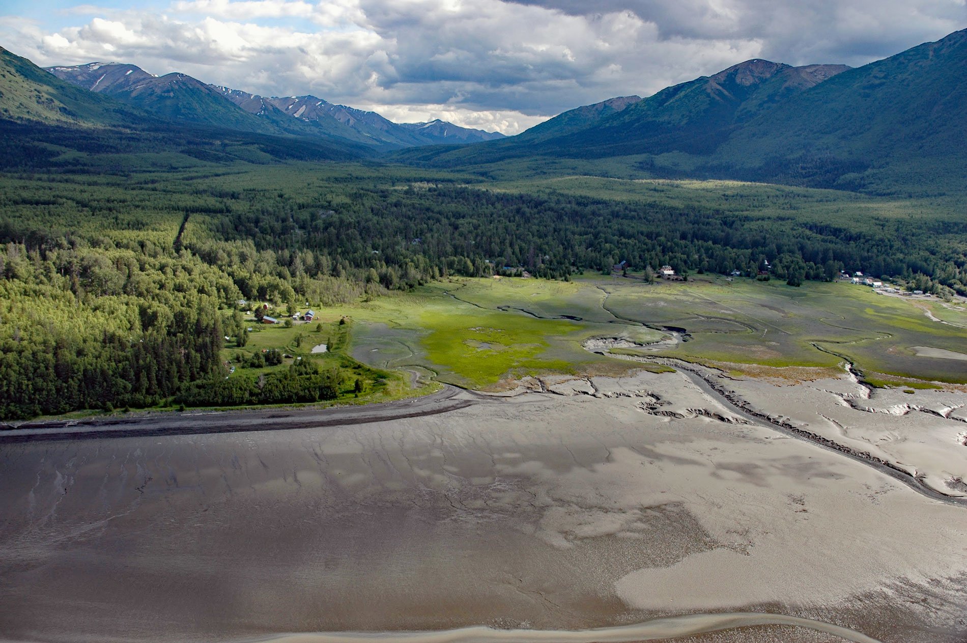
Hope is a historic community on the Kenai Peninsula at the mouth of Resurrection Creek on the south shore of Turnagain Arm in upper Cook Inlet, about 22 miles (35.5 km) southeast of Anchorage and 18 miles (29 km) west-southwest of Girdwood, Alaska. Resurrection Creek starts in the Kenai Mountains and flows generally north for 20 miles (32 km) to Turnagain Arm, draining a watershed of 103,040 acres (41,699 ha). In the 1890s, Resurrection Creek was the site of Alaska’s first gold rush. Charles Miller located the first claim on the creek before leasing it to others. By 1893, about a dozen miners were working claims, and in the following year, many more claims were established on the creek. Since 1895, Resurrection Creek has yielded about 30,000 to 40,000 ounces (850 to 1134 kg) of gold.
The low country near Hope consists of a grassy tide flat of about 50 acres (20 ha) that was suitable for vegetable gardening and making hay for livestock. The town was established in about 1896 as Hope City and became an important trading post for placer miners and early pioneers. Ocean-going ships could not enter Turnagain Arm and small gasoline boats were used at high tide to reach the settlements at Kern Creek, Girdwood, Sunrise, and Hope from steamship terminals at Seldovia, Tyonek, and Knik Anchorage. The steamships of the Alaska Coast Company and the Alaska Steamship Company ran regularly between Seattle and Seldovia throughout the year. However, water transportation to ports on upper Cook Inlet was possible only during the summer since the upper inlet is closed by ice during the winter months. Most gold seekers arrived in Seldovia by ship from Seattle and then traveled overland to the Resurrection Pass Trail and on to Hope. The alternative was to board a shoal-draft vessel at Seldovia and proceed up Cook Inlet to Tyonek, and then take a smaller boat to Hope.
Today, the Resurrection Pass Trail is a popular recreational hike. The trail is about 38.4 miles (62 km) long between the northern end near Hope and the southern end at the Sterling Highway near Cooper Landing. Public use shelters are available by reservation at Caribou Creek, Fox Creek, East Creek, and at Devil’s Pass cabins. Recreational gold panning is still allowed in designated areas. The trail offers spectacular scenery and opportunities to see wildlife including moose, black and brown bears, caribou, wolves, marmot, Dall sheep, mountain goats, ptarmigan, and grouse. The trail goes through spruce and aspen forests at lower elevations and alpine tundra with wildflowers above tree line at 2,400 feet (732 m). Read more here and here. Explore more of Hope and Resurrection Creek here:

