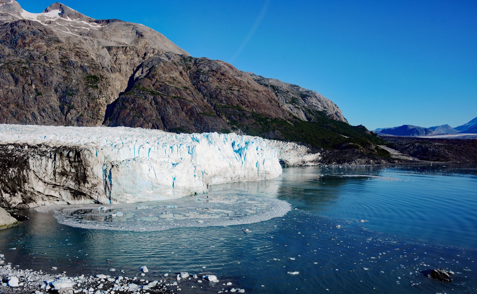
Margerie Glacier starts at an elevation of 9,860 feet (3,005 m) on the international border of the United States and Canada between Mount Root to the north and Mount Fairweather to the south and flows generally east for 21 miles (34 km) to tidewater at Tarr Inlet in Glacier Bay National Park and Preserve, about 101 miles (163 km) southeast of Yakutat and 66 miles (107 km) northwest of Gustavus, Alaska. Tarr Inlet was named by Lawrence Martin of the U.S. Geological Survey in 1912 for Ralph S. Tarr, a professor of physical geography at Cornell University who visited this fjord in 1911. The glacier was named by Martin in 1923 for Emmanuel de Margerie, a prominent French geographer and geologist who visited Glacier Bay in 1913 and published many scientific papers including several on the geology of North America. The bedrock underneath the glacier is part of the Valdez Group of metasedimentary rocks that consist of greywacke sandstone and mudstone turbidites deposited in a deep ocean trench during the Cretaceous. The Valdez Group is part of the Southern Margin composite terrane, an accretionary complex that dominates the southern Alaska coastline.
There are over 1,000 glaciers in Glacier Bay National Park and Preserve, most are high in the mountains and only 11 presently reach tidewater with eight terminating in Glacier Bay and connecting fjords and three terminating on the Pacific coast. Glacial advances in Glacier Bay occurred 7,000, 5,000, and 500 years ago with the last extending south to Icy Strait where it was encountered by the Captain George Vancouver expedition in 1794. In 1879, naturalist John Muir found that the ice had retreated a distance of around 48 miles (77 km). Since then, tidewater and terrestrial glaciers in the park have continued to thin and slowly recede. Reduced snowfall in the source ice fields and warmer temperatures during winter, coupled with an apparent reduction in cloud cover and precipitation during the summer, are the probable causes of this trend. Johns Hopkins Glacier is currently the only advancing tidewater glacier on the eastern side of the Fairweather Range, and the glaciers in Lituya Bay also continue to advance. Margerie Glacier, and LaPerouse Glacier which flows from the western side of the Fairweather Range, are relatively stable, neither growing nor receding.
Margerie Glacier is a primary destination for cruise ships visiting Glacier Bay National Park and Preserve. The glacier face at tidewater is about 1 mile (1.6 km) wide and 250 feet (76 m) high. About 100 feet (30 m) of the glacier is below sea level. The ice flows about 2,000 feet (610 m) per year or about 6 feet (2 m) per day. In 1990, Margerie Glacier was still joined to Grand Pacific Glacier which has since retreated about 1 mile (1.6 km) to the northwest. Since 1998, the northern third of the terminus of Margerie Glacier began a recession that formed a small embayment. In 2017, this section experienced dramatic changes with deep embayments and a large mass of bedrock now exposed. Perpetual meltwater discharges from subglacial streams below the water surface cause strong upwelling and occasional water fountains. Where the ocean is disturbed by streams of upwelling meltwater and calving icebergs, flocks of black-legged kittiwake gulls swarm and feed on fish and small marine invertebrates adding to the cacophony at the calving glacier face. Read more here and here. Explore more of Margerie Glacier and Tarr Inlet here:

