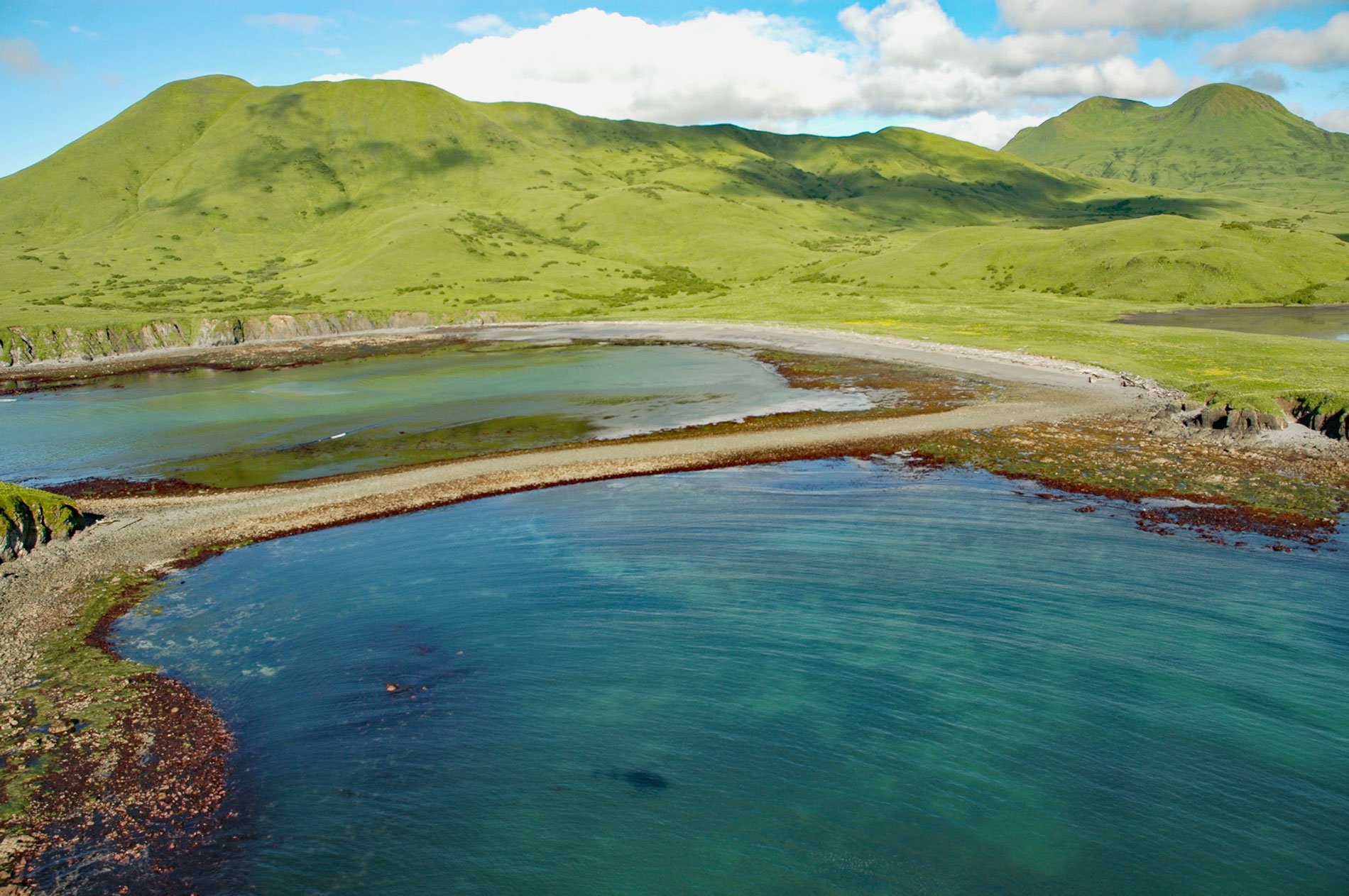
Refuge Rock is in Partition Cove on the eastern shore of Sitkalidak Island, about 54 miles (87 km) southwest of Kodiak and 10 miles (16 km) southeast of Old Harbor, Alaska. Partition Cove is separated from McDonald Lagoon by a narrow isthmus. Partition Cove was named in 1934 by the U.S. Coast and Geodetic Survey for an islet and tombolo about 0.3 miles (483 m) long bisecting the cove. The islet was the site of the Awa’uq or Refuge Rock Massacre, an attack and massacre of Koniag Alutiiq people in April 1784 by Russian fur trader Grigory Shelikhov and 130 armed Russian men and cannoneers of the Shelikhov-Golikov Company.
In the mid-1700s, as Russian fur traders expanded north and east from Unalaska, they encountered resistance from Aleut and Alutiiq natives who were intent on repulsing them. In 1784 on Kodiak Island, Shelikhov moved to assert Russian dominance and sent a force to Refuge Rock to subjugate the native Koniag. The Koniag villagers traditionally gathered at Refuge Rock when under threat of attack because the precipitous cliffs and narrow tidal spit provided natural protection from their enemies. However, Shelikhov and his company of mostly promyshlenniki sailed their boats from Three Saints Bay into McDonald Lagoon and remained hidden from view until the attack.
Eyewitness accounts vary but the Russians killed at least 300 men, women, and children on Refuge Rock, and Shelikhov claimed to have captured over 1,000 people, detaining 400 as hostages. This began a dark period for the Alutiiq as the Russian traders enslaved men to hunt sea otters year-round, while women and children were held hostage. This massacre was an isolated incident, but the violence and taking of hostages resulted in the Alutiiq becoming completely subjugated by the Russian traders. Read more here and here. Explore more of Refuge Rock and Partition Cove here:

