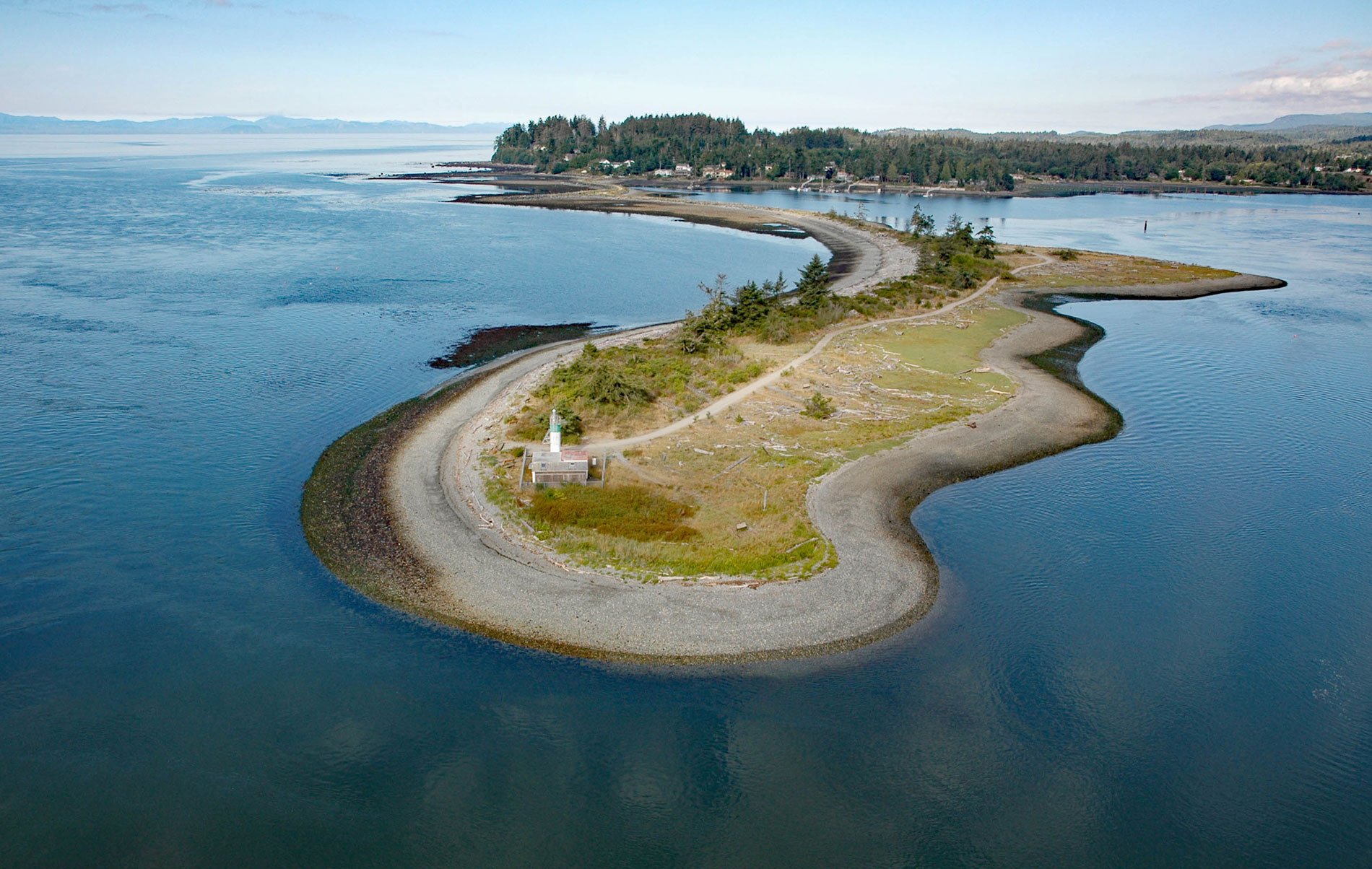
Whiffin Spit is a narrow sandspit that almost landlocks Sooke Harbour and Sooke Basin, about 17 miles (27 km) southwest of Victoria and 1.5 miles (2.4 km) southeast of Sooke, British Columbia. Sooke Basin is a tidal inlet connected to the Strait of Juan de Fuca by Sooke Harbour, a 2.5 miles (4 km) long narrow natural harbour discovered in 1790 by the Spanish Captain Manuel Quimper when he entered aboard Princesa Real. The spit was named in 1846 for John George Whiffin who was a clerk for Captain Henry Kellett on HMS Herald when the inlet and coast of British Columbia were surveyed with HMS Pandora after the Oregon boundary dispute with the United States.
Sooke Basin is named for the T’sou-ke Nation of the Coast Salish peoples, the native inhabitants who had a thriving community around the basin for several thousand years before the arrival of the first Europeans. In 1843, the Hudson’s Bay Company built a fortified fur trading post called Fort Victoria at Camosun, and European immigration and land acquisition soon followed. In 1849, Captain Walter Grant arrived at Sooke Harbour from Scotland along with John and Anne Muir. Grant built a water-powered sawmill and is known for introducing the Scotch broom to British Columbia as seeds he planted for an ornamental garden. In 1855, the Muirs had a steam sawmill, a farm, and built a number of ocean-going vessels in Sooke Harbour. They established lumber markets from San Francisco to South America, Hawaii, and Australia. During the early 1900s the temperate rainforests with Douglas fir, western red cedar, Sitka spruce, and western hemlock that surrounded Sooke attracted corporate timber interests and logging began in earnest.
The spit may have been a lookout post for the T’Sou-ke Nation before the arrival of Europeans. In the early 1900s, a series of fish traps, with piles driven into the ocean floor and webbing designed to intercept salmon, was to become the mainstay of the local economy. The spit was used for decades by the Sooke Harbour Fishing and Packing Company to store fish trap pilings. In the 1920s, the spit also had a fish reduction plant run by the Stand Fast Bible Students Movement. It was the mid-1900s before independent fishing boats put an end to the use of fish traps. There has been a lighted navigational aid at the end of the spit since about 1906. The current light is a beacon atop a cylindrical tower 21 feet (6.4 m) tall. The site also has a fog signal and a weather station. Today, the spit is a popular place for walks and protects the harbour from breaking waves in the Strait of Juan de Fuca. Reinforcement work has been done on the spit since 1907, and in 1995, a large project was undertaken to restore a breach and install a rock breakwater. Read more here and here. Explore more of Whiffin Spit and Sooke Harbour here:

