Beaches
Recent Articles
More Articles
Ancon Rock, Point Gustavus
Ancon Rock is a reef located about 0.5 miles (0.8 km) off Point Gustavus on the eastern shore, at the entrance to Glacier Bay within Glacier Bay National Park and Preserve, about 55 miles (89 km) west of Juneau and 8.5 miles (12 km) southwest of Gustavus, Alaska.
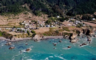
Westport, Mendocino Coast
Westport is a historic timber export community on the Mendocino coast, where lumber schooners were loaded using long chutes built across nearshore rocks, about 83 miles (134 km) south-southeast of Eureka and 13 miles (21 km) north of Fort Bragg, California.
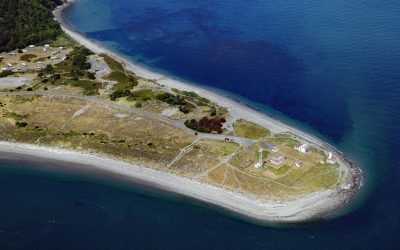
Point Wilson Light Station, Fort Worden
Point Wilson is the site of a historic light station on the grounds of former Fort Worden, situated on a low, broad sand spit that extends northeast for 1.5 miles (0.8 km) from the northern end of the Quimper Peninsula into Admiralty Inlet, about 31 miles (50 km) east of Port Angeles and 2 miles (3.2 km) north of Port Townsend, Washington.
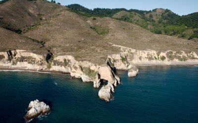
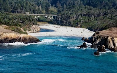
Point Resistance, Point Reyes National Seashore
Point Resistance is a headland on Drakes Bay, on the western shore of the Marin Peninsula, at the north end of Kelham Beach in the Phillip Burton Wilderness of Point Reyes National Seashore, about 27 miles (44 km) northwest of San Francisco and 3.5 miles (7 km) southwest of Olema, California.
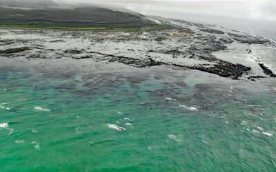
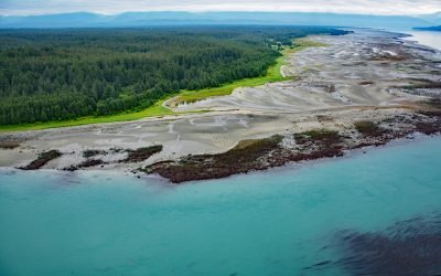
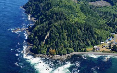
Cape Suckling, Suckling Hills
Cape Suckling is an area of wave eroded rocky reefs backed by dunes, and farther inland lie the Suckling Hills and the terminus of the Bering Glacier, about 150 miles (241 km) west-northwest of Yakutat and 73 miles (117 km) southeast of Cordova, Alaska.
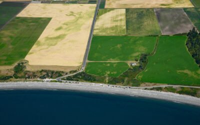
Ebey’s Landing, Whidbey Island
Ebey’s Landing is a beach on the southwest coast of Whidbey Island, on Admiralty Inlet in northern Puget Sound, about 45 miles (72 km) north-northwest of Seattle and 2 miles (3.2 km) south-southwest of Coupeville, Washington.
Cape Lewis, Lisburne Peninsula
Cape Lewis is a 1,222-foot (372 m) promontory with steep sea cliffs situated between Ukinyak Creek to the north and Kiliktakgot Creek to the south, 11 miles (18 km) south of Cape Lisburne on the Lisburne Peninsula, about 107 miles (172 km) southwest of Point Lay and 27 miles (44 km) north-northeast of Point Hope, Alaska.
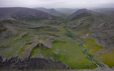
Pitmegea River, Cape Sabine
The Pitmegea River originates at an elevation of about 1,300 feet (396 meters) in the De Long Mountains of the western Brooks Range, and flows northwest for 37 miles (60 kilometers) to the Chukchi Sea at Cape Sabine, about 70 miles (113 kilometers) south-southwest of Point Lay and 66 miles (106 kilometers) northeast of Point Hope, Alaska.
Jug Handle Cove, Ecological Staircase
Jug Handle Cove is a California State Natural Preserve made up of a series of ancient marine terraces, known as the Ecological Staircase, which exhibit different stages of ecological succession at the mouth of Jug Handle Creek, about 5 miles (8 km) south of Fort Bragg and 5 miles (8 km) north of Mendocino, California.
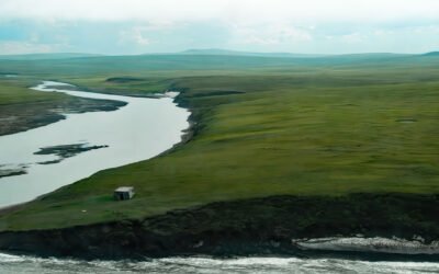
Slip Point, Clallam Bay
Slip Point sits on the southern shore of the Strait of Juan de Fuca at the eastern end of Clallam Bay on the Olympic Peninsula, about 39 miles (63 km) west-northwest of Port Angeles and 0.7 miles (1 km) northeast of the community of Clallam Bay, Washington.
About the background graphic
This ‘warming stripe’ graphic is a visual representation of the change in global temperature from 1850 (top) to 2019 (bottom). Each stripe represents the average global temperature for one year. The average temperature from 1971-2000 is set as the boundary between blue and red. The colour scale goes from -0.7°C to +0.7°C. The data are from the UK Met Office HadCRUT4.6 dataset.
Click here for more information about the #warmingstripes.