
Beaches
Recent Articles
More Articles
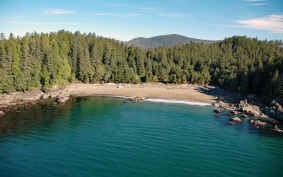
Clo-oose, Cheewhat River
Clo-oose is the site of an abandoned village of the Ditidaht First Nation on the southwest coast of Vancouver Island, above a beach 0.25 miles (0.4 km) west of the Cheewhat River mouth, about 20 miles (32 km) west-northwest of Port Renfrew and 19 miles (31 km) southeast of Bamfield, British Columbia.
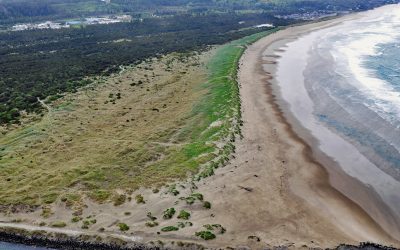
South Beach, Yaquina Bay South Jetty
South Beach is a state park south of the jetty protecting the mouth of Yaquina Bay and extending for 1 mile (1.6 km) along the Pacific coast, about 12 miles (19 km) north of Waldport and 2 miles (3.2 km) south-southwest of Newport, Oregon.
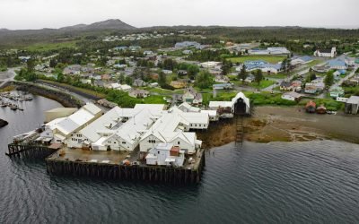
Metlakatla, Annette Island
Metlakatla is a Tsimshian community situated on Port Chester, an embayment on the west coast of Annette Island, about 75 miles (121 km) northwest of Prince Rupert and 16 miles (26 km) south-southeast of Ketchikan, Alaska.
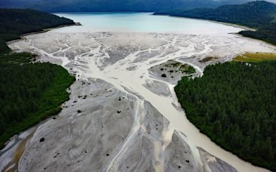
Geikie Inlet, Glacier Bay
Geikie Inlet is a fjord about 8 miles (13 km) long that trends generally northeast from the mouth of the Geikie River to the western coast of Glacier Bay, in Glacier Bay National Park and Preserve, about 130 miles (209 km) southeast of Yakutat and 32 miles (51 km) northwest of Gustavus, Alaska.
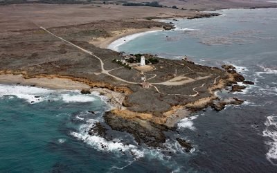
Point Piedras Blancas, San Simeon
Point Piedras Blancas is a prominent headland and the site of a historic light station within the California Coastal National Monument, and surrounded by the Hearst San Simeon State Park, about 73 miles (117 km) south-southeast of Monterey and 6 miles (10 km) west-northwest of San Simeon, California.
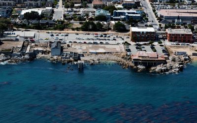
Cannery Row, Monterey
Cannery Row is the Monterey waterfront between San Carlos Beach and Cabrillo Beach, or between the Monterey Harbor Marina and the Monterey Bay Aquarium, where several historical Pacific sardine canneries once operated, about 25 miles (40 km) south-southeast of Santa Cruz and 1 mile (1.6 km) southeast of Pacific Grove, California.
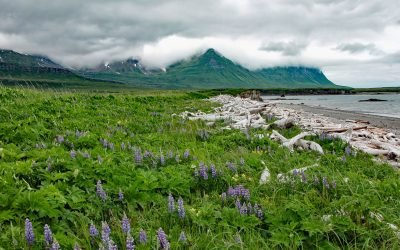
Sukoi Bay, Cape Douglas
Sukoi Bay is situated at Cape Douglas on the western shore of Shelikof Strait, in Katmai National Park and Preserve, about 121 miles (195 km) east of King Salmon and 83 miles (134 km) southwest of Homer, Alaska.
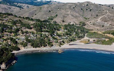
Muir Beach, Marin Peninsula
Muir Beach is a small community situated on the west coast of the Marin Peninsula overlooking the Pacific Ocean, with the adjacent sand beach in the Golden Gate National Recreation Area, about 11 miles (18 km) northwest of San Francisco and 5 miles (8 km) southeast of Stinson Beach, California.
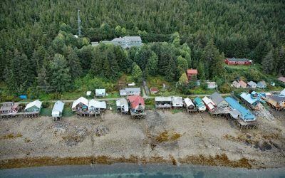
Tenakee Springs, Chichagof Island
Tenakee Springs is a community on the north shore of Tenakee Inlet, on the eastern shore of Chichagof Island in the Alexander Archipelago of Southeast Alaska, about 46 miles (74 km) southwest of Juneau and 30 miles (48 km) northwest of Angoon, Alaska.
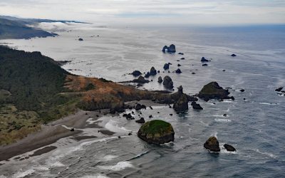
Crook Point, Oregon Islands National Wildlife Refuge
Crook Point is a prominent headland within the Oregon Islands National Wildlife Refuge that includes 1.4 miles (2.3 km) of shoreline with sandy beaches and areas of rocky intertidal, offshore rocks, islets, and subtidal reefs with kelp beds, about 15 miles (24 km) north-northwest of Brookings and 11 miles (18 km) south of Gold Beach, Oregon.
About the background graphic
This ‘warming stripe’ graphic is a visual representation of the change in global temperature from 1850 (top) to 2019 (bottom). Each stripe represents the average global temperature for one year. The average temperature from 1971-2000 is set as the boundary between blue and red. The colour scale goes from -0.7°C to +0.7°C. The data are from the UK Met Office HadCRUT4.6 dataset.
Click here for more information about the #warmingstripes.