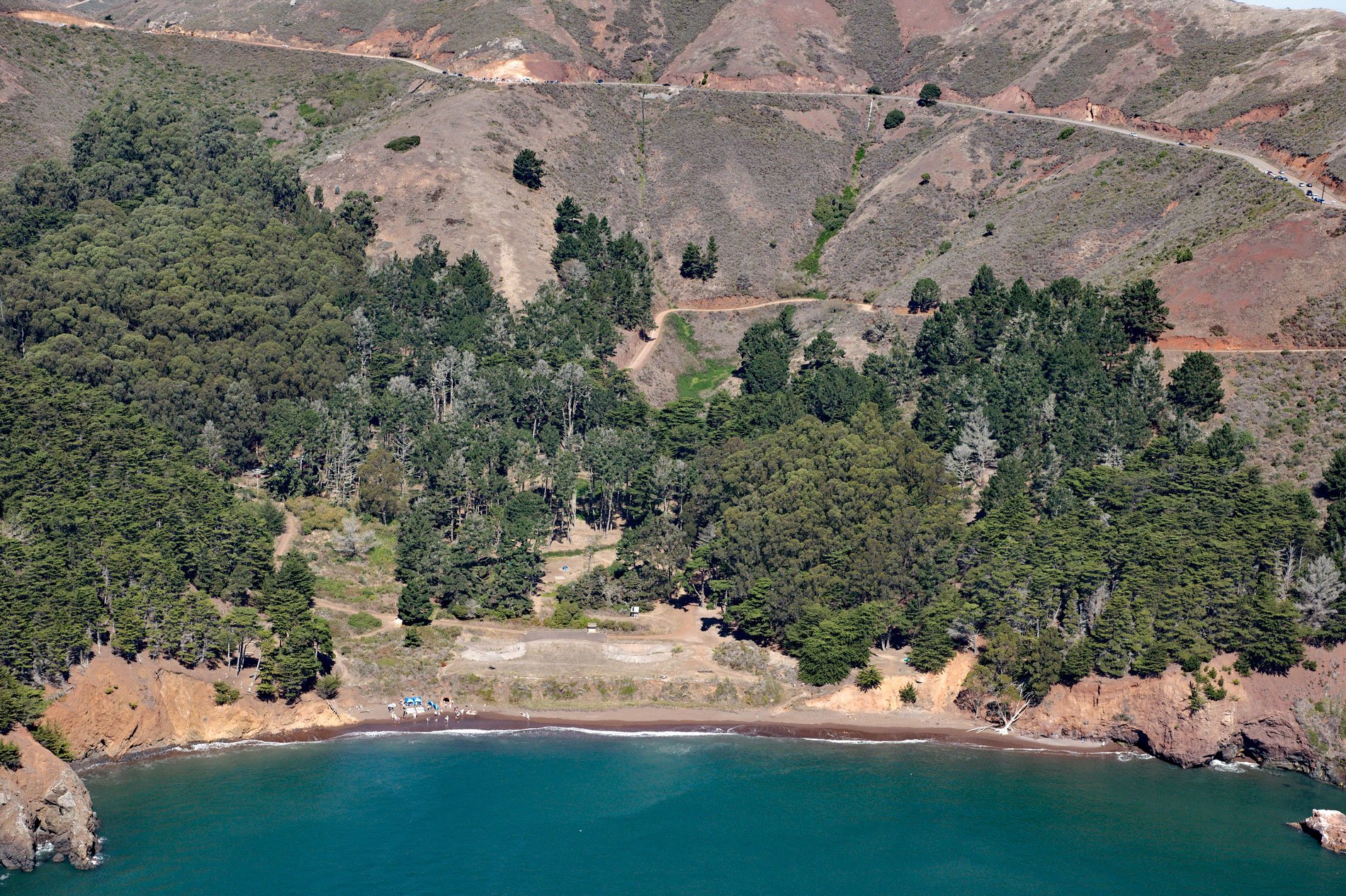
Kirby Cove is an embayment in the Marin Headlands on the northern shore of the Golden Gate in the Golden Gate National Recreation Area, and the site of a historic military installation, about 5.5 miles (9 km) northwest of downtown San Francisco and 2.3 miles (4 km) south of Sausalito, California. The cove is named after Battery Kirby, a coastal defense site from 1898 to 1934, which in 1902 was named to honor Lieutenant Edmund Kirby, who died in 1863 from wounds received at the Battle of Chancellorsville, Virginia. The bedrock forming Kirby Cove and much of the Marin Headlands represents sedimentary rocks of the Franciscan Complex that developed during the Late Jurassic or Early Cretaceous period. The distinctive red coloration is from oxidized iron in the silica skeleton of radiolaria, a microscopic zooplankton found throughout the global ocean, that accumulates on the ocean floor as siliceous ooze, which in this case was subsequently lithified as chert and uplifted as the Marin Headlands.
The Marin Headlands are the traditional territory of the Coast Miwok people, who for thousands of years freely moved across the peninsula in pursuit of subsistence foods. In the early 1800s, the land was grazed by cattle to support the Spanish missions ate San Francisco and San Rafael. After the Mexican War of Independence in 1821, the mission lands were secularized and in 1835 a land grant of 19,752 acres named Rancho Saucelito was given by Governor Juan Alvarado to José Antonio Galindo; however, in 1838, Galindo was arrested for murder and the rancho lands were re-granted to William A. Richardson. In 1848, the Treaty of Guadalupe Hidalgo ended the Mexican-American War, and Alta California was ceded to the United States. The Presidio of San Francisco on the south shore of the Golden Gate was rebuilt, and after the American Civil War, a new fort was built with guns and powder magazines behind earthworks reinforced with brick and granite. On the north side of the Golden Gate, a land parcel of 1700 acres (688 ha) called the Lime Point Tract was purchased in 1866, and Fort Baker was built with a series of satellite gun batteries including Battery Kirby in 1900 with two twelve-inch rifles on disappearing carriages designed to defend San Francisco Bay from attack at mid and short-range. In 1934, the battery was abandoned, and the gun carriages were removed in 1943.
The site of Battery Kirby is surrounded by plantings of Monterey cypress, blue-gum eucalyptus, and Monterey pines. These plantings have matured and create a large forested area near the beach and along the adjacent coastline. The site is now part of the Golden Gate National Recreation Area, one of the largest urban parks in the world, and is managed by the National Park Service to provide camping facilities and educational opportunities about the historic coastal fortifications, natural history of the Marin Headlands, and the marine environment of the Golden Gate. The headlands are the habitat of lupine host plants for the endangered mission blue butterfly. The plants are necessary for survival of the butterfly because their larvae only feed on the leaves of three species of lupines that occur on the Marin Headlands. Habitat loss is probably the primary threat to the lupines due to development and the introduction of invasive plants. Other threats to mission blue butterflies at various stages of their life cycles include parasites, predators, and desiccation and disease during dormancy. Adults have one generation per year, with a flight period from mid-March to mid-May at Marin Headlands. Read more here and here. Explore more of Kirby Cove and Marin Headlands here:

