Beaches
Recent Articles
More Articles
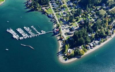
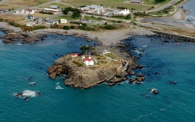
Dofflemyer Point, Boston Harbor
Dofflemyer Point is located in the community of Boston Harbor, on the eastern shore of South Puget Sound, and defines the entrance to Budd Inlet, about 23 miles (37 km) west-southwest of Tacoma and 7 miles (11 km) north of Olympia, Washington.
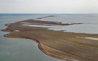
Cooper Island, Beaufort Sea
Cooper Island is an Arctic barrier island and one of the Plover Islands on Elson Lagoon on the Beaufort Sea coast, about 129 miles (208 km) northwest of Nuiqsut and 24 miles (39 km) east of Utqiaġvik, Alaska.
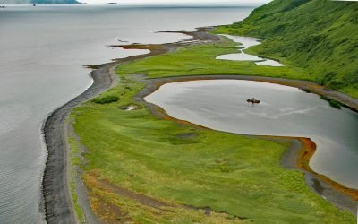
Three Saints Harbor, Kodiak Island
Three Saints Harbor is the location of a historical Russian settlement established in 1784 on Three Saints Bay on the east coast of Kodiak Island, about 63 miles (101 km) southwest of Kodiak and 29 miles (47 km) northeast of Akhiok, Alaska.
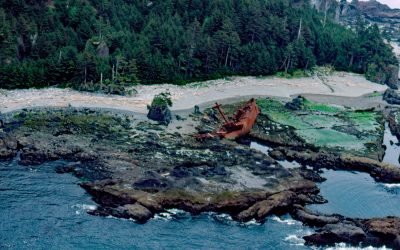
SS Clarksdale Victory, Hippa Island
SS Clarksdale Victory is a shipwreck on the west coast of Hippa Island, 1.5 miles (2.4 km) west of Graham Island in the Haida Gwaii Archipelago, about 49 miles (79 km) southwest of Masset and 42 miles (68 km) northwest of Queen Charlotte, British Columbia.
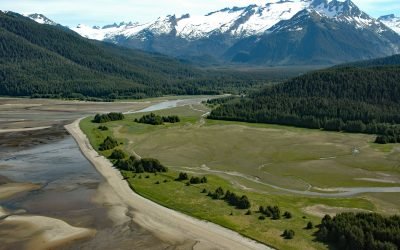
Eagle River Beach, Favorite Channel
Eagle Beach is at the mouth of Eagle River on the eastern shore of Favorite Channel, about 68 miles (109 km) south-southeast of Skagway and 22 miles (35 km) northwest of Juneau, Alaska.
Battery Point, Crescent City
Battery Point forms the western shore of a crescent-shaped bight, and the harbor for Crescent City, about 22 miles (35 km) south-southeast of Brookings and 66 miles (106 km) north of Eureka, California.
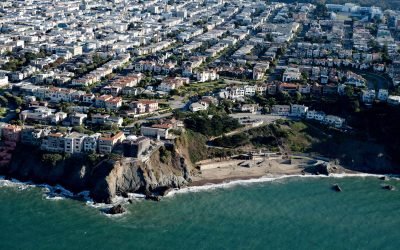
China Beach, San Francisco
China Beach is a small sandy cove on the South Bay of the Golden Gate tucked between Lands End and Baker Beach, once used as a campsite by Chinese fishermen, about 7 miles (11 km) north of Daly City and 5 miles (8 km) west of downtown San Francisco, California.
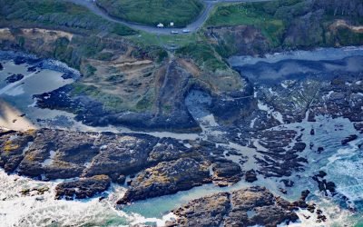
Strawberry Hill, Neptune State Park
Strawberry Hill is part of Neptune State Park, situated between Nancy Creek and Bob Creek, about 19 miles (31 km) north of Florence and 5 miles (8 km) south of Yachats, Oregon.

Soquel Creek, Capitola
Soquel Creek runs through Capitola, a community adjacent to Santa Cruz on the north coast of Monterey Bay, about 75 miles (120 km) south of San Francisco and 26 miles (42 km) north of Monterey, California.
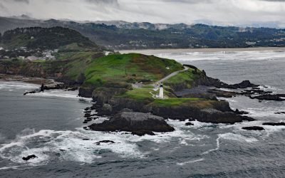
Yaquina Head, Agate Beach
Yaquina Head is a prominent basalt headland, adjacent to the community of Agate Beach, rising over 100 feet (30 m) in elevation and extending 0.75 miles (1.2 km) into the Pacific Ocean, about 9 miles (15 km) south of Depoe Bay and 3 miles (5 km) north-northwest of Newport, Oregon.
About the background graphic
This ‘warming stripe’ graphic is a visual representation of the change in global temperature from 1850 (top) to 2019 (bottom). Each stripe represents the average global temperature for one year. The average temperature from 1971-2000 is set as the boundary between blue and red. The colour scale goes from -0.7°C to +0.7°C. The data are from the UK Met Office HadCRUT4.6 dataset.
Click here for more information about the #warmingstripes.