Beaches
Recent Articles
More Articles
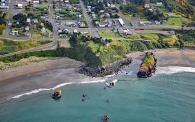
Battle Rock, Port Orford
Battle Rock is a large sea stack connected to the mainland by a narrow rocky ridge, situated 500 feet (152 m) southeast of Fort Point at the head of Port Orford, a shallow embayment or bight, about 23 miles (37 km) north of Gold Beach and adjacent to the community of Port Orford, Oregon.
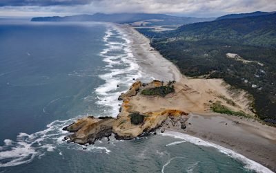
Cape Kiwanda, Pacific City
Cape Kiwanda is a sandstone headland with an elevation of 240 feet (73 m), protected by a basalt island known as Haystack Rock lying 0.5 miles (0.8 km) to the southwest, about 18 miles (29 km) south-southwest of Tillamook and 1 mile (1.6 km) northwest of Pacific City, Oregon.
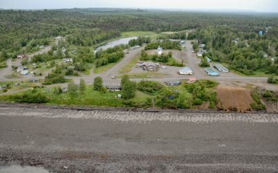
Tyonek, Cook Inlet
Tyonek is a historical Dena’ina Athabascan community situated on a bluff on the northwest shore of Cook Inlet, about 43 miles (69 km) west-southwest of Anchorage and 35 miles (56 km) north of Kenai, Alaska.
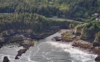
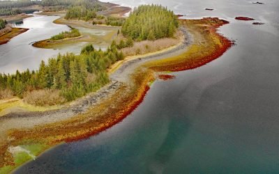
Boiler Bay Intertidal Research Reserve
Boiler Bay Intertidal Research Reserve is a rocky embayment 0.6 miles (1 km) wide between Government Point to the south and Rabbit Rock to the north, about 9 miles (14.5 km) south of Lincoln City and 1.6 miles (2.6 km) north of Depoe Bay, Oregon.
Stockdale Harbor, Montague Island
Stockdale Harbor is on the northwest coast of Montague Island in Prince William Sound, about 62 miles (100 km) southeast of Whittier and 54 miles (87 km) southwest of Cordova, Alaska.
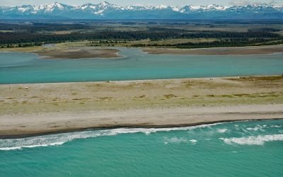
Situk River, Johnson Slough
Situk River starts at Situk Lake and flows southwest for about 18 miles (29 km) through the Yakutat Forelands in Tongass National Forest to Johnson Slough on the Gulf of Alaska, about 200 miles (322 km) northwest of Juneau and 9 miles (15 km) southeast of Yakutat, Alaska.
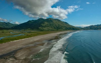
Ocean Bay, Sitkalidak Island
Ocean Bay is on the southeast shore of Sitkalidak Island in the Kodiak Archipelago, about 56 miles (90 km) southwest of Kodiak and 9 miles (15 km) southeast of the village of Old Harbor, Alaska.
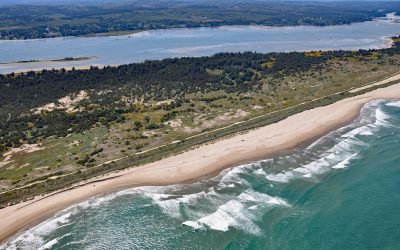
Camp Castaway, North Spit Coos Bay
Camp Castaway is a historical site on North Spit of Coos Bay, a sandy, vegetated peninsula separating the estuary of the Coos River from the Pacific Ocean, about 3.8 miles (6 km) west of North Bend and 1 mile (1.6 km) north of Charleston, Oregon.
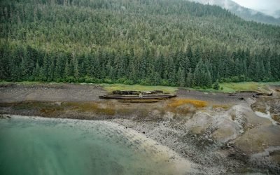
SS Islander, Green Cove
The remains of SS Islander and the salvage barge Griffson are in Green Cove on Stephens Passage, a waterway that separates the north shore of the Glass Peninsula on Admiralty Island from Douglas Island, about 86 miles (138 km) northeast of Sitka and 12 miles (19 km) southeast of Juneau, Alaska.
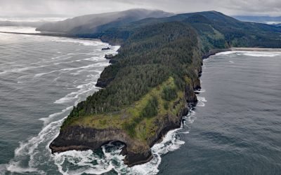
Cape Lookout, Cape Lookout State Park
Cape Lookout is a narrow basalt headland about 2 miles (3.2 km) long with vertical sea cliffs 800 feet (244 m) high in Cape Lookout State Park and the Siuslaw National Forest, about 26 miles (42 km) north of Lincoln City and 11 miles (18 km) southwest of Tillamook, Oregon.
About the background graphic
This ‘warming stripe’ graphic is a visual representation of the change in global temperature from 1850 (top) to 2019 (bottom). Each stripe represents the average global temperature for one year. The average temperature from 1971-2000 is set as the boundary between blue and red. The colour scale goes from -0.7°C to +0.7°C. The data are from the UK Met Office HadCRUT4.6 dataset.
Click here for more information about the #warmingstripes.