Beaches
Recent Articles
More Articles
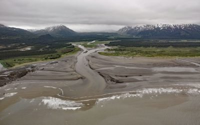
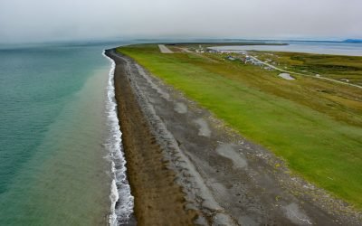
SS Portland, Katalla River
SS Portland is a shipwreck at the mouth of the Katalla River, near the abandoned oil prospecting community of Katalla, about 70 miles (113 km) west-northwest of Yakataga and 48 miles (77 km) southeast of Cordova, Alaska.
Whiffin Spit, Sooke Harbour
Whiffin Spit is a narrow sandspit that almost landlocks Sooke Harbour and Sooke Basin, about 17 miles (27 km) southwest of Victoria and 1.5 miles (2.4 km) southeast of Sooke, British Columbia.
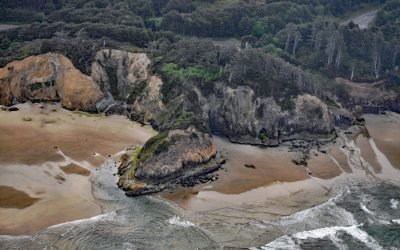
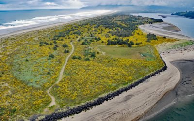
Hug Point, Arch Cape
Hug Point is a headland in Hug Point State Recreation Site on the northern Oregon coast, about 1 mile (1.6 km) north of the community of Arch Cape and 5 miles (8.0 km) south of Cannon Beach, Oregon.
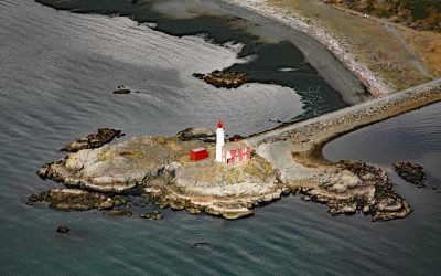
Fisgard Island, Esquimalt Harbour
Fisgard Island Light Station is located in Royal Roads off the southern shore of Vancouver Island at the entrance to Esquimalt Harbour, about 3.6 miles (5.8 km) west of Victoria and in the community of Colwood, British Columbia.
Platinum, Goodnews Bay
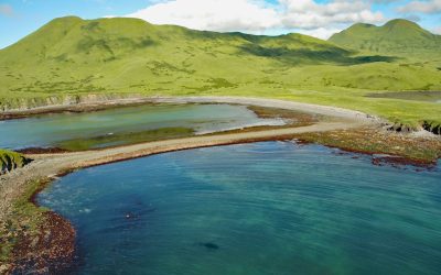
Platinum is a mining community located on the Smalls River at the base of South Spit in Goodnews Bay, about 123 miles (198 km) south of Bethel and 11 miles (18 km) southwest of the village of Goodnews, Alaska.
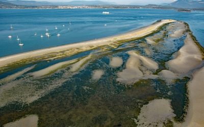
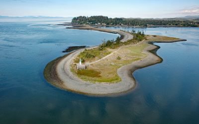
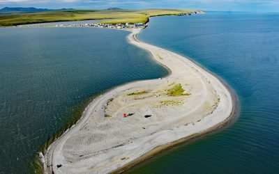
Sidney Spit, Sidney Island
Sidney Island is one of the southern Gulf Islands located in Haro Strait, about 45 miles (73 km) south-southwest of Vancouver and 2.8 miles (4.5 km) east of Sidney, British Columbia.
Kaguyak Village, Kodiak Island
Kaguyak is an abandoned Alutiiq village on the Aliulik Peninsula on the southeastern coast of Kodiak Island at the head of Kaguyak Bay, about 165 miles (266 km) southeast of King Salmon and 81 miles (131 km) southwest of the city of Kodiak, Alaska.
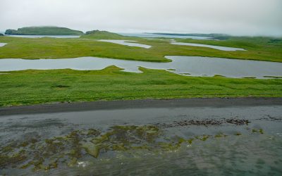
Nehalem Spit, Nehalem Bay State Park
Nehalem Bay is separated from the Pacific Ocean by an along shore dune called Nehalem Spit in Nehalem Bay State Park, about 15 miles (25 km) north-northwest of Tillamook and 3.8 miles (6 km) south of Manzanita, Oregon.
Refuge Rock, Partition Cove
Refuge Rock is in Partition Cove on the eastern shore of Sitkalidak Island, about 54 miles (87 km) southwest of Kodiak and 10 miles (16 km) southeast of Old Harbor, Alaska.
Teller, Port Clarence
Teller is an Iñupiat village located at the base of a spit separating Port Clarence Bay from Grantley Harbor, about 59 miles (95 km) northwest of Nome and 6 miles (10 km) southeast of Brevig Mission, Alaska.
About the background graphic
This ‘warming stripe’ graphic is a visual representation of the change in global temperature from 1850 (top) to 2019 (bottom). Each stripe represents the average global temperature for one year. The average temperature from 1971-2000 is set as the boundary between blue and red. The colour scale goes from -0.7°C to +0.7°C. The data are from the UK Met Office HadCRUT4.6 dataset.
Click here for more information about the #warmingstripes.