Beaches
Recent Articles
More Articles
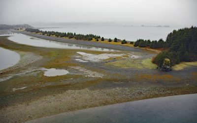
Nuchek, Constantine Harbor
Nuchek is the site of a historical village and Russian trading post on Constantine Harbor at Port Etches on Hinchinbrook Island in Prince William Sound, about 56 miles (90 km) south-southwest of Valdez and 35 miles (56 km) southwest of Cordova, Alaska.
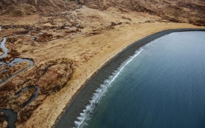
Ugadaga Bay, Unalaska Island
Ugadaga Bay is part of Beaver Inlet, one of the large embayments nearly bisecting Unalaska Island in the Eastern Aleutians, about 141 miles southwest of False Pass and 5.5 miles (9 km) southeast of Dutch Harbor, Alaska.
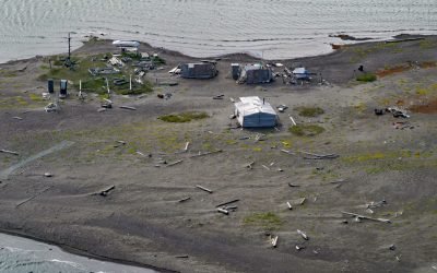
Griffin Point Fish Camp, Beaufort Sea
Griffin Point, also called Uqsruqtalik in the Iñupiat language, is the site of a traditional fish camp on the Beaufort Sea in the Arctic National Wildlife Refuge, about 240 miles (387 km) west-northwest of Tuktoyuktuk and 15 miles (24 km) southeast of Kaktovik, Alaska.
Kaliakh River, Malaspina Coastal Plain
Kaliakh River drains Hanna Lake and flows generally south through the Malaspina Coastal Plain for 24 miles (39 km) to the Gulf of Alaska, about 13 miles (21 km) northwest of Cape Yakataga and 106 miles (171 km) southeast of Cordova, Alaska.
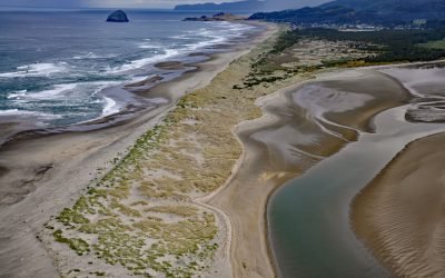
Nestucca Bay, Pacific City
Nestucca Bay is an estuary of about 1,000 acres (405 ha) formed by a sand spit located where the Nestucca River meets the Pacific Ocean, about 38 miles (61 km) west of McMinnville and at Pacific City, Oregon.
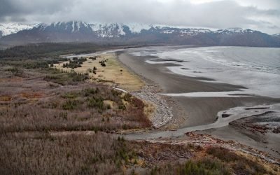
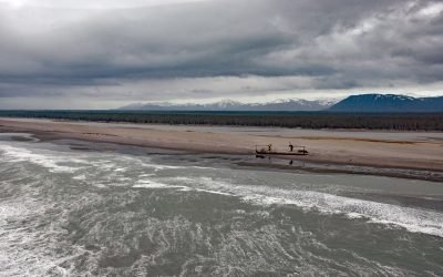
Patton Bay, Montague Island
Patton Bay is about 4 miles (6.5 km) wide, located on the southeast coast of Montague Island, about 75 miles (121 km) southwest of Cordova and 70 miles (113 km) southeast of Seward, Alaska.
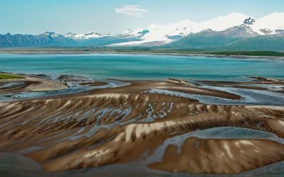
Hallo Bay, Katmai National Park and Preserve
Hallo Bay is a bight in Shelikof Strait on the south coast of the Alaska Peninsula in Katmai National Park and Preserve, about 122 miles (197 km) southwest of Homer and 76 miles (123 km) northwest of Kodiak, Alaska.

Stardust Bay, Sedanka Island
Stardust Bay is situated on the southeast coast of Sedanka Island, which is separated from Unalaska Island by Udagak Strait to the west and Beaver Inlet to the north, about 780 miles (1258 km) southwest of Anchorage and 16 miles (26 km) southeast of Dutch Harbor, Alaska.

Will Rogers-Wiley Post Memorial, Walakpa Bay
Will Rogers-Wiley Post Memorial is at Walakpa Bay, a coastal inlet that extends 6 miles (10 km) east from the Chukchi Sea and is fed by a watershed of 56,487 acres (22,860 ha), about 76 miles (123 km) northeast of Wainwright and 11 miles (18 km) southwest of Utqiaġvik, Alaska.

Marys Slough, Unalakleet River
Marys Slough is a side channel about 5 miles (8 km) long at the mouth of the Unalakleet River formed by a barrier spit on Norton Sound that creates an extensive tidal wetland, about 46 miles (74 km) northeast of Saint Michael and 1.1 miles (1.8 km) south-southeast of Unalakleet, Alaska.
About the background graphic
This ‘warming stripe’ graphic is a visual representation of the change in global temperature from 1850 (top) to 2019 (bottom). Each stripe represents the average global temperature for one year. The average temperature from 1971-2000 is set as the boundary between blue and red. The colour scale goes from -0.7°C to +0.7°C. The data are from the UK Met Office HadCRUT4.6 dataset.
Click here for more information about the #warmingstripes.